

$2,300 / Month
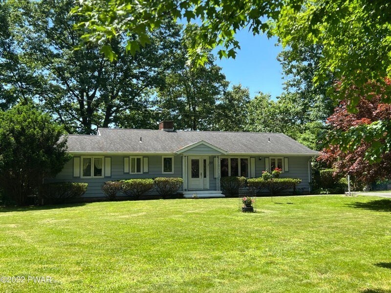
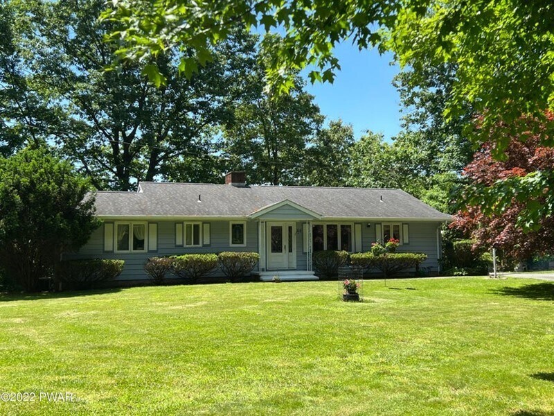
312 Route 6
Milford, PA 18337
2 Weeks Ago
Favorites
312 Route 6

Favorites
Check Back Soon for Upcoming Availability
| Beds | Baths | Average SF |
|---|---|---|
| 3 Bedrooms 3 Bedrooms 3 Br | 2 Baths 2 Baths 2 Ba | 1,826 SF |
About This Property
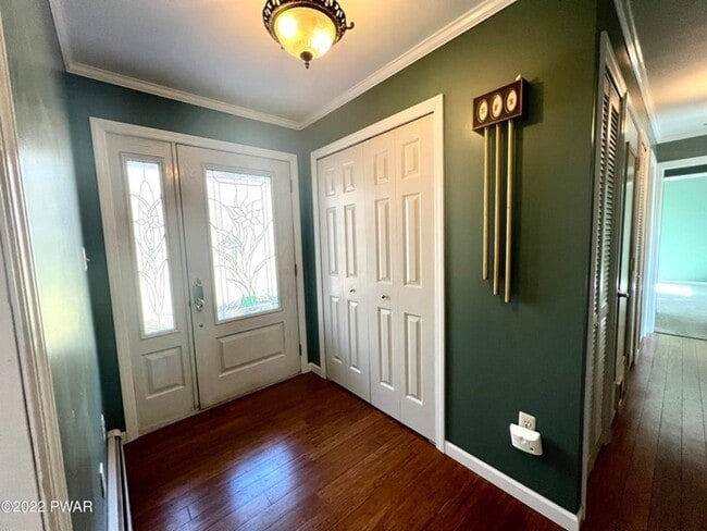
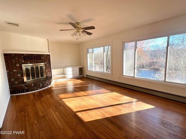
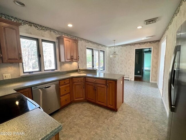
See more pictures and the virtual tour at Sprawling ranch on 1.25 Acres w/ 250 feet of river frontage on the Delaware River. Less than 5 minutes from the quaint town of Milford. One level living at it's best with gorgeous river views out of almost every window. Open floor plan, wood flooring, fireplace, spacious primary bedroom, trex two tiered deck. Long tree lined paved driveway gives you privacy. Walk down to the river to fish, swim, raft or canoe. Hike on the trail at the water's edge. Great retreat setting. Close to shopping, schools, restaurants, train and Rt 84 and NJ. Great commuter location.
312 Route 6 is a house located in Pike County and the 18337 ZIP Code. This area is served by the Montague Township attendance zone.
Location
Get Directions
Education
| Colleges & Universities | Distance | ||
|---|---|---|---|
| Colleges & Universities | Distance | ||
| Drive: | 60 min | 32.3 mi | |
| Drive: | 66 min | 39.8 mi | |
| Drive: | 76 min | 43.0 mi | |
| Drive: | 66 min | 43.8 mi |
312 Route 6 is within 60 minutes or 32.3 miles from East Stroudsburg University. It is also near Centenary College and Northampton C.C., Monroe.
Schools


Public Elementary & Middle School
Grades PK-8
310 Students
Nearby
Public High School
Grades 9-12
1,418 Students
Attendance Zone
Private Elementary & Middle School
Grades PK-9
198 Students
Nearby
Private Elementary & Middle School
Grades 1-8
40 Students
Nearby
Private High School
Grades 9-12
Nearby
School data provided by
 The GreatSchools Rating helps parents compare schools within a state based on a variety of school quality indicators and provides a helpful picture of how effectively each school serves all of its students. Ratings are on a scale of 1 (below average) to 10 (above average) and can include test scores, college readiness, academic progress, advanced courses, equity, discipline and attendance data. We also advise parents to visit schools, consider other information on school performance and programs, and consider family needs as part of the school selection process.
View GreatSchools Rating Methodology
Data provided by GreatSchools.org © 2025. All rights reserved.
View GreatSchools Rating Methodology
Data provided by GreatSchools.org © 2025. All rights reserved.
You May Also Like
Similar Rentals Nearby


What Are Walk Score®, Transit Score®, and Bike Score® Ratings?
Walk Score® measures the walkability of any address. Transit Score® measures access to public transit. Bike Score® measures the bikeability of any address.
What is a Sound Score Rating?
A Sound Score Rating aggregates noise caused by vehicle traffic, airplane traffic and local sources
312 Route 6
Milford, PA 18337