
$4,900 / Month
312 Navigators Pl
Bethel Island, CA 94511
2 Weeks Ago
Favorites
312 Navigators Pl

Favorites
Check Back Soon for Upcoming Availability
| Beds | Baths | Average SF |
|---|---|---|
| 4 Bedrooms 4 Bedrooms 4 Br | 4.5 Baths 4.5 Baths 4.5 Ba | 2,849 SF |
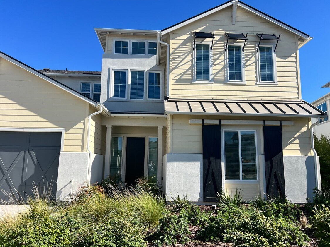
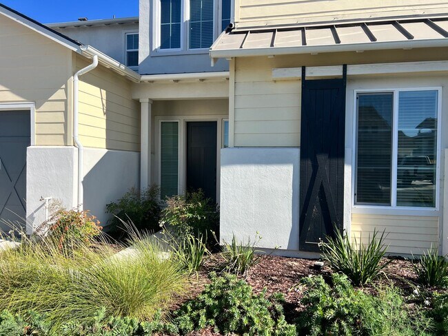
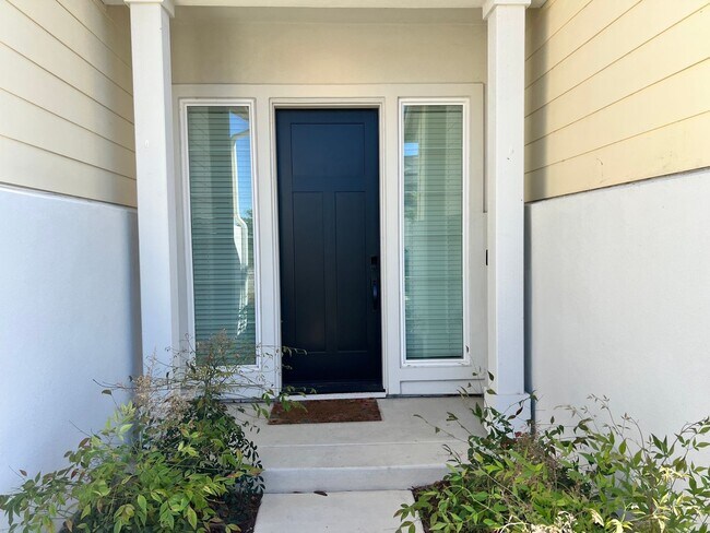
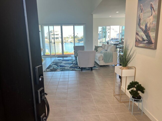
About This Property
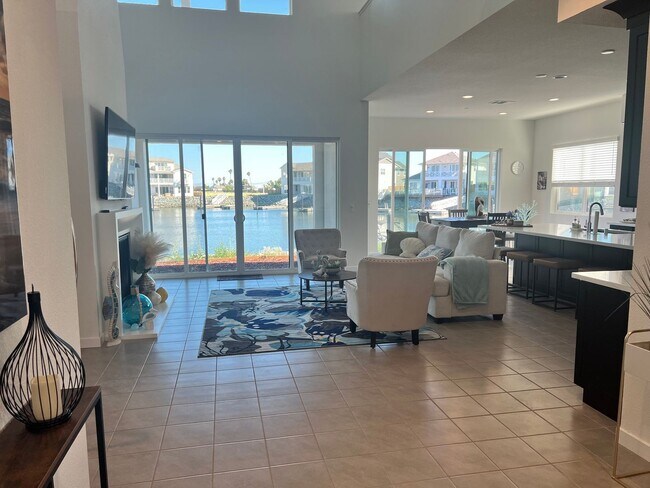
This home has all you could imagine and more. Inside the Gated Community of "The Coves" you will enjoy a waterfront dream home. From the moment you walk in the front door you will know you are home as you enter the open floor plan which is great for family and friends gatherings. There are two upstairs and two downstairs bedrooms and each bedroom has its own bathroom. There is a large bonus room upstairs ideal for "movie night," "game night," a workout room or a large office. Go out to the upstairs balcony and enjoy the evening breeze and beauty as you look over the private cove. Love to enjoy the water? This home comes with a large dock that easily fits at least two ski boats. If you have never been to THE ISLAND CAMP you are in for a great treat. You will have full access to the gym, the swimming pool, the recreation center, the yoga/pilates center and all the activities that take place throughout the year in this active community.
312 Navigators Pl is a house located in Contra Costa County and the 94511 ZIP Code. This area is served by the Oakley Union Elementary attendance zone.
Location
Get Directions
Education
| Colleges & Universities | Distance | ||
|---|---|---|---|
| Colleges & Universities | Distance | ||
| Drive: | 18 min | 8.1 mi | |
| Drive: | 33 min | 16.4 mi | |
| Drive: | 63 min | 38.0 mi | |
| Drive: | 65 min | 39.4 mi |
312 Navigators Pl is within 18 minutes or 8.1 miles from Los Medanos College, Brentwood. It is also near Los Medanos College, Pittsburg and University of the Pacific.
Schools


Public Elementary School
Grades K-5
496 Students
Attendance Zone
Public Elementary School
Grades K-6
460 Students
Nearby
Public Middle School
Grades 6-8
910 Students
Attendance Zone
Public High School
Grades 9-12
2,527 Students
Attendance Zone
Private Elementary, Middle & High School
Grades 1-11
12 Students
Nearby
Private Elementary, Middle & High School
Grades K-12
Nearby
Private Elementary, Middle & High School
Grades PK-11
Nearby
School data provided by
 The GreatSchools Rating helps parents compare schools within a state based on a variety of school quality indicators and provides a helpful picture of how effectively each school serves all of its students. Ratings are on a scale of 1 (below average) to 10 (above average) and can include test scores, college readiness, academic progress, advanced courses, equity, discipline and attendance data. We also advise parents to visit schools, consider other information on school performance and programs, and consider family needs as part of the school selection process.
View GreatSchools Rating Methodology
Data provided by GreatSchools.org © 2025. All rights reserved.
View GreatSchools Rating Methodology
Data provided by GreatSchools.org © 2025. All rights reserved.
Transportation options available in Bethel Island include Antioch, located 10.9 miles from 312 Navigators Pl. 312 Navigators Pl is near Stockton Metro, located 40.0 miles or 65 minutes away.
| Transit / Subway | Distance | ||
|---|---|---|---|
| Transit / Subway | Distance | ||
|
|
Drive: | 21 min | 10.9 mi |
| Commuter Rail | Distance | ||
|---|---|---|---|
| Commuter Rail | Distance | ||
|
|
Drive: | 26 min | 12.8 mi |
| Drive: | 51 min | 30.2 mi | |
|
|
Drive: | 58 min | 35.6 mi |
| Drive: | 60 min | 36.8 mi | |
|
|
Drive: | 71 min | 44.7 mi |
| Airports | Distance | ||
|---|---|---|---|
| Airports | Distance | ||
|
Stockton Metro
|
Drive: | 65 min | 40.0 mi |
Time and distance from 312 Navigators Pl.
| Shopping Centers | Distance | ||
|---|---|---|---|
| Shopping Centers | Distance | ||
| Walk: | 4 min | 0.2 mi | |
| Walk: | 15 min | 0.8 mi | |
| Drive: | 11 min | 4.4 mi |
312 Navigators Pl has 3 shopping centers within 4.4 miles, which is about a 11-minute walk. The miles and minutes will be for the farthest away property.
| Parks and Recreation | Distance | ||
|---|---|---|---|
| Parks and Recreation | Distance | ||
|
Franks Tract State Recreation Area
|
Drive: | 6 min | 2.2 mi |
|
Marsh Creek Regional Trail
|
Drive: | 17 min | 8.0 mi |
|
Big Break Regional Shoreline
|
Drive: | 19 min | 8.1 mi |
|
Brannan Island State Recreation Area
|
Drive: | 33 min | 17.9 mi |
|
Delta Meadows State Park
|
Drive: | 34 min | 17.9 mi |
312 Navigators Pl has 5 parks within 17.9 miles, including Franks Tract State Recreation Area, Marsh Creek Regional Trail, and Big Break Regional Shoreline.
| Hospitals | Distance | ||
|---|---|---|---|
| Hospitals | Distance | ||
| Drive: | 28 min | 12.8 mi | |
| Drive: | 26 min | 13.6 mi |
312 Navigators Pl is 12.8 miles from Kaiser Foundation Hospital - Antioch, and is convenient to other hospitals, including Sutter Delta Medical Center.
| Military Bases | Distance | ||
|---|---|---|---|
| Military Bases | Distance | ||
| Drive: | 57 min | 33.1 mi |
312 Navigators Pl is 33.1 miles and a 57 minute drive from Stockton Naval Commun Station.
You May Also Like
Similar Rentals Nearby


What Are Walk Score®, Transit Score®, and Bike Score® Ratings?
Walk Score® measures the walkability of any address. Transit Score® measures access to public transit. Bike Score® measures the bikeability of any address.
What is a Sound Score Rating?
A Sound Score Rating aggregates noise caused by vehicle traffic, airplane traffic and local sources

312 Navigators Pl
Bethel Island, CA 94511