$3,000
/ Month
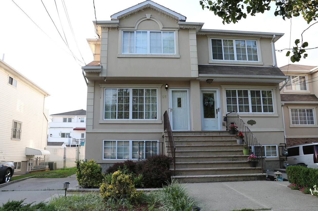
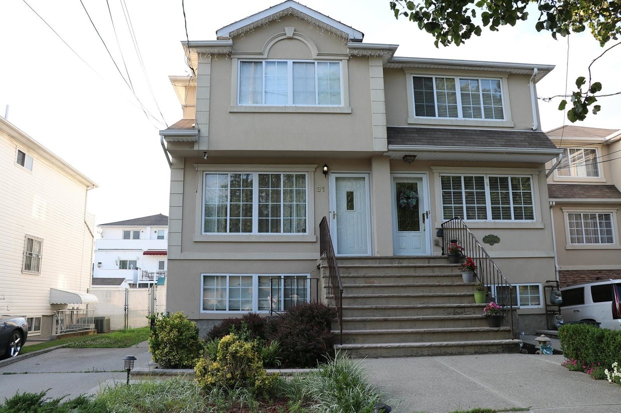
31 Clay Pit Rd Unit 3-F
Staten Island, NY 10309
Favorites
31 Clay Pit Rd Unit 3-F

Favorites
Check Back Soon for Upcoming Availability
| Beds | Baths | Average SF |
|---|---|---|
| 4 Bedrooms 4 Bedrooms 4 Br | 3.5 Baths 3.5 Baths 3.5 Ba | 1,500 SF |
About This Property
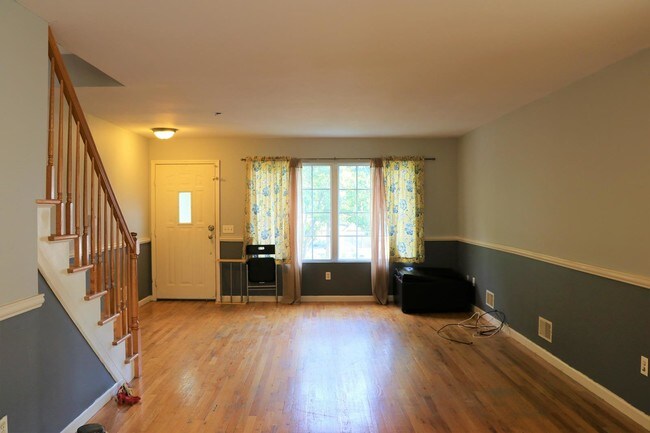
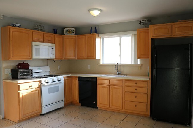
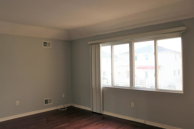
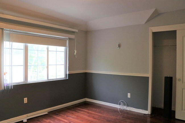
4 Bedroom Total Of 3 Levels Full House For Rent! Renovated 2018 September.don't Miss Out! gorgeous Extra Large Semi In Rossville. Home Features Custom Kitchen With Cabinetry With Sliders To Huge Backyard. Large Living/dining Room Combo With Hardwood Flooring.king Size Master Bedroom With 3/4 Bath. 2 Additional Large Bedroom And Legal Studio In First Floor. Nothing To Do But Move In And Enjoy! Level 1: Separate Entrance Studio, Kitchen, Full Bath, Laundry Room With Family Room. Level 2: Large Living Room/dining Room Combo, Hardwood Floors, Custom Kitchen, Half Bath,sliders To Yard Level 3: King Size Master Bedroom With 3/4 Bath, Bedroom,bedroom,full Bath. with Full Access To Clay Pit Ponds State Park Preserve, 5 Mins Walking Distance. 1 Month Rent, 1 Month Security Deposit, 1 Month Broker Fee.income Inquiry And Credit Check Is Required. *****please Call Or Text Instead Of Email Because There Has Been A Email Server Issue Recently. Sorry About Any Inconvenience It Might Occur.
31 Clay Pit Rd is an apartment community located in Richmond County and the 10309 ZIP Code.
Features
- Dishwasher
- Microwave
31 Clay Pit Rd,
Staten Island,
NY
10309
Staten Island occupies a singular position as New York City's southernmost borough, physically separate from the rest of the city yet firmly connected to it through the iconic, round-the-clock Staten Island Ferry. As the least densely populated of the five boroughs, it carries a noticeably quieter, more residential character than Manhattan or Brooklyn, covering roughly 59 square miles with a population near 490,000. The College of Staten Island anchors the borough's educational presence, while Snug Harbor Cultural Center and Botanical Garden reflects a deep commitment to the arts and green space. During the American Revolution, Staten Island served as a primary staging ground for British forces and remained under British control longer than any other part of what would become the United States.
Neighborhoods vary considerably across the island. St. George on the North Shore functions as the civic and cultural hub, while Tottenville anchors the quieter South Shore.
Learn more about living in Staten IslandBelow are rent ranges for similar nearby apartments
Amenities
- Dishwasher
- Microwave
Education
| Colleges & Universities | Distance | ||
|---|---|---|---|
| Colleges & Universities | Distance | ||
| Drive: | 16 min | 7.5 mi | |
| Drive: | 21 min | 10.7 mi | |
| Drive: | 19 min | 10.9 mi | |
| Drive: | 20 min | 11.1 mi |
31 Clay Pit Rd Unit 3-F is within 16 minutes or 7.5 miles from Coll. of Staten Island, CUNY. It is also near Wagner College and Union County Coll., Elizabeth.
Transportation options available in Staten Island include 8Th Street Light Rail Station, located 10.5 miles from 31 Clay Pit Rd Unit 3-F. 31 Clay Pit Rd Unit 3-F is near Newark Liberty International, located 17.2 miles or 28 minutes away, and John F Kennedy International, located 33.5 miles or 51 minutes away.
| Transit / Subway | Distance | ||
|---|---|---|---|
| Transit / Subway | Distance | ||
| Drive: | 19 min | 10.5 mi | |
|
|
Drive: | 21 min | 11.7 mi |
| Commuter Rail | Distance | ||
|---|---|---|---|
| Commuter Rail | Distance | ||
|
|
Drive: | 3 min | 1.4 mi |
|
|
Drive: | 5 min | 2.1 mi |
|
|
Drive: | 4 min | 2.1 mi |
|
|
Drive: | 6 min | 2.5 mi |
| Drive: | 7 min | 3.0 mi |
| Airports | Distance | ||
|---|---|---|---|
| Airports | Distance | ||
|
Newark Liberty International
|
Drive: | 28 min | 17.2 mi |
|
John F Kennedy International
|
Drive: | 51 min | 33.5 mi |
Walkability Near 31 Clay Pit Rd Staten Island, NY 10309
Getting Around
 What do Walkability, Transit, Drivability, and Bikeability mean?
Walkability measures the walking distance to day-to-day needs.
Transit measures access to public transportation.
Drivability measures congestion, parking availability, and access to major roads.
Bikeability measures the suitability for cycling.
How It Works
What do Walkability, Transit, Drivability, and Bikeability mean?
Walkability measures the walking distance to day-to-day needs.
Transit measures access to public transportation.
Drivability measures congestion, parking availability, and access to major roads.
Bikeability measures the suitability for cycling.
How It Works
Fairly Walkable
Walkability
50
/ 100
Some Public Transit
Transit
40
/ 100
Moderately Drivable
Drivability
60
/ 100
Moderately Bikeable
Bikeability
60
/ 100
Scores provided by
-
Soundscore™
-
/ 100
Traffic
-Airport
-Businesses
-Scores provided by
HowLoud What is a Sound Score Rating? A Sound Score Rating aggregates noise caused by vehicle traffic, airplane traffic and local sources. How It WorksTime and distance from 31 Clay Pit Rd Unit 3-F.
| Shopping Centers | Distance | ||
|---|---|---|---|
| Shopping Centers | Distance | ||
| Walk: | 14 min | 0.7 mi | |
| Walk: | 14 min | 0.8 mi | |
| Drive: | 3 min | 1.4 mi |
31 Clay Pit Rd Unit 3-F has 3 shopping centers within 1.4 miles, which is about a 3-minute drive. The miles and minutes will be for the farthest away property.
| Parks and Recreation | Distance | ||
|---|---|---|---|
| Parks and Recreation | Distance | ||
|
Clay Pit Ponds State Park Preserve
|
Drive: | 4 min | 1.2 mi |
|
Bloomingdale Park
|
Drive: | 4 min | 1.4 mi |
|
Lemon Creek Park
|
Drive: | 8 min | 3.0 mi |
|
Wolfes Pond Park
|
Drive: | 7 min | 3.1 mi |
|
Long Pond Park Preserve
|
Drive: | 8 min | 3.2 mi |
31 Clay Pit Rd Unit 3-F has 5 parks within 3.2 miles, including Clay Pit Ponds State Park Preserve, Bloomingdale Park, and Lemon Creek Park.
| Hospitals | Distance | ||
|---|---|---|---|
| Hospitals | Distance | ||
| Drive: | 10 min | 5.5 mi | |
| Drive: | 21 min | 10.3 mi | |
| Drive: | 23 min | 10.8 mi |
31 Clay Pit Rd Unit 3-F has 3 hospitals within 10.8 miles, the nearest is Raritan Bay Medical Center Perth Amboy Division which is 5.5 miles away and a 10 minute drive.
| Military Bases | Distance | ||
|---|---|---|---|
| Military Bases | Distance | ||
| Drive: | 23 min | 12.2 mi | |
| Drive: | 29 min | 15.7 mi | |
| Drive: | 27 min | 16.1 mi |
31 Clay Pit Rd Unit 3-F has 3 military bases within 16.1 miles, the nearest is US Government Reservation which is 12.2 miles away and a 23 minute drive.
You May Also Like
Similar Rentals Nearby


What Are Walk Score®, Transit Score®, and Bike Score® Ratings?
Walk Score® measures the walkability of any address. Transit Score® measures access to public transit. Bike Score® measures the bikeability of any address.
What is a Sound Score Rating?
A Sound Score Rating aggregates noise caused by vehicle traffic, airplane traffic and local sources.
31 Clay Pit Rd
Staten Island, NY 10309