
Kinect at Southport
2301 Jefferson Blvd,
Sacramento, CA 95691
$1,550 - $3,049
Studio - 3 Beds
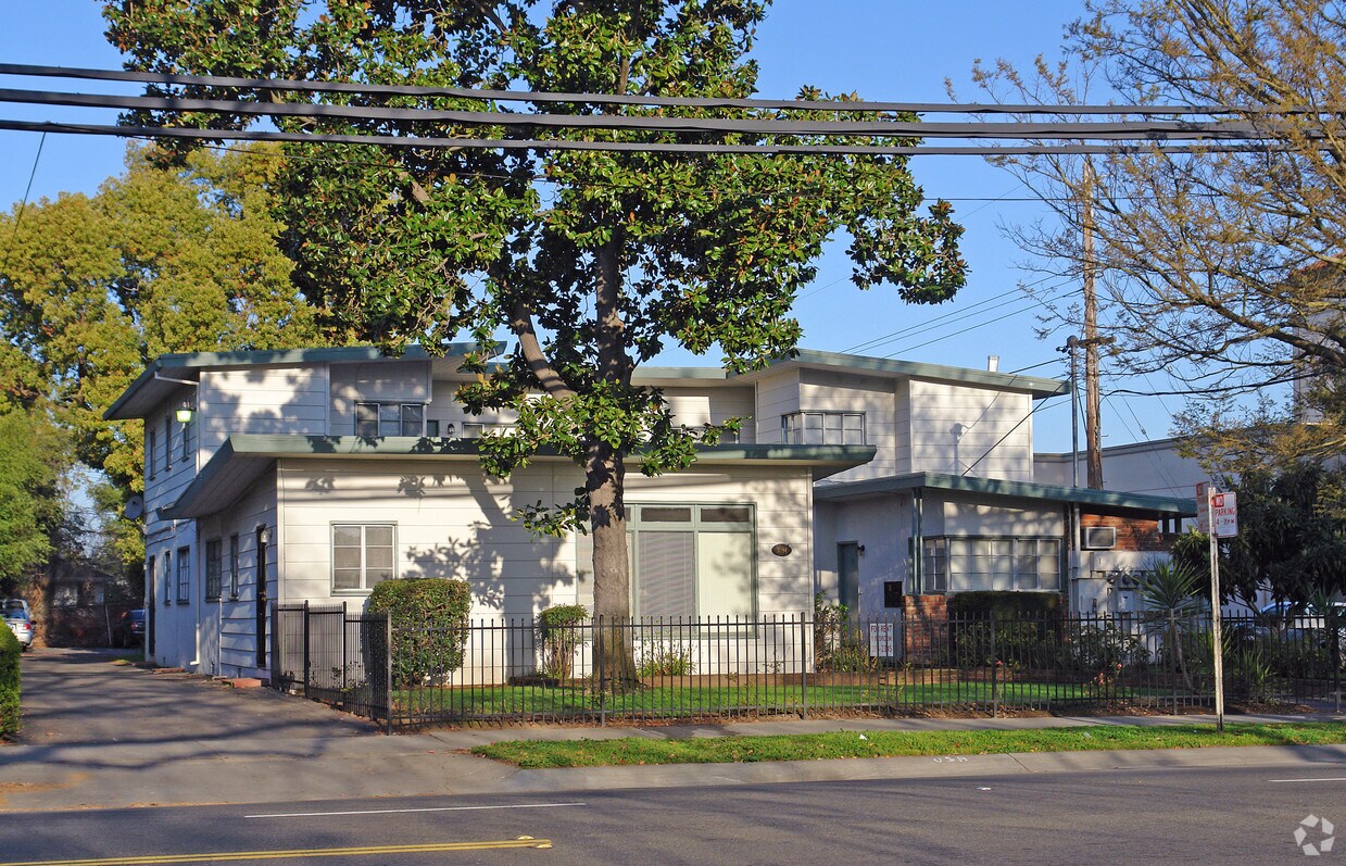
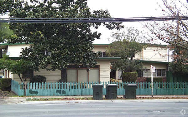
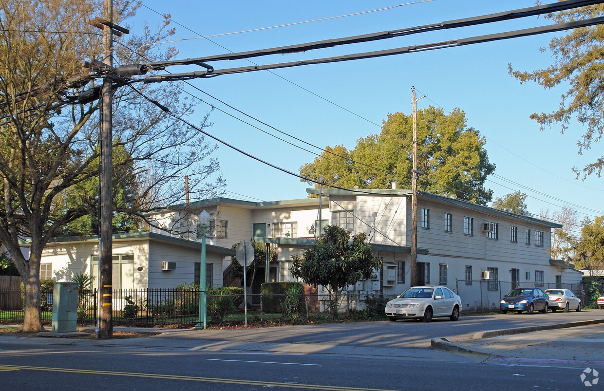

At 3094 Freeport Blvd, experience stylish living. The address for this community is in Sacramento on Freeport Blvd. The team of leasing professionals is ready to take you for a tour. You'll experience a variety of features and amenities at this community including high-speed internet access, convenient on-site parking options, and smoke free options. So get a head start on your move. Contact or stop by 3094 Freeport Blvd to check the current floorplan availability today!
3094 Freeport Blvd is an apartment community located in Sacramento County and the 95818 ZIP Code. This area is served by the Sacramento City Unified School District attendance zone.
Adjacent to Downtown Sacramento, Land Park is a family-friendly, suburban neighborhood that is home to some of the city’s biggest attractions. Its namesake park, William Land Park, houses several amusement parks, the Sacramento Zoo, a golf course, a garden, amphitheater, golf course, and more. Families flocks to Funderland Amusement Park or Fairytale Town during the summer and appreciate being able to send their kids to excellent schools during the fall. There are also several parks, restaurants, and stores in the neighborhood. Land Park is convenient to Sacramento City College and Pacific McGeorge School of Law. Lank Park is within close proximity to Midtown and Downtown Sacramento as well. Within a 10-minute drive, you’ll have access to museums, stadiums, office buildings, coffee shops, bars, theaters, shopping centers, and more.
Learn more about living in Land ParkCompare neighborhood and city base rent averages by bedroom.
| Land Park | Sacramento, CA | |
|---|---|---|
| Studio | $1,877 | $1,476 |
| 1 Bedroom | $1,557 | $1,565 |
| 2 Bedrooms | $1,588 | $1,871 |
| 3 Bedrooms | - | $2,422 |
| Colleges & Universities | Distance | ||
|---|---|---|---|
| Colleges & Universities | Distance | ||
| Walk: | 13 min | 0.7 mi | |
| Drive: | 10 min | 5.9 mi | |
| Drive: | 15 min | 9.3 mi | |
| Drive: | 20 min | 12.4 mi |


Transportation options available in Sacramento include 4Th Ave./Wayne Hultgren, located 0.4 mile from 3094 Freeport Blvd. 3094 Freeport Blvd is near Sacramento International, located 14.2 miles or 21 minutes away.
| Transit / Subway | Distance | ||
|---|---|---|---|
| Transit / Subway | Distance | ||
|
|
Walk: | 7 min | 0.4 mi |
|
|
Walk: | 13 min | 0.7 mi |
|
|
Walk: | 19 min | 1.0 mi |
|
|
Drive: | 3 min | 1.7 mi |
|
|
Drive: | 3 min | 1.9 mi |
| Commuter Rail | Distance | ||
|---|---|---|---|
| Commuter Rail | Distance | ||
| Drive: | 7 min | 3.5 mi | |
| Drive: | 20 min | 15.8 mi | |
|
|
Drive: | 29 min | 21.0 mi |
|
|
Drive: | 30 min | 23.2 mi |
|
|
Drive: | 42 min | 33.4 mi |
| Airports | Distance | ||
|---|---|---|---|
| Airports | Distance | ||
|
Sacramento International
|
Drive: | 21 min | 14.2 mi |
Scores provided by
Traffic
-Airport
-Businesses
-Scores provided by
HowLoud What is a Sound Score Rating? A Sound Score Rating aggregates noise caused by vehicle traffic, airplane traffic and local sources. How It WorksTime and distance from 3094 Freeport Blvd.
| Shopping Centers | Distance | ||
|---|---|---|---|
| Shopping Centers | Distance | ||
| Walk: | 4 min | 0.2 mi | |
| Walk: | 17 min | 0.9 mi | |
| Drive: | 3 min | 1.5 mi |
| Parks and Recreation | Distance | ||
|---|---|---|---|
| Parks and Recreation | Distance | ||
|
Sacramento Zoo
|
Drive: | 3 min | 1.6 mi |
|
California Native Plant Demonstration Garden
|
Drive: | 4 min | 1.9 mi |
|
Sutter's Fort State Historical Monument
|
Drive: | 5 min | 2.4 mi |
|
California State Capitol Museum
|
Drive: | 5 min | 2.4 mi |
|
Leland Stanford Mansion State Historic Park
|
Drive: | 5 min | 2.4 mi |
| Hospitals | Distance | ||
|---|---|---|---|
| Hospitals | Distance | ||
| Drive: | 5 min | 2.5 mi | |
| Drive: | 5 min | 2.8 mi | |
| Drive: | 6 min | 2.9 mi |
| Military Bases | Distance | ||
|---|---|---|---|
| Military Bases | Distance | ||
| Drive: | 27 min | 12.1 mi |
What Are Walk Score®, Transit Score®, and Bike Score® Ratings?
Walk Score® measures the walkability of any address. Transit Score® measures access to public transit. Bike Score® measures the bikeability of any address.
What is a Sound Score Rating?
A Sound Score Rating aggregates noise caused by vehicle traffic, airplane traffic and local sources.

3094 Freeport Blvd
Sacramento, CA 95818


