
$3,150 / Month
308 High St
Moorestown, NJ 08057
2 Weeks Ago
Favorites
308 High St

Favorites
Check Back Soon for Upcoming Availability
| Beds | Baths | Average SF |
|---|---|---|
| 4 Bedrooms 4 Bedrooms 4 Br | 2 Baths 2 Baths 2 Ba | — |
About This Property
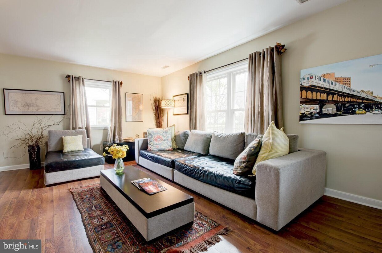
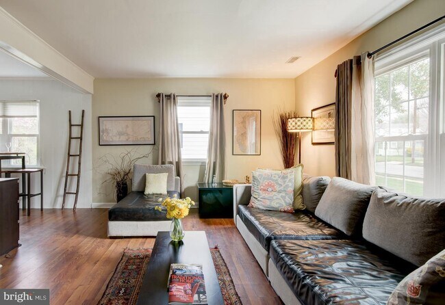
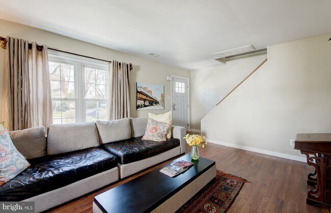
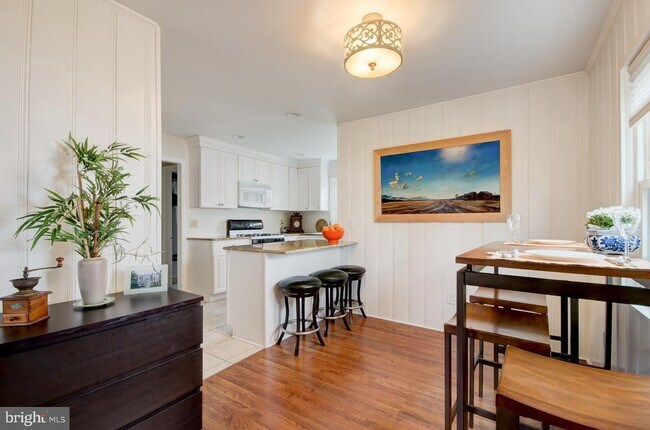
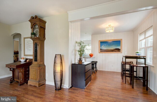
Welcome to this well-cared for Moorestown home, and the great school system that everyone loves. The seller has updated this home in many ways, the first floor (full) bathroom has been completely renovated and redesigned. The kitchen is glorious with granite, easy access to the washer and dryer, and the backyard. Hardwood floors. The yard Is fenced and the seller added a garage for storage or for the car. You will not be disappointed, I promise!
308 High St is a house located in Burlington County and the 08057 ZIP Code. This area is served by the Moorestown Township attendance zone.
Location
Get Directions
Education
| Colleges & Universities | Distance | ||
|---|---|---|---|
| Colleges & Universities | Distance | ||
| Drive: | 8 min | 4.0 mi | |
| Drive: | 15 min | 10.6 mi | |
| Drive: | 16 min | 11.0 mi | |
| Drive: | 25 min | 13.7 mi |
308 High St is within 8 minutes or 4.0 miles from Burlington Co., Mount Laurel. It is also near Camden Co. Coll., Camden City and Rutgers, Camden Campus.
Schools


Public Elementary School
Grades 4-6
853 Students
Attendance Zone
Public Elementary School
Grades PK-3
313 Students
Nearby
Public Elementary School
Grades PK-3
397 Students
Nearby
Public Middle School
Grades 7-8
616 Students
Attendance Zone
Public High School
Grades 9-12
1,267 Students
Attendance Zone
Private Elementary & Middle School
Grades PK-8
334 Students
Nearby
Private Elementary, Middle & High School
Grades PK-12
695 Students
Nearby
School data provided by
 The GreatSchools Rating helps parents compare schools within a state based on a variety of school quality indicators and provides a helpful picture of how effectively each school serves all of its students. Ratings are on a scale of 1 (below average) to 10 (above average) and can include test scores, college readiness, academic progress, advanced courses, equity, discipline and attendance data. We also advise parents to visit schools, consider other information on school performance and programs, and consider family needs as part of the school selection process.
View GreatSchools Rating Methodology
Data provided by GreatSchools.org © 2025. All rights reserved.
View GreatSchools Rating Methodology
Data provided by GreatSchools.org © 2025. All rights reserved.
Transportation options available in Moorestown include Palmyra Light Rail Station, located 5.5 miles from 308 High St. 308 High St is near Philadelphia International, located 21.1 miles or 34 minutes away, and Trenton Mercer, located 32.2 miles or 46 minutes away.
| Transit / Subway | Distance | ||
|---|---|---|---|
| Transit / Subway | Distance | ||
| Drive: | 10 min | 5.5 mi | |
| Drive: | 11 min | 5.8 mi | |
| Drive: | 12 min | 6.6 mi | |
| Drive: | 13 min | 6.6 mi | |
| Drive: | 11 min | 7.8 mi |
| Commuter Rail | Distance | ||
|---|---|---|---|
| Commuter Rail | Distance | ||
| Drive: | 12 min | 8.0 mi | |
| Drive: | 13 min | 8.5 mi | |
| Drive: | 17 min | 9.7 mi | |
| Drive: | 19 min | 10.8 mi | |
| Drive: | 24 min | 13.4 mi |
| Airports | Distance | ||
|---|---|---|---|
| Airports | Distance | ||
|
Philadelphia International
|
Drive: | 34 min | 21.1 mi |
|
Trenton Mercer
|
Drive: | 46 min | 32.2 mi |
Time and distance from 308 High St.
| Shopping Centers | Distance | ||
|---|---|---|---|
| Shopping Centers | Distance | ||
| Walk: | 7 min | 0.4 mi | |
| Drive: | 3 min | 1.6 mi | |
| Drive: | 4 min | 1.8 mi |
308 High St has 3 shopping centers within 1.8 miles, which is about a 4-minute walk. The miles and minutes will be for the farthest away property.
| Parks and Recreation | Distance | ||
|---|---|---|---|
| Parks and Recreation | Distance | ||
|
Garden State Discovery Museum
|
Drive: | 9 min | 4.1 mi |
|
Paws Farm Nature Center
|
Drive: | 10 min | 5.9 mi |
|
Barclay Farmstead Nature Trail
|
Drive: | 11 min | 5.9 mi |
|
Erlton North Trails
|
Drive: | 10 min | 6.1 mi |
|
Kresson Nature Trails
|
Drive: | 13 min | 6.3 mi |
308 High St has 5 parks within 6.3 miles, including Garden State Discovery Museum, Paws Farm Nature Center, and Erlton North Trails.
| Hospitals | Distance | ||
|---|---|---|---|
| Hospitals | Distance | ||
| Drive: | 12 min | 6.2 mi | |
| Drive: | 17 min | 8.8 mi | |
| Drive: | 13 min | 9.1 mi |
308 High St has 3 hospitals within 9.1 miles, the nearest is Weisman Childrens Rehabilitation Hospital which is 6.2 miles away and a 12 minute drive.
| Military Bases | Distance | ||
|---|---|---|---|
| Military Bases | Distance | ||
| Drive: | 24 min | 16.2 mi |
308 High St is 16.2 miles and a 24 minute drive from Philadelphia Naval Busi Center.
You May Also Like
Similar Rentals Nearby


What Are Walk Score®, Transit Score®, and Bike Score® Ratings?
Walk Score® measures the walkability of any address. Transit Score® measures access to public transit. Bike Score® measures the bikeability of any address.
What is a Sound Score Rating?
A Sound Score Rating aggregates noise caused by vehicle traffic, airplane traffic and local sources

308 High St
Moorestown, NJ 08057