

$3,300
/ Month
308 High St
Moorestown, NJ 08057
Today
Favorites
609-922-0501
-
Bedrooms
4
-
Bathrooms
2
-
Square Feet
--
-
Available
Available Sep 27
308 High St

Favorites
About This Home
Available Sep 27
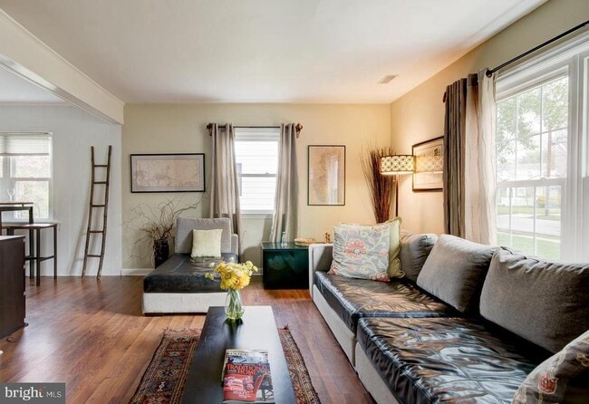
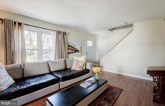
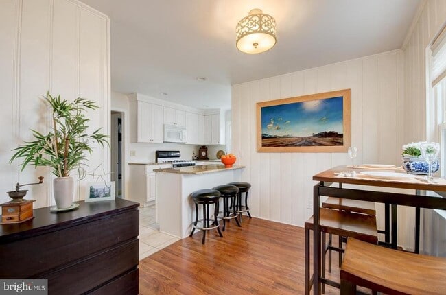
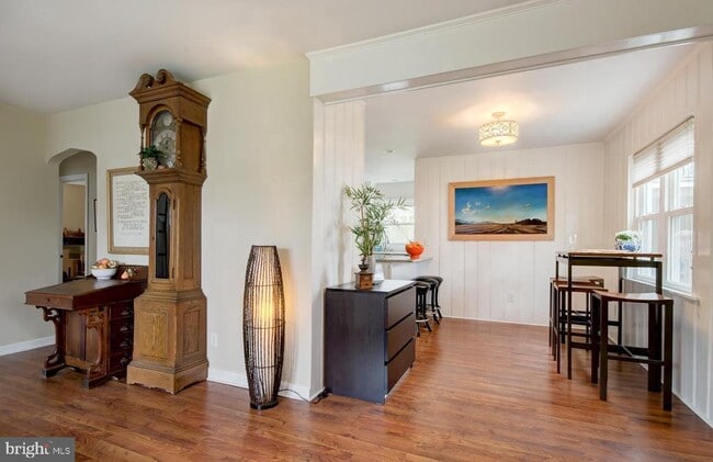
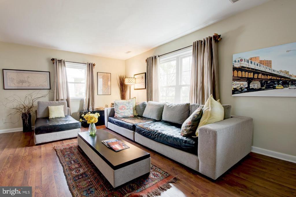
Welcome to this well-cared-for Moorestown home, and the excellent school system that everyone loves. The seller has made numerous updates to this home. The first-floor bathroom has been completely renovated and redesigned. The kitchen is glorious with granite, easy access to the washer and dryer, and a backyard—hardwood floors. The yard is fenced, and the seller has added a garage for storage or parking. You will not be disappointed, I promise! Rent must be paid electronically the latest by the 5th of the month All lawn and landscaping will be maintained and is the responsibility of the buyer
308 High St is a house located in Burlington County and the 08057 ZIP Code.
* Price shown is base rent. Excludes user-selected optional fees and variable or usage-based fees and required charges due at or prior to move-in or at move-out. Price, availability, fees, and any applicable rent special are subject to change without notice.
* Square footage definitions vary. Displayed square footage is approximate.
Contact
- Listed by Lynn A Rossi | Weichert Realtors-Haddonfield
- Phone Number
- Contact
-
Source
 Bright MLS, Inc.
Copyright © 2025 Bright MLS, Inc.
Location
Get Directions
Education
| Colleges & Universities | Distance | ||
|---|---|---|---|
| Colleges & Universities | Distance | ||
| Drive: | 8 min | 4.0 mi | |
| Drive: | 15 min | 10.6 mi | |
| Drive: | 16 min | 11.0 mi | |
| Drive: | 25 min | 13.7 mi |
308 High St is within 8 minutes or 4.0 miles from Burlington Co., Mount Laurel. It is also near Camden Co. Coll., Camden City and Rutgers, Camden Campus.
Transportation options available in Moorestown include Palmyra, located 5.5 miles from 308 High St. 308 High St is near Philadelphia International, located 21.1 miles or 34 minutes away, and Trenton Mercer, located 32.2 miles or 46 minutes away.
| Transit / Subway | Distance | ||
|---|---|---|---|
| Transit / Subway | Distance | ||
|
|
Drive: | 10 min | 5.5 mi |
|
|
Drive: | 10 min | 5.8 mi |
|
|
Drive: | 12 min | 6.6 mi |
|
|
Drive: | 13 min | 6.6 mi |
|
|
Drive: | 11 min | 7.8 mi |
| Commuter Rail | Distance | ||
|---|---|---|---|
| Commuter Rail | Distance | ||
|
|
Drive: | 12 min | 8.0 mi |
| Drive: | 13 min | 8.5 mi | |
|
|
Drive: | 17 min | 9.7 mi |
|
|
Drive: | 19 min | 10.8 mi |
|
|
Drive: | 24 min | 13.4 mi |
| Airports | Distance | ||
|---|---|---|---|
| Airports | Distance | ||
|
Philadelphia International
|
Drive: | 34 min | 21.1 mi |
|
Trenton Mercer
|
Drive: | 46 min | 32.2 mi |
Time and distance from 308 High St.
| Shopping Centers | Distance | ||
|---|---|---|---|
| Shopping Centers | Distance | ||
| Walk: | 7 min | 0.4 mi | |
| Drive: | 3 min | 1.6 mi | |
| Drive: | 4 min | 1.8 mi |
308 High St has 3 shopping centers within 1.8 miles, which is about a 4-minute walk. The miles and minutes will be for the farthest away property.
| Parks and Recreation | Distance | ||
|---|---|---|---|
| Parks and Recreation | Distance | ||
|
Garden State Discovery Museum
|
Drive: | 9 min | 4.1 mi |
|
Paws Farm Nature Center
|
Drive: | 10 min | 5.9 mi |
|
Barclay Farmstead Nature Trail
|
Drive: | 11 min | 5.9 mi |
|
Erlton North Trails
|
Drive: | 10 min | 6.1 mi |
|
Kresson Nature Trails
|
Drive: | 13 min | 6.3 mi |
308 High St has 5 parks within 6.3 miles, including Garden State Discovery Museum, Paws Farm Nature Center, and Erlton North Trails.
| Hospitals | Distance | ||
|---|---|---|---|
| Hospitals | Distance | ||
| Drive: | 12 min | 6.2 mi | |
| Drive: | 17 min | 8.8 mi | |
| Drive: | 13 min | 9.1 mi |
308 High St has 3 hospitals within 9.1 miles, the nearest is Weisman Childrens Rehabilitation Hospital which is 6.2 miles away and a 12 minute drive.
| Military Bases | Distance | ||
|---|---|---|---|
| Military Bases | Distance | ||
| Drive: | 24 min | 16.2 mi |
308 High St is 16.2 miles and a 24 minute drive from Philadelphia Naval Busi Center.
You May Also Like
Similar Rentals Nearby


What Are Walk Score®, Transit Score®, and Bike Score® Ratings?
Walk Score® measures the walkability of any address. Transit Score® measures access to public transit. Bike Score® measures the bikeability of any address.
What is a Sound Score Rating?
A Sound Score Rating aggregates noise caused by vehicle traffic, airplane traffic and local sources
308 High St
Moorestown, NJ 08057