

$500 / Month
3074 W 25th St Unit 2
Cleveland, OH 44113
2 Weeks Ago
Favorites
3074 W 25th St Unit 2

Favorites
Check Back Soon for Upcoming Availability
| Beds | Baths | Average SF |
|---|---|---|
| 2 Bedrooms 2 Bedrooms 2 Br | 1 Bath 1 Bath 1 Ba | 500 SF |
Fees and Policies
The fees below are based on community-supplied data and may exclude additional fees and utilities.
- Parking
-
Street--
Details
Utilities Included
-
Gas
-
Water
-
Heat
-
Sewer
Property Information
-
11 units
About This Property
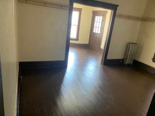
Apartment on 2 nd floor facing West 25 Street. Shopping close by.
3074 W 25th St is an apartment community located in Cuyahoga County and the 44113 ZIP Code.
Apartment Features
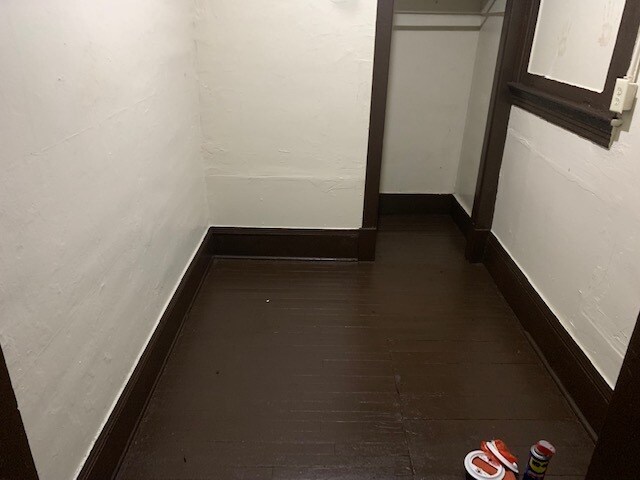
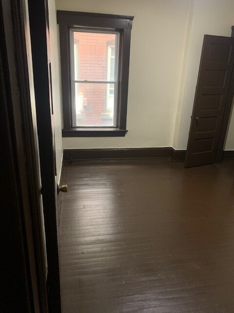
Hardwood Floors
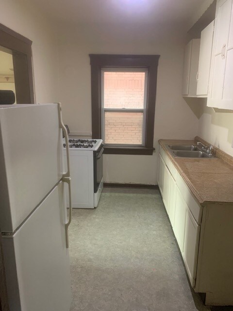
Refrigerator
Smoke Free
Heating
- Heating
- Smoke Free
- Kitchen
- Range
- Refrigerator
- Hardwood Floors
Location
Get Directions
The Near West Side of Cleveland encompasses a stretch of tree-lined neighborhoods that are bordered by Interstate 90 to the north, Clark Avenue to the south, and Interstate 71 to the east. There are historic loft apartments and long-standing single-family homes for rent in the Near West Side, all on tree-lined, walkable streets. The real draw of the area is its proximity to destinations like the West Side Market and the trendy restaurants and breweries along Carnegie Avenue. Commuters can be in Downtown Cleveland in just 10 minutes, adding to the allure of this wooded neighborhood.
Learn more about living in Near West SideBelow are rent ranges for similar nearby apartments
| Beds | Average Size | Lowest | Typical | Premium |
|---|---|---|---|---|
| Studio Studio Studio | 472-480 Sq Ft | $1,370 | $1,402 | $1,433 |
| 1 Bed 1 Bed 1 Bed | 694-714 Sq Ft | $1,200 | $1,626 | $2,104 |
| 2 Beds 2 Beds 2 Beds | 1004-1006 Sq Ft | $850 | $1,779 | $2,626 |
| 3 Beds 3 Beds 3 Beds | 1215 Sq Ft | $900 | $1,353 | $2,350 |
| 4 Beds 4 Beds 4 Beds | 1899 Sq Ft | $875 | $1,086 | $1,297 |
Amenities
- Heating
- Smoke Free
- Kitchen
- Range
- Refrigerator
- Hardwood Floors
Expenses
Utilities Included
Gas, Water, Heat, Sewer
Included
Education
| Colleges & Universities | Distance | ||
|---|---|---|---|
| Colleges & Universities | Distance | ||
| Drive: | 8 min | 3.4 mi | |
| Drive: | 8 min | 3.5 mi | |
| Drive: | 15 min | 6.8 mi | |
| Drive: | 16 min | 7.0 mi |
3074 W 25th St Unit 2 is within 8 minutes or 3.5 miles from Cleveland State University. It is also near Cuyahoga C.C., Metropolitan and Case Western Reserve.
Transportation options available in Cleveland include West 25 - Ohio City, located 1.1 miles from 3074 W 25th St Unit 2. 3074 W 25th St Unit 2 is near Cleveland-Hopkins International, located 10.8 miles or 20 minutes away.
| Transit / Subway | Distance | ||
|---|---|---|---|
| Transit / Subway | Distance | ||
|
|
Walk: | 21 min | 1.1 mi |
| Drive: | 6 min | 2.1 mi | |
|
|
Drive: | 6 min | 2.1 mi |
| Drive: | 7 min | 2.4 mi | |
|
|
Drive: | 7 min | 2.4 mi |
| Commuter Rail | Distance | ||
|---|---|---|---|
| Commuter Rail | Distance | ||
|
|
Drive: | 11 min | 4.3 mi |
| Drive: | 17 min | 9.3 mi | |
| Drive: | 20 min | 10.4 mi | |
| Drive: | 28 min | 15.7 mi | |
|
Boston Mill
|
Drive: | 35 min | 20.8 mi |
| Airports | Distance | ||
|---|---|---|---|
| Airports | Distance | ||
|
Cleveland-Hopkins International
|
Drive: | 20 min | 10.8 mi |
Time and distance from 3074 W 25th St Unit 2.
| Shopping Centers | Distance | ||
|---|---|---|---|
| Shopping Centers | Distance | ||
| Walk: | 6 min | 0.3 mi | |
| Walk: | 7 min | 0.4 mi | |
| Walk: | 19 min | 1.0 mi |
3074 W 25th St Unit 2 has 3 shopping centers within 1.0 miles, which is about a 19-minute walk. The miles and minutes will be for the farthest away property.
| Parks and Recreation | Distance | ||
|---|---|---|---|
| Parks and Recreation | Distance | ||
|
Cleveland Metroparks Zoo
|
Drive: | 5 min | 2.3 mi |
|
Lakefront Reservation and Edgewater Park
|
Drive: | 9 min | 3.3 mi |
|
Great Lakes Science Center
|
Drive: | 8 min | 3.5 mi |
|
Ohio & Erie Canal Reservation
|
Drive: | 9 min | 3.8 mi |
|
CanalWay Center
|
Drive: | 13 min | 5.1 mi |
3074 W 25th St Unit 2 has 5 parks within 5.1 miles, including Cleveland Metroparks Zoo, Great Lakes Science Center, and Lakefront Reservation and Edgewater Park.
| Hospitals | Distance | ||
|---|---|---|---|
| Hospitals | Distance | ||
| Walk: | 12 min | 0.6 mi | |
| Drive: | 4 min | 1.3 mi | |
| Drive: | 7 min | 2.8 mi |
3074 W 25th St Unit 2 has 3 hospitals within 2.8 miles, the nearest is Metrohealth System which is 0.6 mile away and a 12 minute walk.
| Military Bases | Distance | ||
|---|---|---|---|
| Military Bases | Distance | ||
| Drive: | 94 min | 79.6 mi | |
| Drive: | 97 min | 81.4 mi |
3074 W 25th St Unit 2 is 79.6 miles from Mansfield Lahm Airport Air Guard Station, and is convenient to other military bases, including Camp Perry Air Guard Station.
You May Also Like
Similar Rentals Nearby


")


What Are Walk Score®, Transit Score®, and Bike Score® Ratings?
Walk Score® measures the walkability of any address. Transit Score® measures access to public transit. Bike Score® measures the bikeability of any address.
What is a Sound Score Rating?
A Sound Score Rating aggregates noise caused by vehicle traffic, airplane traffic and local sources
3074 W 25th St
Cleveland, OH 44113