
3068 S Abingdon St
Arlington, VA 22206
-
Bedrooms
2
-
Bathrooms
2
-
Square Feet
1,500 sq ft
-
Available
Available Jul 18

Contact
- Contact
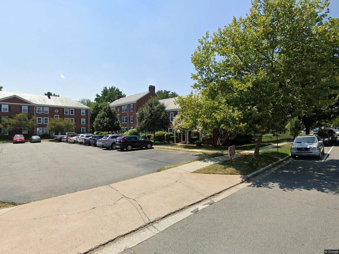
The Fairlington/Shirlington neighborhood of Arlington Countyis a center for professionals who work in Washington, DC, and its surrounding suburbs. The residents enjoy the convenience of urban amenities in a suburban location. Fairlington's red-brick Colonial Revival-style buildings sit on tree-lined streets and lure residents with its close-knit sense of community. Meanwhile, in adjacent Shirlington, there’s upscale residential housing, retail, restaurants, and entertainment.
Shirlington lies in the valley of Four Mile Run, a tributary of the Potomac River. The Fairlington/Shirlington community sits just off Interstate 395, less than five miles southwest of the Pentagon and less than 10 miles from DC.
Learn more about living in Fairlington/Shirlington| Colleges & Universities | Distance | ||
|---|---|---|---|
| Colleges & Universities | Distance | ||
| Drive: | 3 min | 1.3 mi | |
| Drive: | 11 min | 5.6 mi | |
| Drive: | 16 min | 5.8 mi | |
| Drive: | 12 min | 6.2 mi |


View GreatSchools Rating Methodology
Data provided by GreatSchools.org © 2026. All rights reserved.
Transportation options available in Arlington include Braddock Road, located 3.4 miles from 3068 S Abingdon St. 3068 S Abingdon St is near Ronald Reagan Washington Ntl, located 4.4 miles or 10 minutes away, and Washington Dulles International, located 24.7 miles or 43 minutes away.
| Transit / Subway | Distance | ||
|---|---|---|---|
| Transit / Subway | Distance | ||
|
|
Drive: | 10 min | 3.4 mi |
|
|
Drive: | 6 min | 3.7 mi |
| Drive: | 8 min | 3.8 mi | |
|
|
Drive: | 8 min | 4.1 mi |
| Drive: | 10 min | 5.0 mi |
| Commuter Rail | Distance | ||
|---|---|---|---|
| Commuter Rail | Distance | ||
|
|
Drive: | 9 min | 3.1 mi |
|
|
Drive: | 9 min | 3.1 mi |
|
|
Drive: | 9 min | 4.4 mi |
|
|
Drive: | 11 min | 6.3 mi |
|
|
Drive: | 14 min | 7.3 mi |
| Airports | Distance | ||
|---|---|---|---|
| Airports | Distance | ||
|
Ronald Reagan Washington Ntl
|
Drive: | 10 min | 4.4 mi |
|
Washington Dulles International
|
Drive: | 43 min | 24.7 mi |
Scores provided by
Traffic
-Airport
-Businesses
-Scores provided by
HowLoud What is a Sound Score Rating? A Sound Score Rating aggregates noise caused by vehicle traffic, airplane traffic and local sources. How It WorksTime and distance from 3068 S Abingdon St.
| Shopping Centers | Distance | ||
|---|---|---|---|
| Shopping Centers | Distance | ||
| Walk: | 13 min | 0.7 mi | |
| Walk: | 14 min | 0.8 mi | |
| Walk: | 16 min | 0.8 mi |
| Parks and Recreation | Distance | ||
|---|---|---|---|
| Parks and Recreation | Distance | ||
|
Lucky Run Park
|
Walk: | 11 min | 0.6 mi |
|
Allie S. Freed Park
|
Drive: | 3 min | 1.2 mi |
|
Shirlington Park
|
Drive: | 3 min | 1.3 mi |
|
Douglas Park
|
Drive: | 4 min | 1.3 mi |
|
Tuckahoe Park
|
Drive: | 5 min | 1.8 mi |
| Hospitals | Distance | ||
|---|---|---|---|
| Hospitals | Distance | ||
| Drive: | 5 min | 1.9 mi | |
| Drive: | 8 min | 4.4 mi | |
| Drive: | 13 min | 4.6 mi |
| Military Bases | Distance | ||
|---|---|---|---|
| Military Bases | Distance | ||
| Drive: | 9 min | 4.4 mi | |
| Drive: | 10 min | 5.4 mi | |
| Drive: | 14 min | 5.9 mi |
3068 S Abingdon St Photos
What Are Walk Score®, Transit Score®, and Bike Score® Ratings?
Walk Score® measures the walkability of any address. Transit Score® measures access to public transit. Bike Score® measures the bikeability of any address.
What is a Sound Score Rating?
A Sound Score Rating aggregates noise caused by vehicle traffic, airplane traffic and local sources.
3068 S Abingdon St
Arlington, VA 22206