

305 California Blvd
305 California Blvd,
Pasadena,
CA
91101
-
Monthly Rent
$2,200 - $2,595
-
Bedrooms
1 - 2 bd
-
Bathrooms
1 ba
-
Square Feet
612 - 830 sq ft
Highlights
- Yard
- Patio
Pricing & Floor Plans
-
Unit 19price $2,200square feet 612availibility Now
-
Unit 12price $2,595square feet 830availibility Now
-
Unit 09price $2,595square feet 830availibility Now
-
Unit 19price $2,200square feet 612availibility Now
-
Unit 12price $2,595square feet 830availibility Now
-
Unit 09price $2,595square feet 830availibility Now
Fees and Policies
The fees listed below are community-provided and may exclude utilities or add-ons. All payments are made directly to the property and are non-refundable unless otherwise specified. Use the Cost Calculator to determine costs based on your needs.
-
One-Time Basics
-
Application Fee Per Applicant$30
-
-
Cats
-
Pet DepositCharged per pet.$300
-
-
Surface Lot
Property Fee Disclaimer: Based on community-supplied data and independent market research. Subject to change without notice. May exclude fees for mandatory or optional services and usage-based utilities.
Details
Utilities Included
-
Water
Lease Options
-
12 mo
Property Information
-
Built in 1953
-
20 units/2 stories
About 305 California Blvd Pasadena, CA 91101
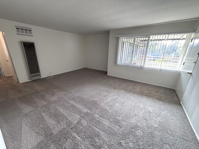
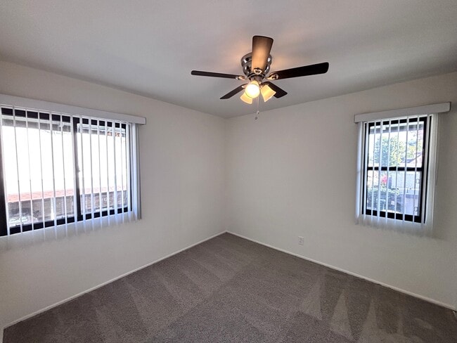
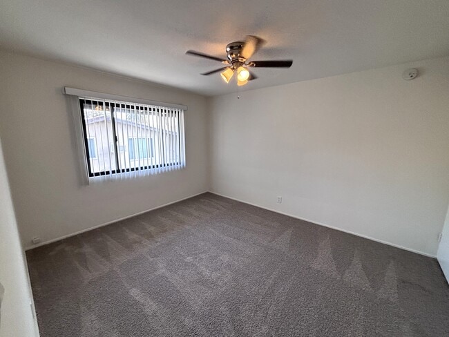
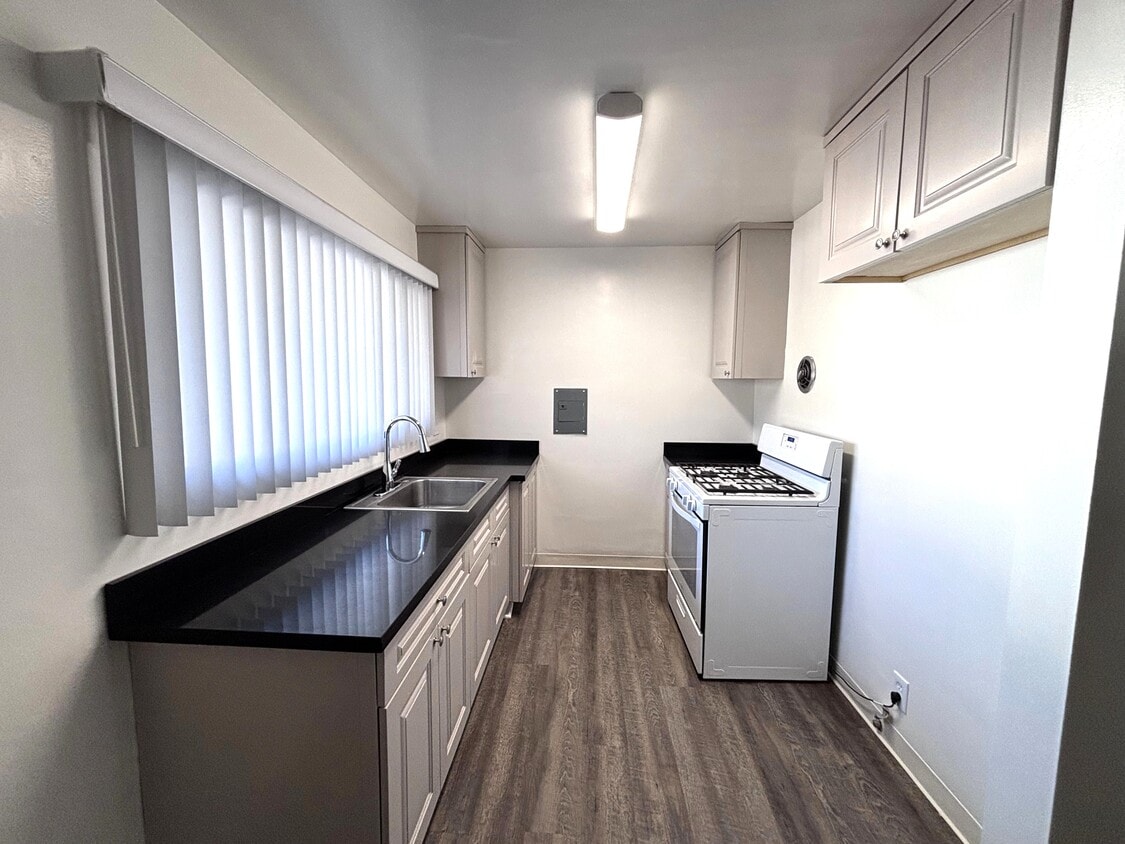
OPEN HOUSE: SATURDAY (3/7) 11 AM - 1 PM **Move In Special for 2 Bed Units: HALF OFF FIRST MONTHS RENT WITH APPROVED CREDIT. 305 E California Blvd is a well-maintained apartment property offering comfortable, practical living in a central Pasadena setting. The building features a clean, functional design with a straightforward layout and good natural light throughout. Residents enjoy the convenience of on-site parking, a shared on-site laundry room, and the added benefit of an on-site manager, providing day-to-day ease and responsive support. The property’s accessible layout and efficient configuration contribute to a comfortable living environment. With a welcoming street presence and thoughtful on-site amenities, this Pasadena apartment community offers a convenient and reliable place to call home.
305 California Blvd is an apartment community located in Los Angeles County and the 91101 ZIP Code. This area is served by the Pasadena Unified School District attendance zone.
Community Amenities
- Laundry Facilities
- Recycling
- Online Services
- Walk-Up
Apartment Features
Air Conditioning
High Speed Internet Access
Yard
Refrigerator
- High Speed Internet Access
- Air Conditioning
- Heating
- Ceiling Fans
- Smoke Free
- Storage Space
- Tub/Shower
- Kitchen
- Range
- Refrigerator
- Freezer
- Carpet
- Tile Floors
- Vinyl Flooring
- Patio
- Yard
Downtown Pasadena is the central business district of Pasadena, and is located at the base of the San Gabriel Mountains, only 10 miles northeast of Downtown Los Angeles. Old Pasadena and the Playhouse District are communities within DT Pasadena Downtown is known for having outdoor festivities like the New Year's Day Rose Parade. Historic Old Pasadena is known for its vibrant shopping, dining, and entertainment. Downtown Pasadena is known for its luxury apartments.
In and around the area, renters can discover various activities, including museums and historical landmarks like the Fork in the Road. Every summer at the Levitt Pavilion Pasadena, a music festival is held with 50 concerts featuring Latin, blues, jazz, and more.
Learn more about living in Downtown PasadenaCompare neighborhood and city base rent averages by bedroom.
| Downtown Pasadena | Pasadena, CA | |
|---|---|---|
| Studio | $2,147 | $1,957 |
| 1 Bedroom | $2,609 | $2,335 |
| 2 Bedrooms | $3,273 | $3,030 |
| 3 Bedrooms | $4,279 | $3,779 |
- Laundry Facilities
- Recycling
- Online Services
- Walk-Up
- High Speed Internet Access
- Air Conditioning
- Heating
- Ceiling Fans
- Smoke Free
- Storage Space
- Tub/Shower
- Kitchen
- Range
- Refrigerator
- Freezer
- Carpet
- Tile Floors
- Vinyl Flooring
- Patio
- Yard
| Monday | By Appointment |
|---|---|
| Tuesday | By Appointment |
| Wednesday | By Appointment |
| Thursday | By Appointment |
| Friday | By Appointment |
| Saturday | 11am - 1pm |
| Sunday | By Appointment |
| Colleges & Universities | Distance | ||
|---|---|---|---|
| Colleges & Universities | Distance | ||
| Walk: | 15 min | 0.8 mi | |
| Drive: | 3 min | 1.1 mi | |
| Drive: | 3 min | 1.3 mi | |
| Drive: | 5 min | 1.8 mi |


View GreatSchools Rating Methodology
Data provided by GreatSchools.org © 2026. All rights reserved.
Transportation options available in Pasadena include Fillmore Station, located 0.5 mile from 305 California Blvd. 305 California Blvd is near Bob Hope, located 17.1 miles or 24 minutes away, and Los Angeles International, located 24.2 miles or 38 minutes away.
| Transit / Subway | Distance | ||
|---|---|---|---|
| Transit / Subway | Distance | ||
|
|
Walk: | 9 min | 0.5 mi |
|
|
Walk: | 12 min | 0.7 mi |
|
|
Walk: | 20 min | 1.0 mi |
|
|
Drive: | 4 min | 2.0 mi |
|
|
Drive: | 5 min | 2.5 mi |
| Commuter Rail | Distance | ||
|---|---|---|---|
| Commuter Rail | Distance | ||
|
|
Drive: | 15 min | 9.2 mi |
|
|
Drive: | 17 min | 9.2 mi |
|
|
Drive: | 14 min | 9.6 mi |
|
|
Drive: | 18 min | 11.2 mi |
| Drive: | 19 min | 13.3 mi |
| Airports | Distance | ||
|---|---|---|---|
| Airports | Distance | ||
|
Bob Hope
|
Drive: | 24 min | 17.1 mi |
|
Los Angeles International
|
Drive: | 38 min | 24.2 mi |
Time and distance from 305 California Blvd.
| Shopping Centers | Distance | ||
|---|---|---|---|
| Shopping Centers | Distance | ||
| Walk: | 6 min | 0.3 mi | |
| Walk: | 7 min | 0.4 mi | |
| Walk: | 9 min | 0.5 mi |
| Parks and Recreation | Distance | ||
|---|---|---|---|
| Parks and Recreation | Distance | ||
|
Huntington Botanical Gardens
|
Drive: | 7 min | 2.2 mi |
|
Kidspace Children's Museum
|
Drive: | 6 min | 2.8 mi |
|
Jet Propulsion Laboratory
|
Drive: | 7 min | 4.5 mi |
|
Audubon Center at Debs Park
|
Drive: | 8 min | 5.2 mi |
|
Eaton Canyon Nature Center
|
Drive: | 11 min | 5.6 mi |
| Hospitals | Distance | ||
|---|---|---|---|
| Hospitals | Distance | ||
| Walk: | 8 min | 0.5 mi | |
| Drive: | 8 min | 3.4 mi | |
| Drive: | 7 min | 4.0 mi |
| Military Bases | Distance | ||
|---|---|---|---|
| Military Bases | Distance | ||
| Drive: | 35 min | 25.8 mi | |
| Drive: | 44 min | 29.6 mi |
305 California Blvd Photos
Nearby Apartments
Within 50 Miles of 305 California Blvd Pasadena, CA 91101
-
255 Oakland Ave
Pasadena, CA 91101
$2,195
1 Br 0.4 mi
-
The Montgomery
4205 Cahuenga Blvd
Toluca Lake, CA 91602
$2,595 - $2,700
1 Br 12.5 mi
-
Courtyard on Miranda
11476 Miranda St
North Hollywood, CA 91601
$2,495
2 Br 13.8 mi
-
The Olive Tree Apartments
14960 Sherman Way
Van Nuys, CA 91405
$1,995 - $2,850
1-2 Br 18.6 mi
-
Zelzah Apartments
5417-5425 Zelzah Ave
Encino, CA 91316
$2,563 - $3,500
2-3 Br 21.8 mi
-
Las Flores Apartments
26123 Bouquet Canyon Rd
Santa Clarita, CA 91350
$1,995 - $2,295
1 Br 30.0 mi
While 305 California Blvd does not provide in‑unit laundry, on‑site laundry facilities are available for shared resident use.
305 California Blvd includes water in rent. Residents are responsible for any other utilities not listed.
Parking is available at 305 California Blvd. Contact this property for details.
305 California Blvd has one to two-bedrooms with rent ranges from $2,200/mo. to $2,595/mo.
Yes, 305 California Blvd welcomes pets. Breed restrictions, weight limits, and additional fees may apply. View this property's pet policy.
A good rule of thumb is to spend no more than 30% of your gross income on rent. Based on the lowest available rent of $2,200 for a one-bedroom, you would need to earn about $88,000 per year to qualify. Want to double-check your budget? Calculate how much rent you can afford with our Rent Affordability Calculator.
305 California Blvd is offering Specials for eligible applicants, with rental rates starting at $2,200.
While 305 California Blvd does not offer Matterport 3D tours, renters can request a tour directly through our online platform.
What Are Walk Score®, Transit Score®, and Bike Score® Ratings?
Walk Score® measures the walkability of any address. Transit Score® measures access to public transit. Bike Score® measures the bikeability of any address.
What is a Sound Score Rating?
A Sound Score Rating aggregates noise caused by vehicle traffic, airplane traffic and local sources.
305 California Blvd
Pasadena, CA 91101
Property Manager Responded