
$3,500 / Month
3048 Fair Oaks Ave
Altadena, CA 91001
Today
Favorites
818-261-9596
-
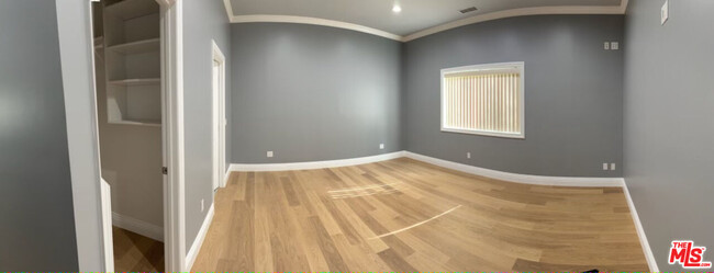
Bedrooms
2
-
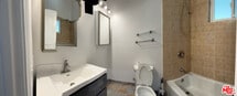
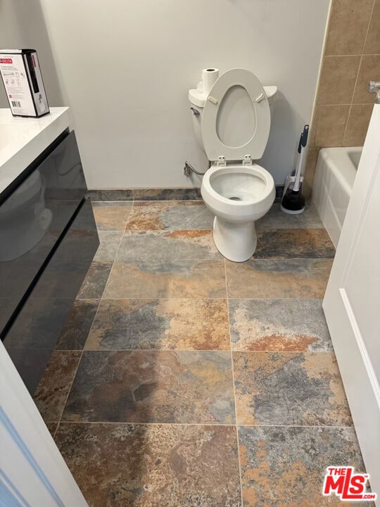
Bathrooms
2
-
Square Feet
1,200 sq ft
-
Available
Available Now
3048 Fair Oaks Ave

Favorites
About This Home
$3,500 deposit,
Available Now
MLS# 24-474283
3048 Fair Oaks Ave is a house located in Los Angeles County and the 91001 ZIP Code. This area is served by the Pasadena Unified attendance zone.
* Price shown is base rent and may not include non-optional fees and utilities.
Price, availability, fees, and any applicable rent special are subject to change without notice.
* Square footage definitions vary. Displayed square footage is approximate.
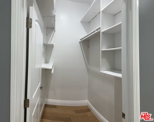
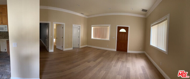
House Features
Dishwasher
Washer/Dryer Hookup
Refrigerator
Vinyl Flooring
- Washer/Dryer Hookup
- Dishwasher
- Refrigerator
- Vinyl Flooring
- Family Room
- Views
Fees and Policies
The fees below are based on community-supplied data and may exclude additional fees and utilities.
Contact
- Listed by Ovsanna Khacheryan | eXp Realty of California Inc
- Phone Number
- Contact
-
Source
 MLS(TM)/CLAW
Copyright 2025 TheMLS/CLAW. All rights reserved. Information is deemed reliable but not guaranteed.
Location
Get Directions
Amenities
- Washer/Dryer Hookup
- Dishwasher
- Refrigerator
- Vinyl Flooring
- Family Room
- Views
Altadena is a thriving suburban community sandwiched between Pasadena to the south and the Angeles National Forest to the north. Almost entirely a residential community, Altadena’s rental market is mostly composed of unpretentious single-family homes with a handful of apartments and condos in the mix as well.
NASA’s Jet Propulsion Lab oratory sits just to the west of town, making Altadena a popular home base for many of the facility’s staff. The Rubio Canyon and Sam Merrill Trailheads provide direct links from the northern part of Altadena into the nearby hills, making it a great spot for folks who enjoy hiking and exploring the rugged landscape of Southern California.
Learn more about living in Altadena
Education
| Colleges & Universities | Distance | ||
|---|---|---|---|
| Colleges & Universities | Distance | ||
| Drive: | 9 min | 4.1 mi | |
| Drive: | 11 min | 4.6 mi | |
| Drive: | 12 min | 5.1 mi | |
| Drive: | 13 min | 5.8 mi |
3048 Fair Oaks Ave is within 9 minutes or 4.1 miles from Fuller Theological Seminary. It is also near Art Center College of Design and Pasadena City College.
Schools


Public Elementary School
Grades K-5
457 Students
Attendance Zone
Public Elementary School
Grades K-6
454 Students
Nearby
Public Middle School
Grades 6-8
423 Students
Attendance Zone
Public High School
Grades 9-12
1,012 Students
Attendance Zone
Private Elementary, Middle & High School
Grades PK-12
281 Students
Nearby
School data provided by
 The GreatSchools Rating helps parents compare schools within a state based on a variety of school quality indicators and provides a helpful picture of how effectively each school serves all of its students. Ratings are on a scale of 1 (below average) to 10 (above average) and can include test scores, college readiness, academic progress, advanced courses, equity, discipline and attendance data. We also advise parents to visit schools, consider other information on school performance and programs, and consider family needs as part of the school selection process.
View GreatSchools Rating Methodology
Data provided by GreatSchools.org © 2025. All rights reserved.
View GreatSchools Rating Methodology
Data provided by GreatSchools.org © 2025. All rights reserved.
Transportation options available in Altadena include Memorial Park Station, located 3.7 miles from 3048 Fair Oaks Ave. 3048 Fair Oaks Ave is near Bob Hope, located 17.7 miles or 28 minutes away, and Los Angeles International, located 28.7 miles or 46 minutes away.
| Transit / Subway | Distance | ||
|---|---|---|---|
| Transit / Subway | Distance | ||
| Drive: | 9 min | 3.7 mi | |
| Drive: | 10 min | 4.0 mi | |
| Drive: | 11 min | 4.6 mi | |
| Drive: | 9 min | 5.5 mi | |
| Drive: | 10 min | 6.5 mi |
| Commuter Rail | Distance | ||
|---|---|---|---|
| Commuter Rail | Distance | ||
| Drive: | 19 min | 11.9 mi | |
| Drive: | 26 min | 12.9 mi | |
| Drive: | 24 min | 13.8 mi | |
|
|
Drive: | 21 min | 13.9 mi |
| Drive: | 27 min | 17.7 mi |
| Airports | Distance | ||
|---|---|---|---|
| Airports | Distance | ||
|
Bob Hope
|
Drive: | 28 min | 17.7 mi |
|
Los Angeles International
|
Drive: | 46 min | 28.7 mi |
Time and distance from 3048 Fair Oaks Ave.
| Shopping Centers | Distance | ||
|---|---|---|---|
| Shopping Centers | Distance | ||
| Walk: | 18 min | 1.0 mi | |
| Drive: | 3 min | 1.3 mi | |
| Drive: | 4 min | 1.7 mi |
3048 Fair Oaks Ave has 3 shopping centers within 1.7 miles, which is about a 4-minute walk. The miles and minutes will be for the farthest away property.
| Parks and Recreation | Distance | ||
|---|---|---|---|
| Parks and Recreation | Distance | ||
|
Jet Propulsion Laboratory
|
Drive: | 5 min | 2.4 mi |
|
Kidspace Children's Museum
|
Drive: | 9 min | 3.8 mi |
|
Eaton Canyon Nature Center
|
Drive: | 9 min | 3.9 mi |
|
Descanso Gardens
|
Drive: | 11 min | 6.0 mi |
|
Huntington Botanical Gardens
|
Drive: | 16 min | 6.4 mi |
3048 Fair Oaks Ave has 5 parks within 6.4 miles, including Jet Propulsion Laboratory, Kidspace Children's Museum, and Eaton Canyon Nature Center.
| Hospitals | Distance | ||
|---|---|---|---|
| Hospitals | Distance | ||
| Drive: | 10 min | 5.4 mi | |
| Drive: | 11 min | 6.0 mi | |
| Drive: | 13 min | 6.5 mi |
3048 Fair Oaks Ave has 3 hospitals within 6.5 miles, the nearest is Huntington Memorial Hospital which is 5.4 miles away and a 10 minute drive.
| Military Bases | Distance | ||
|---|---|---|---|
| Military Bases | Distance | ||
| Drive: | 43 min | 30.2 mi | |
| Drive: | 53 min | 33.8 mi |
3048 Fair Oaks Ave is 30.2 miles from Los Angeles Air Force Base, and is convenient to other military bases, including Los Alamitos Army Airfield.
You May Also Like
Similar Rentals Nearby


What Are Walk Score®, Transit Score®, and Bike Score® Ratings?
Walk Score® measures the walkability of any address. Transit Score® measures access to public transit. Bike Score® measures the bikeability of any address.
What is a Sound Score Rating?
A Sound Score Rating aggregates noise caused by vehicle traffic, airplane traffic and local sources

3048 Fair Oaks Ave
Altadena, CA 91001