
$6,500
/ Month
30000 N Camino los Robles
Santa Clarita, CA 91354
Today
|
Edit
Favorites
-
Bedrooms
4
-
Bathrooms
4.5
-
Square Feet
3,377 sq ft
30000 N Camino los Robles

Favorites
About This Home
$13,000 deposit
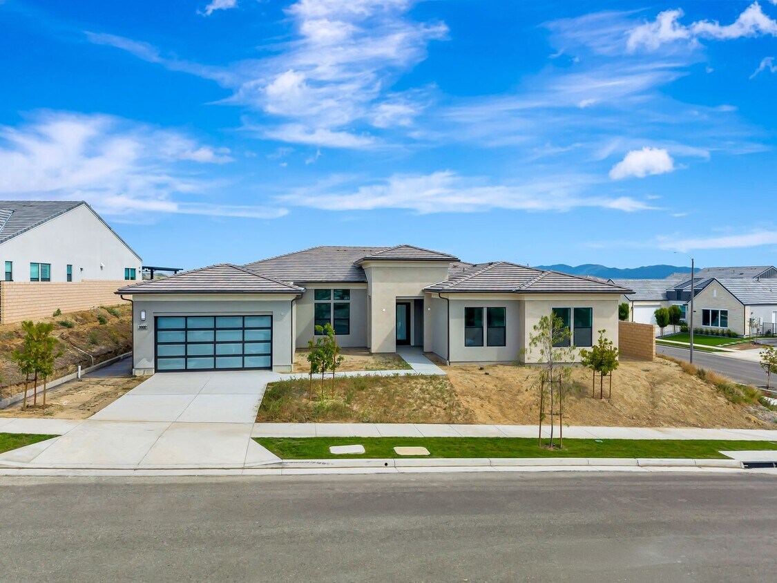
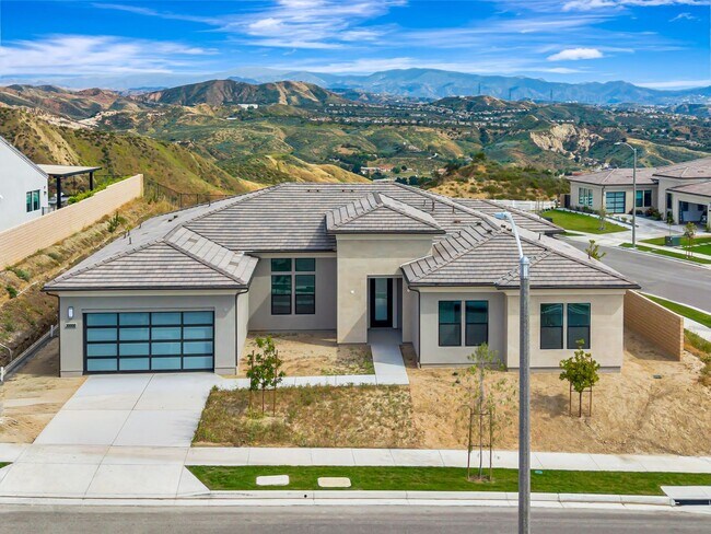
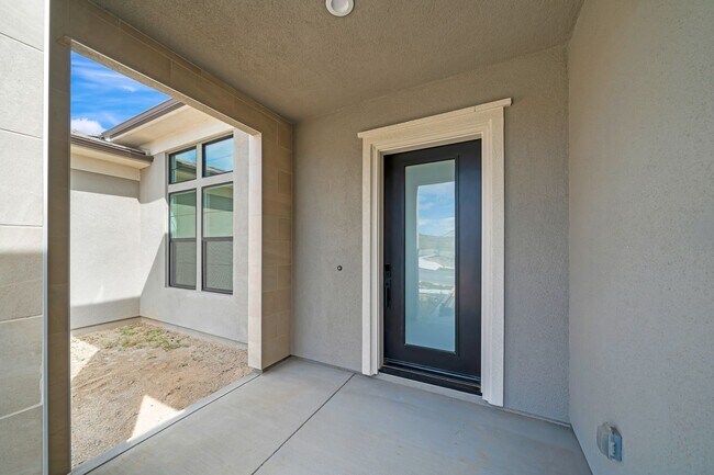
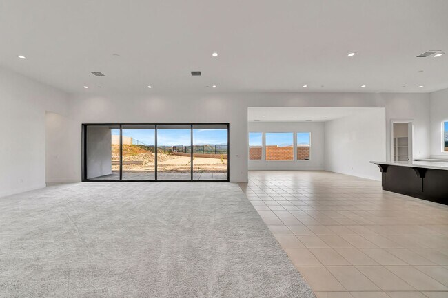
Welcome to this stunning single-story residence at 30000 Camino Los Robles in Valencia’s prestigious hillside community. This elegant 4-bedroom, 4.5-bathroom home delivers approximately 3,377 square feet of spacious, open-concept living with premium finishes throughout. Soaring ceilings and abundant natural light greet you as you enter. The chef-inspired kitchen features sleek dark cabinetry, crisp white quartz countertops, a large center island perfect for entertaining, high-end stainless steel appliances including a Wolf range, and a walk-in pantry. The primary suite offers a private retreat with a luxurious en-suite bath, while the additional three bedrooms provide generous space and ample closet storage. Multiple bathrooms ensure convenience for family and guests. The home is equipped with energy-efficient solar panels and is smart home-ready. Expansive windows and multi-panel sliding glass doors open to breathtaking panoramic views of rolling hills, mountains, and the surrounding valley. With durable tile flooring, modern recessed lighting, and designer touches throughout, this residence is move-in ready. The backyard presents a large outdoor oasis with endless vistas. **Photos feature AI generated backyard. This is a concept of what the backyard may resemble.**
30000 N Camino Los Robles is a house located in Los Angeles County and the 91354 ZIP Code. This area is served by the William S. Hart Union High School District attendance zone.
* Price shown is base rent. Excludes user-selected optional fees and variable or usage-based fees and required charges due at or prior to move-in or at move-out. Price, availability, fees, and any applicable rent special are subject to change without notice.
* Square footage definitions vary. Displayed square footage is approximate.
Contact
- Listed by Dagger Management | Dagger Management
Location
Get Directions
Situated in Southern California, Santa Clarita Valley is an opulent suburb surrounded by nature preserves. The northern section of the region encompasses Castaic Lake State Recreation Park, while the eastern and western sides of the area are bordered by the Santa Clarita Woodlands Park and the Golden Valley Ranch Open Space. Also located in the valley are meandering trails that follow along the river and connect to scenic community parks. Located just 35 miles north of Los Angeles, Santa Clarita offers more than the great outdoors. Places like Six Flags Magic Mountain, sprawling golf courses, and premier shopping at plazas like Westfield Valencia Town Center are all located within Santa Clarita Valley. More shopping and retail centers can be found off Lyons Avenue and Soledad Canyon Road, while Main Street’s locally owned cafes, specialty shops, and restaurants provide a nice contrast to large commercial plazas.
Learn more about living in Santa Clarita Valley
Education
| Colleges & Universities | Distance | ||
|---|---|---|---|
| Colleges & Universities | Distance | ||
| Drive: | 17 min | 7.8 mi | |
| Drive: | 32 min | 21.1 mi | |
| Drive: | 38 min | 22.4 mi | |
| Drive: | 57 min | 40.0 mi |
30000 N Camino los Robles is within 17 minutes or 7.8 miles from College of the Canyons. It is also near Mission College and Cal State Northridge.
Schools


Public Elementary School
Grades K-5
503 Students
Nearby
Public Middle School
Grades 6-8
1,138 Students
Nearby
Public High School
Grades 9-12
2,286 Students
Nearby
Private Elementary, Middle & High School
Grades K-12
123 Students
Nearby
School data provided by
 The GreatSchools Rating helps parents compare schools within a state based on a variety of school quality indicators and provides a helpful picture of how effectively each school serves all of its students. Ratings are on a scale of 1 (below average) to 10 (above average) and can include test scores, college readiness, academic progress, advanced courses, equity, discipline and attendance data. We also advise parents to visit schools, consider other information on school performance and programs, and consider family needs as part of the school selection process.
View GreatSchools Rating Methodology
Data provided by GreatSchools.org © 2026. All rights reserved.
View GreatSchools Rating Methodology
Data provided by GreatSchools.org © 2026. All rights reserved.
Getting Around
 What do Walkability, Transit, Drivability, and Bikeability mean?
Walkability measures the walking distance to day-to-day needs.
Transit measures access to public transportation.
Drivability measures congestion, parking availability, and access to major roads.
Bikeability measures the suitability for cycling.
How It Works
What do Walkability, Transit, Drivability, and Bikeability mean?
Walkability measures the walking distance to day-to-day needs.
Transit measures access to public transportation.
Drivability measures congestion, parking availability, and access to major roads.
Bikeability measures the suitability for cycling.
How It Works
Not Walkable
Walkability
10
/ 100
Minimal Public Transit
Transit
0
/ 100
Exceptionally Drivable
Drivability
100
/ 100
Somewhat Bikeable
Bikeability
20
/ 100
Scores provided by
-
Soundscore™
-
/ 100
Traffic
-Airport
-Businesses
-Scores provided by
HowLoud What is a Sound Score Rating? A Sound Score Rating aggregates noise caused by vehicle traffic, airplane traffic and local sources. How It WorksYou May Also Like
Similar Rentals Nearby
-
-

-

-

-

-
-

-

-

-
 5 Beds, 4 Baths, 3,084 sq ft$5,000Total Monthly PriceTotal Monthly Price NewPrices include all required monthly fees.27016 Island Rd


What Are Walk Score®, Transit Score®, and Bike Score® Ratings?
Walk Score® measures the walkability of any address. Transit Score® measures access to public transit. Bike Score® measures the bikeability of any address.
What is a Sound Score Rating?
A Sound Score Rating aggregates noise caused by vehicle traffic, airplane traffic and local sources.

30000 N Camino los Robles
Santa Clarita, CA 91354