
$2,400
Total Monthly Price
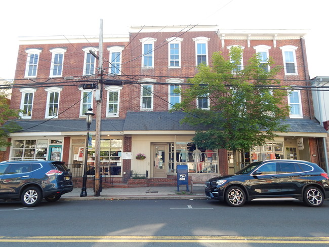
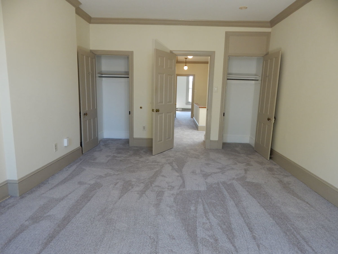
30 S State St Unit 2
Newtown, PA 18940
2 Weeks Ago
|
Edit
Favorites
30 S State St Unit 2

Favorites
Check Back Soon for Upcoming Availability
| Beds | Baths | Average SF |
|---|---|---|
| 2 Bedrooms 2 Bedrooms 2 Br | 1 Bath 1 Bath 1 Ba | 1,000 SF |
Fees and Policies
The fees listed below are community-provided and may exclude utilities or add-ons. All payments are made directly to the property and are non-refundable unless otherwise specified.
- Cats Allowed
-
Fees not specified
-
Weight limit--
-
Pet Limit--
- Parking
-
Surface Lot--
Details
Utilities Included
-
Water
-
Trash Removal
-
Sewer
Lease Options
-
12 Months
About This Property
Comprising the second and third floors of an historic building, downtown in the Borough of Newtown, Bucks County, Pennsylvania, your apartment is above Smooth Roots, next-to Strada Boutique and the former Marisa Boutique, just down the street from Starbucks and a wealth of other walk-to establishments, including the Newtown Depot shopping center and the center of Newtown. It’s just two miles from Bucks County Community College, a mile-and-a-half from Tyler State Park, under a mile from Council Rock High School North, just over 5 miles from SEPTA in Langhorne and just over 11 miles from NJ Transit in Trenton.
30 S State St is an apartment community located in Bucks County and the 18940 ZIP Code. This area is served by the Council Rock School District attendance zone.
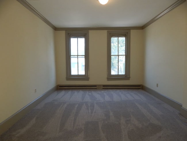
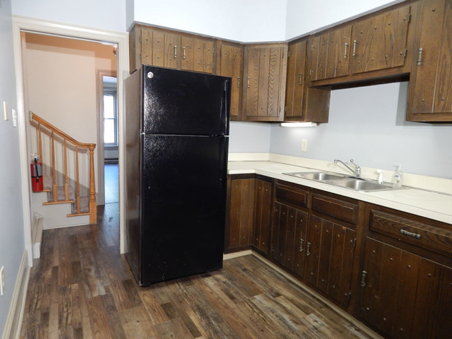
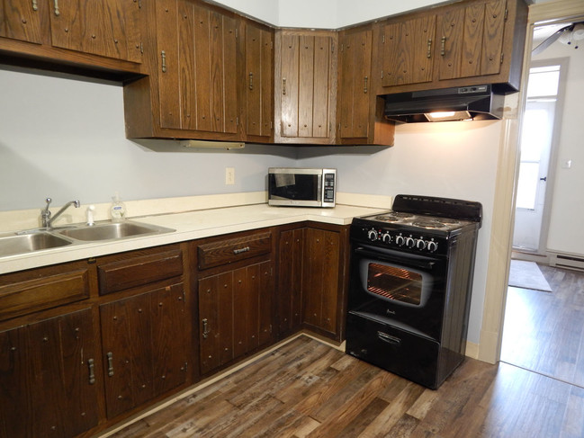
Apartment Features
Washer/Dryer
Air Conditioning
Refrigerator
Smoke Free
- Washer/Dryer
- Air Conditioning
- Smoke Free
- Kitchen
- Oven
- Range
- Refrigerator
- High Ceilings
- Skylights
- Deck
30 S State St,
Newtown,
PA
18940
Amenities
- Washer/Dryer
- Air Conditioning
- Smoke Free
- Kitchen
- Oven
- Range
- Refrigerator
- High Ceilings
- Skylights
- Deck
Expenses
Utilities Included
Water, Trash Removal, Sewer
Included
Education
| Colleges & Universities | Distance | ||
|---|---|---|---|
| Colleges & Universities | Distance | ||
| Drive: | 5 min | 2.0 mi | |
| Drive: | 19 min | 10.4 mi | |
| Drive: | 19 min | 10.9 mi | |
| Drive: | 22 min | 13.4 mi |
30 S State St Unit 2 is within 5 minutes or 2.0 miles from Bucks County Community College. It is also near Mercer Co. C.C., Kerney and C.C. of Philadelphia, NE Ctr.
Schools


Public Elementary School
Grades K-5
Nearby
Public Elementary School
Grades K-5
Attendance Zone
Public Middle School
Grades 6-8
Attendance Zone
Public High School
Grades 9-12
Attendance Zone
Private Elementary & Middle School
Grades PK-8
Nearby
Private Elementary School
Grades PK-K
148 Students
Nearby
Private High School
Grades 9-12
Nearby
School data provided by
 The GreatSchools Rating helps parents compare schools within a state based on a variety of school quality indicators and provides a helpful picture of how effectively each school serves all of its students. Ratings are on a scale of 1 (below average) to 10 (above average) and can include test scores, college readiness, academic progress, advanced courses, equity, discipline and attendance data. We also advise parents to visit schools, consider other information on school performance and programs, and consider family needs as part of the school selection process.
View GreatSchools Rating Methodology
Data provided by GreatSchools.org © 2026. All rights reserved.
View GreatSchools Rating Methodology
Data provided by GreatSchools.org © 2026. All rights reserved.
Transportation options available in Newtown include Hamilton Avenue, located 11.2 miles from 30 S State St Unit 2. 30 S State St Unit 2 is near Trenton Mercer, located 9.1 miles or 16 minutes away, and Philadelphia International, located 37.7 miles or 58 minutes away.
| Transit / Subway | Distance | ||
|---|---|---|---|
| Transit / Subway | Distance | ||
|
|
Drive: | 20 min | 11.2 mi |
| Drive: | 20 min | 11.3 mi | |
|
|
Drive: | 23 min | 12.6 mi |
| Commuter Rail | Distance | ||
|---|---|---|---|
| Commuter Rail | Distance | ||
|
|
Drive: | 10 min | 5.1 mi |
|
|
Drive: | 12 min | 6.3 mi |
|
|
Drive: | 10 min | 6.6 mi |
|
|
Drive: | 14 min | 7.3 mi |
|
|
Drive: | 16 min | 8.1 mi |
| Airports | Distance | ||
|---|---|---|---|
| Airports | Distance | ||
|
Trenton Mercer
|
Drive: | 16 min | 9.1 mi |
|
Philadelphia International
|
Drive: | 58 min | 37.7 mi |
Walkability Near 30 S State St Newtown, PA 18940
Getting Around
 What do Walkability, Transit, Drivability, and Bikeability mean?
Walkability measures the walking distance to day-to-day needs.
Transit measures access to public transportation.
Drivability measures congestion, parking availability, and access to major roads.
Bikeability measures the suitability for cycling.
How It Works
What do Walkability, Transit, Drivability, and Bikeability mean?
Walkability measures the walking distance to day-to-day needs.
Transit measures access to public transportation.
Drivability measures congestion, parking availability, and access to major roads.
Bikeability measures the suitability for cycling.
How It Works
Moderately Walkable
Walkability
70
/ 100
Limited Public Transit
Transit
30
/ 100
Exceptionally Drivable
Drivability
100
/ 100
Fairly Bikeable
Bikeability
50
/ 100
Scores provided by
Active
Soundscore™
72
/ 100
Traffic
ActiveAirport
CalmBusinesses
BusyScores provided by
HowLoud What is a Sound Score Rating? A Sound Score Rating aggregates noise caused by vehicle traffic, airplane traffic and local sources. How It WorksTime and distance from 30 S State St Unit 2.
| Shopping Centers | Distance | ||
|---|---|---|---|
| Shopping Centers | Distance | ||
| Walk: | 4 min | 0.3 mi | |
| Walk: | 6 min | 0.3 mi | |
| Walk: | 6 min | 0.4 mi |
30 S State St Unit 2 has 3 shopping centers within 0.4 mile, which is about a 6-minute walk. The miles and minutes will be for the farthest away property.
| Parks and Recreation | Distance | ||
|---|---|---|---|
| Parks and Recreation | Distance | ||
|
Tyler State Park
|
Drive: | 7 min | 3.3 mi |
|
Core Creek Park
|
Drive: | 9 min | 3.8 mi |
|
Churchville Nature Center
|
Drive: | 9 min | 5.1 mi |
|
Washington Crossing State Park
|
Drive: | 16 min | 7.9 mi |
|
Simpson Observatory
|
Drive: | 19 min | 8.5 mi |
30 S State St Unit 2 has 5 parks within 8.5 miles, including Tyler State Park, Core Creek Park, and Churchville Nature Center.
| Hospitals | Distance | ||
|---|---|---|---|
| Hospitals | Distance | ||
| Drive: | 17 min | 9.9 mi | |
| Drive: | 20 min | 10.6 mi | |
| Drive: | 20 min | 11.6 mi |
30 S State St Unit 2 has 3 hospitals within 11.6 miles, the nearest is Rothman Orthopaedic Specialty Hospital which is 9.9 miles away and a 17 minute drive.
| Military Bases | Distance | ||
|---|---|---|---|
| Military Bases | Distance | ||
| Drive: | 18 min | 9.3 mi | |
| Drive: | 28 min | 14.7 mi |
30 S State St Unit 2 is 9.3 miles from Naval Air Development Center, and is convenient to other military bases, including Willow Grove Naval Air Station.
You May Also Like
Similar Rentals Nearby


What Are Walk Score®, Transit Score®, and Bike Score® Ratings?
Walk Score® measures the walkability of any address. Transit Score® measures access to public transit. Bike Score® measures the bikeability of any address.
What is a Sound Score Rating?
A Sound Score Rating aggregates noise caused by vehicle traffic, airplane traffic and local sources.
30 S State St
Newtown, PA 18940