


$1,325
/ Month
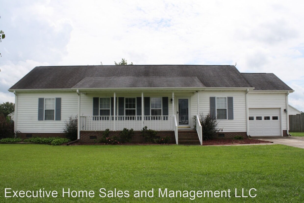
1961 Nahunta Rd
Pikeville, NC 27863
2 Weeks Ago
|
Edit
Favorites
1961 Nahunta Rd

Favorites
Check Back Soon for Upcoming Availability
| Beds | Baths | Average SF |
|---|---|---|
| 3 Bedrooms 3 Bedrooms 3 Br | 2 Baths 2 Baths 2 Ba | 1,287 SF |
About This Property
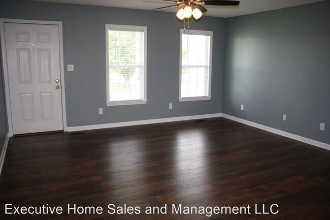
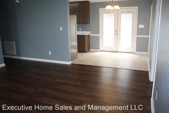
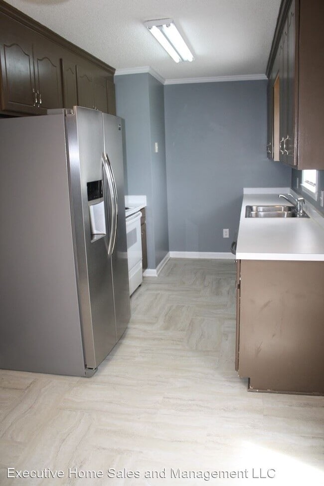
(919) 988-0518 - 1961 Nahunta Rd - Must see this beautiful home! New flooring and paint throughout most of home. Living room open to dining area. Galley kitchen with lots of counter and cabinet space. Split bedroom floorplan. Master with large closest and private bath. 2 secondary bedrooms and an additional room for an office or playroom. Hall bath. Back deck overlooks large, fenced in backyard. Swing set and large storage shed included. 1 car garage. (RLNE4338218)
1961 Nahunta Rd is a house located in Wayne County and the 27863 ZIP Code. This area is served by the Wayne County Public School District attendance zone.
1961 Nahunta Rd,
Pikeville,
NC
27863
Education
| Colleges & Universities | Distance | ||
|---|---|---|---|
| Colleges & Universities | Distance | ||
| Drive: | 32 min | 24.7 mi | |
| Drive: | 44 min | 37.1 mi | |
| Drive: | 47 min | 37.5 mi | |
| Drive: | 63 min | 50.9 mi |
1961 Nahunta Rd is within 32 minutes or 24.7 miles from Mount Olive College. It is also near Wake Technical,Eastern Edu Ctr and Nash Community College.
Schools


Public Elementary School
Grades PK-5
241 Students
Nearby
Public Elementary School
Grades K-5
709 Students
Attendance Zone
Public Middle School
Grades 6-8
886 Students
Attendance Zone
Public High School
Grades 9-12
1,122 Students
Attendance Zone
Private Elementary, Middle & High School
Grades K-12
303 Students
Nearby
Private Elementary, Middle & High School
Grades PK-12
743 Students
Nearby
Private Elementary, Middle & High School
Grades K-12
23 Students
Nearby
School data provided by
 The GreatSchools Rating helps parents compare schools within a state based on a variety of school quality indicators and provides a helpful picture of how effectively each school serves all of its students. Ratings are on a scale of 1 (below average) to 10 (above average) and can include test scores, college readiness, academic progress, advanced courses, equity, discipline and attendance data. We also advise parents to visit schools, consider other information on school performance and programs, and consider family needs as part of the school selection process.
View GreatSchools Rating Methodology
Data provided by GreatSchools.org © 2026. All rights reserved.
View GreatSchools Rating Methodology
Data provided by GreatSchools.org © 2026. All rights reserved.
Walkability Near 1961 Nahunta Rd Pikeville, NC 27863
Getting Around
 What do Walkability, Transit, Drivability, and Bikeability mean?
Walkability measures the walking distance to day-to-day needs.
Transit measures access to public transportation.
Drivability measures congestion, parking availability, and access to major roads.
Bikeability measures the suitability for cycling.
How It Works
What do Walkability, Transit, Drivability, and Bikeability mean?
Walkability measures the walking distance to day-to-day needs.
Transit measures access to public transportation.
Drivability measures congestion, parking availability, and access to major roads.
Bikeability measures the suitability for cycling.
How It Works
Not Walkable
Walkability
10
/ 100
Exceptionally Drivable
Drivability
100
/ 100
Somewhat Bikeable
Bikeability
30
/ 100
Scores provided by
-
Soundscore™
-
/ 100
Traffic
-Airport
-Businesses
-Scores provided by
HowLoud What is a Sound Score Rating? A Sound Score Rating aggregates noise caused by vehicle traffic, airplane traffic and local sources. How It WorksYou May Also Like
Similar Rentals Nearby


What Are Walk Score®, Transit Score®, and Bike Score® Ratings?
Walk Score® measures the walkability of any address. Transit Score® measures access to public transit. Bike Score® measures the bikeability of any address.
What is a Sound Score Rating?
A Sound Score Rating aggregates noise caused by vehicle traffic, airplane traffic and local sources.
1961 Nahunta Rd
Pikeville, NC 27863