
$1,640
Total Monthly Price
12 Month Lease
29B Broad St Unit 29 B Broad Street
Medway, MA 02053
Favorites
508-614-9569
-
Bedrooms
2
-
Bathrooms
1
-
Square Feet
850 sq ft
-
Available
Available Now
Highlight
- Attic
29B Broad St Unit 29 B Broad Street

Favorites
About This Home
12 Month Lease,
$3,280 deposit,
Available Now
Looking for a comfortable, quiet place to call home? This bright 2 bedroom apartment offers the perfect balance of convenience and charm. Located on the 2nd floor of a quiet owner-occupied 4-family home, the approximately 850 sq ft space features excellent natural light, bedrooms/living room & bathroom refreshed w/ paint/trim, new bathroom floor new living room carpeting. Plenty of storage space. Everything you need is nearby, easy access to Route 495, shopping, dining, parks, and walking trails. Local laundry services are also conveniently located nearby. No smoking. No pets. Rent is $1,640 per month plus utilities based on tenant usage.
29B Broad St is an apartment community located in Norfolk County and the 02053 ZIP Code. This area is served by the Medway School District attendance zone.
* Price shown is total price based on community-supplied monthly required fees. Excludes user-selected optional fees and variable or usage-based fees and required charges due at or prior to move-in or at move-out. Price, availability, fees, and any applicable rent special are subject to change without notice.
* Square footage definitions vary. Displayed square footage is approximate.
Apartment Features
Refrigerator
Tub/Shower
Freezer
Ceiling Fans
- Ceiling Fans
- Storage Space
- Tub/Shower
- Oven
- Refrigerator
- Freezer
- Attic
- Linen Closet
- Storage Space
- Lawn
Fees and Policies
The fees listed below are community-provided and may exclude utilities or add-ons. All payments are made directly to the property and are non-refundable unless otherwise specified.
- Parking
-
Street--
Details
Utilities Included
-
Water
-
Trash Removal
-
Sewer
Property Information
-
4 units
Contact
- Phone Number
- Contact
Location
Get Directions
495-South is a large area surrounding Interstate 495 about 20 miles south of Boston. This suburban town features peaceful neighborhoods nestled in forested areas paired with commercial developments. Renters have the choice of moderately priced to luxury apartments, condos, and single-family homes. An abundance of shopping and dining choices are scattered along the town’s major thoroughfares. Ponds, creeks, and large natural areas like Franklin State Forest and DelCarte Conservation Area provide relaxing outdoor activities. Residents have access to big-city amenities by driving a bit north into Boston, and the eclectic downtown districts of Worcester and Framingham are situated outside of the western and eastern corners of town.
Learn more about living in 495-South
Education
| Colleges & Universities | Distance | ||
|---|---|---|---|
| Colleges & Universities | Distance | ||
| Drive: | 25 min | 12.5 mi | |
| Drive: | 28 min | 14.4 mi | |
| Drive: | 31 min | 16.3 mi | |
| Drive: | 38 min | 20.1 mi |
29B Broad St Unit 29 B Broad Street is within 25 minutes or 12.5 miles from Framingham State College. It is also near Wellesley College and Babson College.
Schools


Public Elementary School
Grades K-5
517 Students
Nearby
Public High School
Grades 9-12
585 Students
Nearby
School data provided by
 The GreatSchools Rating helps parents compare schools within a state based on a variety of school quality indicators and provides a helpful picture of how effectively each school serves all of its students. Ratings are on a scale of 1 (below average) to 10 (above average) and can include test scores, college readiness, academic progress, advanced courses, equity, discipline and attendance data. We also advise parents to visit schools, consider other information on school performance and programs, and consider family needs as part of the school selection process.
View GreatSchools Rating Methodology
Data provided by GreatSchools.org © 2026. All rights reserved.
View GreatSchools Rating Methodology
Data provided by GreatSchools.org © 2026. All rights reserved.
Getting Around
 What do Walkability, Transit, Drivability, and Bikeability mean?
Walkability measures the walking distance to day-to-day needs.
Transit measures access to public transportation.
Drivability measures congestion, parking availability, and access to major roads.
Bikeability measures the suitability for cycling.
How It Works
What do Walkability, Transit, Drivability, and Bikeability mean?
Walkability measures the walking distance to day-to-day needs.
Transit measures access to public transportation.
Drivability measures congestion, parking availability, and access to major roads.
Bikeability measures the suitability for cycling.
How It Works
Somewhat Walkable
Walkability
30
/ 100
Limited Public Transit
Transit
30
/ 100
Very Drivable
Drivability
80
/ 100
Somewhat Bikeable
Bikeability
30
/ 100
Scores provided by
Active
Soundscore™
73
/ 100
Traffic
BusyAirport
CalmBusinesses
CalmScores provided by
HowLoud What is a Sound Score Rating? A Sound Score Rating aggregates noise caused by vehicle traffic, airplane traffic and local sources. How It Works
Amenities
- Ceiling Fans
- Storage Space
- Tub/Shower
- Oven
- Refrigerator
- Freezer
- Attic
- Linen Closet
- Storage Space
- Lawn
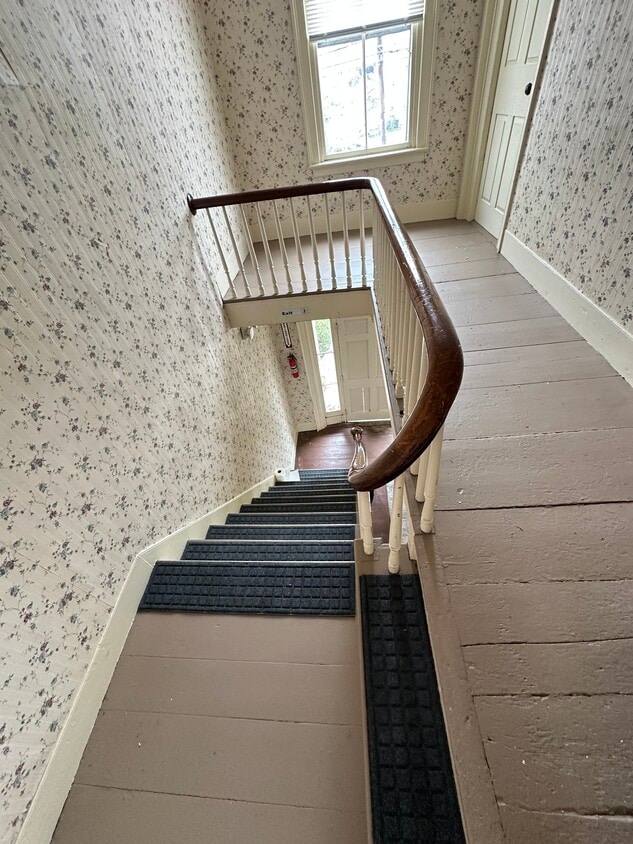
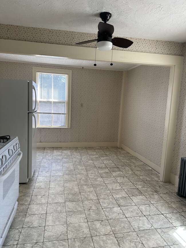
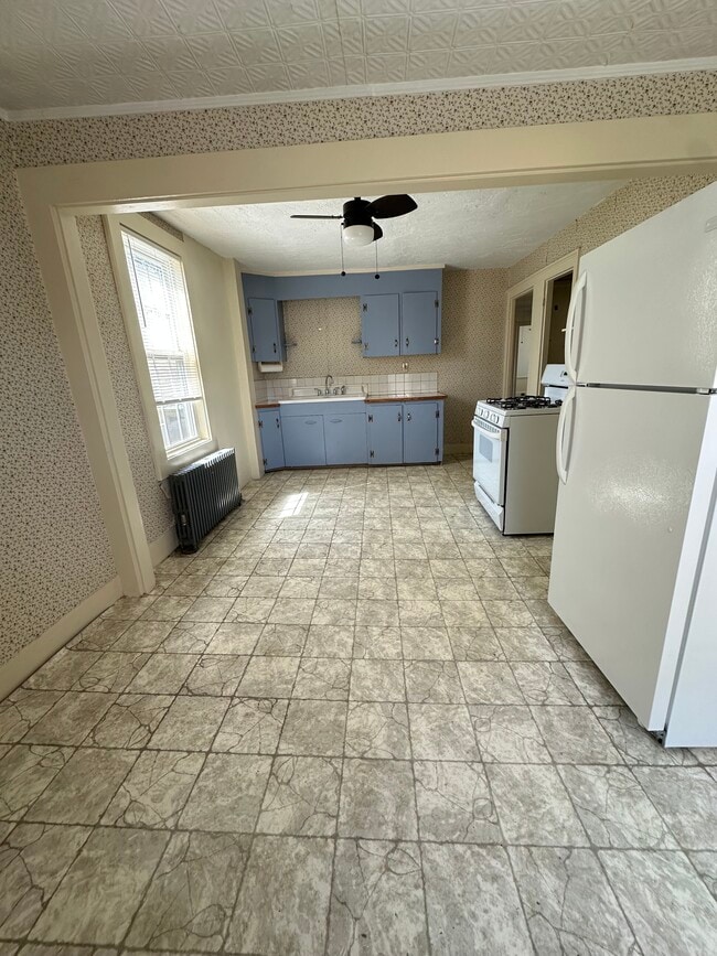
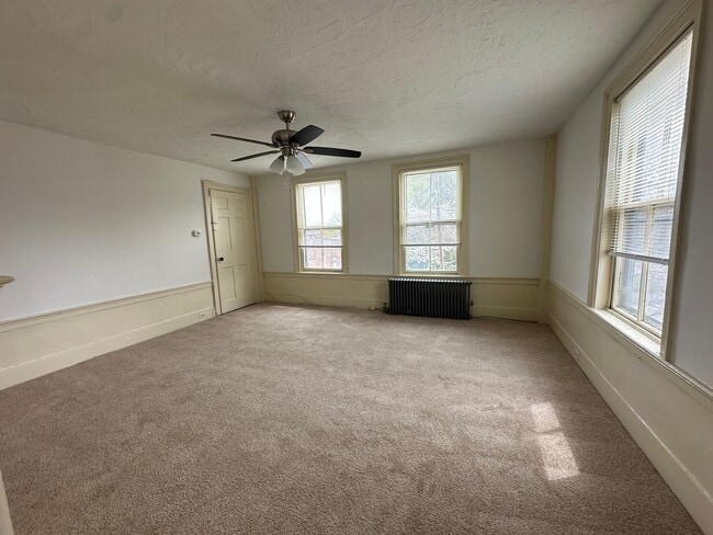
29B Broad St Unit 29 B Broad Street Photos
-
2nd floor
-
Kitchen view
-
Kitchen view
-
Kitchen view
-
Carpeted living room view
-
Bedroom
-
LR view
-
2nd BR
-
Bathroom view
What Are Walk Score®, Transit Score®, and Bike Score® Ratings?
Walk Score® measures the walkability of any address. Transit Score® measures access to public transit. Bike Score® measures the bikeability of any address.
What is a Sound Score Rating?
A Sound Score Rating aggregates noise caused by vehicle traffic, airplane traffic and local sources.

29B Broad St
Medway, MA 02053