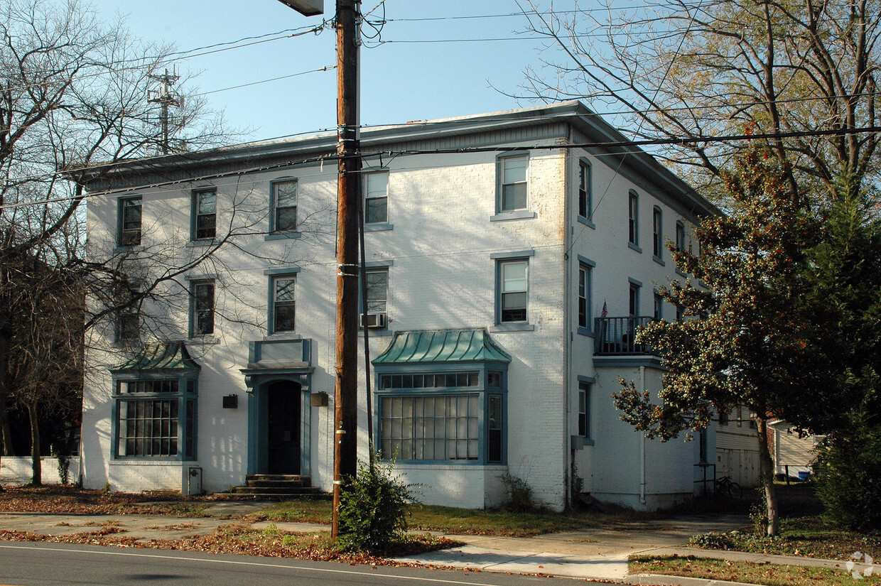
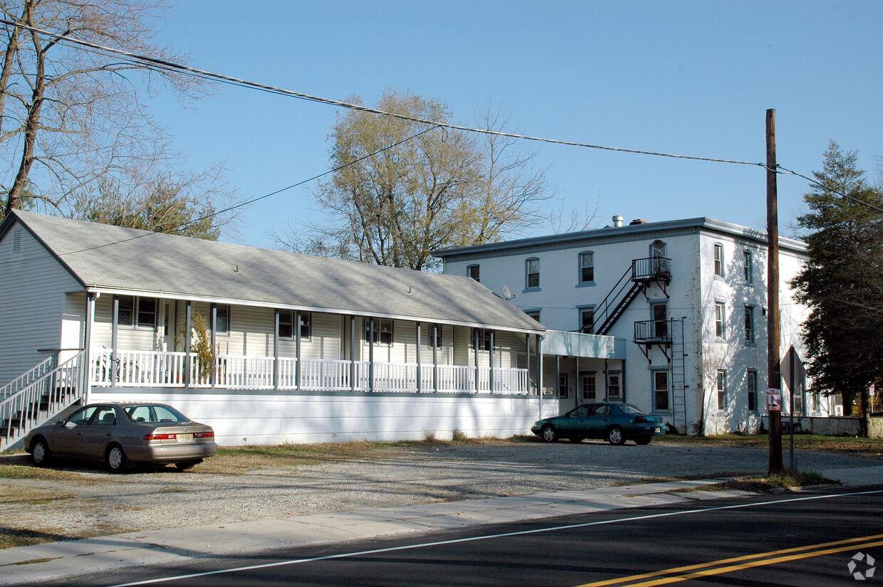
297 Kings Hwy
297 Kings Hwy,
Clarksboro,
NJ
08020
Favorites
297 Kings Hwy

Favorites
About 297 Kings Hwy Clarksboro, NJ 08020
At 297 Kings Hwy in Clarksboro, NJ, experience fine living. This community is located at 297 Kings Hwy. in the 08020 area of Clarksboro. Schedule a time to see the available floorplan options. The leasing staff is waiting to show you all that this community has in store. Start living the good life at 297 Kings Hwy. Contact or drop by the leasing office to talk about leasing your next apartment.
297 Kings Hwy is an apartment community located in Gloucester County and the 08020 ZIP Code. This area is served by the East Greenwich Township Board Of Education School District attendance zone.
297 Kings Hwy,
Clarksboro,
NJ
08020
Education
| Colleges & Universities | Distance | ||
|---|---|---|---|
| Colleges & Universities | Distance | ||
| Drive: | 14 min | 8.0 mi | |
| Drive: | 17 min | 9.6 mi | |
| Drive: | 22 min | 13.9 mi | |
| Drive: | 27 min | 16.5 mi |
297 Kings Hwy is within 14 minutes or 8.0 miles from Gloucester County College. It is also near Rowan University and Widener University.
Schools


Public Elementary School
Grades PK-5
556 Students
Attendance Zone
Public Elementary School
Grades PK-5
556 Students
Attendance Zone
Public Elementary School
Grades K-5
726 Students
Attendance Zone
Public Elementary School
Grades K-5
726 Students
Attendance Zone
Public Elementary & Middle School
Grades K-8
849 Students
Nearby
Public Middle School
Grades 6-8
954 Students
Attendance Zone
Public Middle School
Grades 6-8
954 Students
Attendance Zone
Public High School
Grades 9-12
1,947 Students
Attendance Zone
Public High School
Grades 9-12
1,947 Students
Attendance Zone
Public High School
Grades 9-12
384 Students
Nearby
Private Elementary School
Grades K-5
Nearby
Private Elementary School
Grades K-5
Nearby
Private Elementary & Middle School
Grades PK-8
226 Students
Nearby
Private Elementary & Middle School
Grades PK-8
226 Students
Nearby
Private Elementary, Middle & High School
Grades PK-12
354 Students
Nearby
Private Elementary, Middle & High School
Grades PK-12
354 Students
Nearby
School data provided by
 The GreatSchools Rating helps parents compare schools within a state based on a variety of school quality indicators and provides a helpful picture of how effectively each school serves all of its students. Ratings are on a scale of 1 (below average) to 10 (above average) and can include test scores, college readiness, academic progress, advanced courses, equity, discipline and attendance data. We also advise parents to visit schools, consider other information on school performance and programs, and consider family needs as part of the school selection process.
View GreatSchools Rating Methodology
Data provided by GreatSchools.org © 2026. All rights reserved.
View GreatSchools Rating Methodology
Data provided by GreatSchools.org © 2026. All rights reserved.
Transportation options available in Clarksboro include Island Avenue And 76Th Street, located 19.6 miles from 297 Kings Hwy. 297 Kings Hwy is near Philadelphia International, located 20.0 miles or 31 minutes away.
| Transit / Subway | Distance | ||
|---|---|---|---|
| Transit / Subway | Distance | ||
|
|
Drive: | 31 min | 19.6 mi |
|
|
Drive: | 30 min | 19.7 mi |
|
|
Drive: | 31 min | 19.8 mi |
|
|
Drive: | 30 min | 19.9 mi |
|
|
Drive: | 30 min | 20.0 mi |
| Commuter Rail | Distance | ||
|---|---|---|---|
| Commuter Rail | Distance | ||
|
|
Drive: | 23 min | 14.5 mi |
|
|
Drive: | 29 min | 19.5 mi |
|
|
Drive: | 30 min | 19.8 mi |
|
|
Drive: | 33 min | 20.0 mi |
|
|
Drive: | 31 min | 20.2 mi |
| Airports | Distance | ||
|---|---|---|---|
| Airports | Distance | ||
|
Philadelphia International
|
Drive: | 31 min | 20.0 mi |
Walkability Near 297 Kings Hwy Clarksboro, NJ 08020
Getting Around
 What do Walkability, Transit, Drivability, and Bikeability mean?
Walkability measures the walking distance to day-to-day needs.
Transit measures access to public transportation.
Drivability measures congestion, parking availability, and access to major roads.
Bikeability measures the suitability for cycling.
How It Works
What do Walkability, Transit, Drivability, and Bikeability mean?
Walkability measures the walking distance to day-to-day needs.
Transit measures access to public transportation.
Drivability measures congestion, parking availability, and access to major roads.
Bikeability measures the suitability for cycling.
How It Works
Somewhat Walkable
Walkability
20
/ 100
Limited Public Transit
Transit
30
/ 100
Exceptionally Drivable
Drivability
100
/ 100
Somewhat Bikeable
Bikeability
30
/ 100
Scores provided by
-
Soundscore™
-
/ 100
Traffic
-Airport
-Businesses
-Scores provided by
HowLoud What is a Sound Score Rating? A Sound Score Rating aggregates noise caused by vehicle traffic, airplane traffic and local sources. How It WorksTime and distance from 297 Kings Hwy.
| Shopping Centers | Distance | ||
|---|---|---|---|
| Shopping Centers | Distance | ||
| Drive: | 4 min | 2.7 mi | |
| Drive: | 5 min | 2.9 mi | |
| Drive: | 6 min | 3.5 mi |
297 Kings Hwy has 3 shopping centers within 3.5 miles, which is about a 6-minute drive. The miles and minutes will be for the farthest away property.
| Parks and Recreation | Distance | ||
|---|---|---|---|
| Parks and Recreation | Distance | ||
|
Creamy Acres Farm
|
Drive: | 17 min | 8.3 mi |
|
Upland Park
|
Drive: | 22 min | 13.7 mi |
|
Franklin D. Roosevelt Park
|
Drive: | 25 min | 16.4 mi |
|
Bartram's Garden
|
Drive: | 29 min | 18.9 mi |
|
John Heinz National Wildlife Refuge
|
Drive: | 31 min | 20.2 mi |
297 Kings Hwy has 5 parks within 20.2 miles, including Creamy Acres Farm, Upland Park, and Franklin D. Roosevelt Park.
| Hospitals | Distance | ||
|---|---|---|---|
| Hospitals | Distance | ||
| Drive: | 10 min | 5.2 mi | |
| Drive: | 18 min | 10.9 mi | |
| Drive: | 35 min | 20.9 mi |
297 Kings Hwy has 3 hospitals within 20.9 miles, the nearest is Inspira Medical Center Woodbury which is 5.2 miles away and a 10 minute drive.
| Military Bases | Distance | ||
|---|---|---|---|
| Military Bases | Distance | ||
| Drive: | 24 min | 16.5 mi |
297 Kings Hwy is 16.5 miles and a 24 minute drive from Philadelphia Naval Busi Center.
Explore Similar Rentals Nearby


What Are Walk Score®, Transit Score®, and Bike Score® Ratings?
Walk Score® measures the walkability of any address. Transit Score® measures access to public transit. Bike Score® measures the bikeability of any address.
What is a Sound Score Rating?
A Sound Score Rating aggregates noise caused by vehicle traffic, airplane traffic and local sources.