$995
/ Month
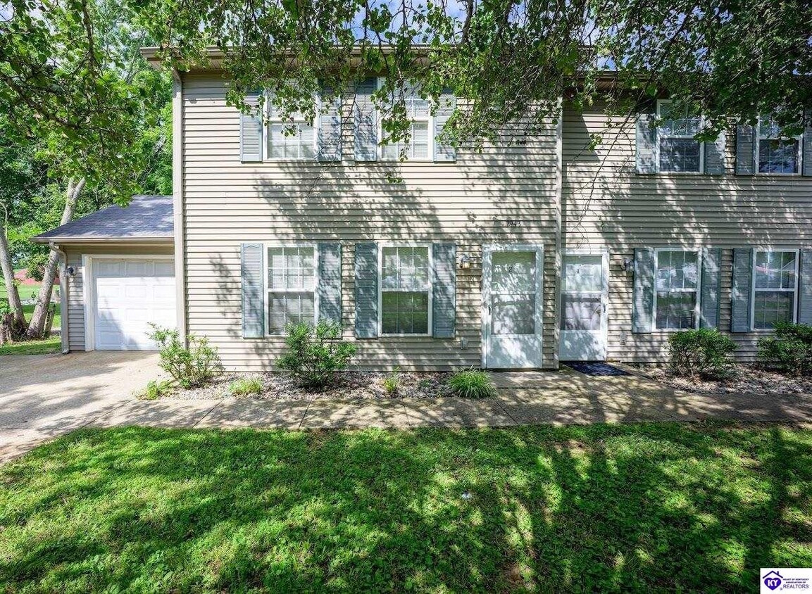
2943 S Wilson Rd
Radcliff, KY 40160
Favorites
270-272-7856
-
Bedrooms
2
-
Bathrooms
3
-
Square Feet
1,092 sq ft
-
Available
Available Now
Highlight
- Pets Allowed
2943 S Wilson Rd

Favorites
About This Home
$995 deposit,
Available Now
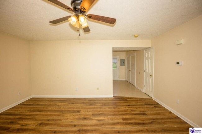
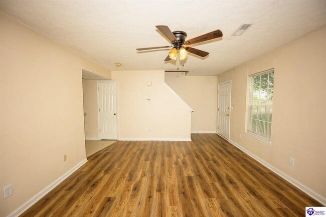
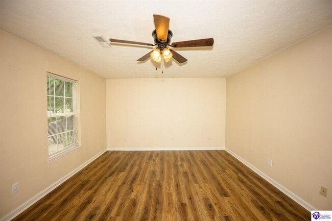
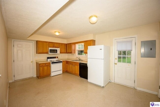
Two story town house now available. Right off S. Wilson Rd, easy access to I-65, 31W, Joe Prather HWY. Access to Hilltop Terrace Pool and Picnic Pavilion included! (Photos similar to unit).
2943 S Wilson Rd is a townhome located in Hardin County and the 40160 ZIP Code. This area is served by the Hardin County attendance zone.
* Price shown is base rent. Excludes user-selected optional fees and variable or usage-based fees and required charges due at or prior to move-in or at move-out. Price, availability, fees, and any applicable rent special are subject to change without notice.
* Square footage definitions vary. Displayed square footage is approximate.
Fees and Policies
The fees listed below are community-provided and may exclude utilities or add-ons. All payments are made directly to the property and are non-refundable unless otherwise specified. Use the Cost Calculator to determine costs based on your needs.
-
One-Time Basics
-
Due at Move-In
-
Security Deposit - RefundableCharged per unit.$995
-
-
Due at Move-In
-
Dogs
-
Allowed
-
-
Cats
-
Allowed
-
-
Garage Lot
Property Fee Disclaimer: Based on community-supplied data and independent market research. Subject to change without notice. May exclude fees for mandatory or optional services and usage-based utilities.
Townhome Features
- Washer/Dryer Hookup
- Air Conditioning
- Heating
Contact
- Listed by Kim Shortt | TW SHORTT REALTY
- Phone Number
- Contact
-
Source
Heart of Kentucky Association of REALTORS®
Copyright © 2026 Heart of Kentucky Association of Realtors. All rights reserved. All information provided by the listing agent/broker is deemed reliable but is not guaranteed and should be independently verified.
Location
Get Directions
Bordering Fort Knox directly north of Elizabethtown, Radcliff figures heavily in the military history of the region. Radcliff's economy is based heavily in neighboring Fort Knox, an Army post that is home to the United States Bullion Depository. The military base was built in 1861, and today it is home of the George S. Patton Museum. Radcliff was settled in 1919 and was named for Major William Radcliffe, head of the Quartermaster Corps at Fort Knox.
Radcliff is home to some terrific locations, including Radcliff City Park and Saunders Springs Nature Preserve. Radcliff City Park has an amphitheater, a playground, basketball courts, a disc golf course, and the Skate Wave Park. The preserve includes three historic cabins built in the 1800s. The park is popular for hiking, biking, picnicking, and wildlife viewing. The park features several caves, springs, and waterfalls.
Learn more about living in Radcliff
Amenities
- Washer/Dryer Hookup
- Air Conditioning
- Heating
Education
| Colleges & Universities | Distance | ||
|---|---|---|---|
| Colleges & Universities | Distance | ||
| Drive: | 11 min | 8.7 mi | |
| Drive: | 39 min | 27.5 mi | |
| Drive: | 52 min | 35.6 mi | |
| Drive: | 54 min | 42.6 mi |
2943 S Wilson Rd is within 11 minutes or 8.7 miles from ECTC. It is also near Jefferson Comm. & Tech., SW and Univ. of Louisville, Belknap.
Schools


Public Elementary School
Grades K-5
509 Students
Attendance Zone
Public Elementary School
Grades PK-5
673 Students
Attendance Zone
Public Middle School
Grades 6-8
558 Students
Attendance Zone
Public High School
Grades 9-12
1,518 Students
Attendance Zone
Private Elementary, Middle & High School
Grades PK-12
522 Students
Nearby
Private Elementary, Middle & High School
Grades K-12
31 Students
Nearby
School data provided by
 The GreatSchools Rating helps parents compare schools within a state based on a variety of school quality indicators and provides a helpful picture of how effectively each school serves all of its students. Ratings are on a scale of 1 (below average) to 10 (above average) and can include test scores, college readiness, academic progress, advanced courses, equity, discipline and attendance data. We also advise parents to visit schools, consider other information on school performance and programs, and consider family needs as part of the school selection process.
View GreatSchools Rating Methodology
Data provided by GreatSchools.org © 2026. All rights reserved.
View GreatSchools Rating Methodology
Data provided by GreatSchools.org © 2026. All rights reserved.
Getting Around
 What do Walkability, Transit, Drivability, and Bikeability mean?
Walkability measures the walking distance to day-to-day needs.
Transit measures access to public transportation.
Drivability measures congestion, parking availability, and access to major roads.
Bikeability measures the suitability for cycling.
How It Works
What do Walkability, Transit, Drivability, and Bikeability mean?
Walkability measures the walking distance to day-to-day needs.
Transit measures access to public transportation.
Drivability measures congestion, parking availability, and access to major roads.
Bikeability measures the suitability for cycling.
How It Works
Somewhat Walkable
Walkability
30
/ 100
Exceptionally Drivable
Drivability
100
/ 100
Not Bikeable
Bikeability
10
/ 100
Scores provided by
-
Soundscore™
-
/ 100
Traffic
-Airport
-Businesses
-Scores provided by
HowLoud What is a Sound Score Rating? A Sound Score Rating aggregates noise caused by vehicle traffic, airplane traffic and local sources. How It WorksYou May Also Like
Similar Rentals Nearby


What Are Walk Score®, Transit Score®, and Bike Score® Ratings?
Walk Score® measures the walkability of any address. Transit Score® measures access to public transit. Bike Score® measures the bikeability of any address.
What is a Sound Score Rating?
A Sound Score Rating aggregates noise caused by vehicle traffic, airplane traffic and local sources.

2943 S Wilson Rd
Radcliff, KY 40160