

$950 / Month
2932 W Liberty Ave
Pittsburgh, PA 15216
2 Weeks Ago
Favorites
2932 W Liberty Ave

Favorites
Check Back Soon for Upcoming Availability
| Beds | Baths | Average SF |
|---|---|---|
| 1 Bedroom 1 Bedroom 1 Br | 1 Bath 1 Bath 1 Ba | — |
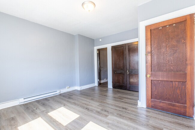
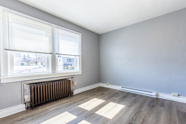
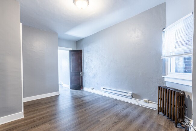
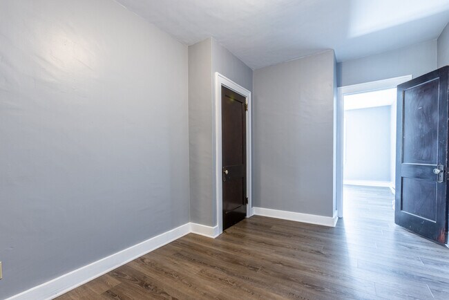
About This Property
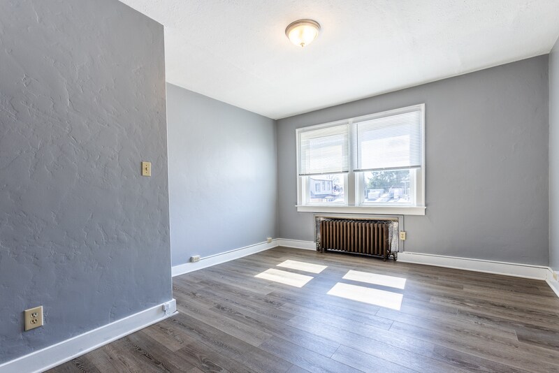
Large 1 bed/1 bath above West Liberty Avenue available now. This unit includes a spacious living and dining area. Cats are OK. No dogs or smoking. Shared Laundry on site. Within walking distance to the Bus and T lines. Street Parking. -12 month lease required. -Security deposit equal to one months rent. -Tenants must make minimum 3 times the monthly rent to qualify. -Landlord will screen background and credit reports. Large 1 bed/1 bath above West Liberty Avenue available now. This unit includes a spacious living and dining area. Cats are OK. No dogs or smoking. Shared Laundry on site. Within walking distance to the Bus and T lines. Street Parking. -12 month lease required. -Security deposit equal to one months rent. -Tenants must make minimum 3 times the monthly rent to qualify. -Landlord will screen background and credit reports.
2932 W Liberty Ave is a condo located in Allegheny County and the 15216 ZIP Code. This area is served by the Keystone Oaks attendance zone.
Location
Get Directions
Known for rugged hills and rolling countryside mixed with developed areas called boroughs, the southern portion of Allegheny County remains a beautiful compliment to nearby city life in Pittsburgh. Located about 14 miles southeast of Pittsburgh, it takes about an hour to reach the city's center. One of Pennsylvania’s largest areas, South Allegheny consists of several towns and suburbs set in an idyllic landscape. Great destinations include historic Kennywood Park, which first opened in 1899 and is listed on the National Register of Historic Places.
Learn more about living in South Allegheny
Expenses
Utilities Included
Gas, Water, Trash Removal
Included
Education
| Colleges & Universities | Distance | ||
|---|---|---|---|
| Colleges & Universities | Distance | ||
| Drive: | 10 min | 4.2 mi | |
| Drive: | 9 min | 4.2 mi | |
| Drive: | 10 min | 4.3 mi | |
| Drive: | 12 min | 5.4 mi |
2932 W Liberty Ave is within 10 minutes or 4.2 miles from Duquesne University. It is also near Point Park University and The Art Inst. of Pittsburgh.
Schools


Public Elementary & Middle School
Grades PK-8
388 Students
Nearby
Public Elementary School
Grades K-5
351 Students
Nearby
Public Middle School
Grades 6-8
382 Students
Attendance Zone
Public High School
Grades 9-12
570 Students
Attendance Zone
Private Elementary & Middle School
Grades K-8
90 Students
Nearby
Private Elementary School
Grades PK-3
Nearby
Private High School
Grades 9-12
390 Students
Nearby
School data provided by
 The GreatSchools Rating helps parents compare schools within a state based on a variety of school quality indicators and provides a helpful picture of how effectively each school serves all of its students. Ratings are on a scale of 1 (below average) to 10 (above average) and can include test scores, college readiness, academic progress, advanced courses, equity, discipline and attendance data. We also advise parents to visit schools, consider other information on school performance and programs, and consider family needs as part of the school selection process.
View GreatSchools Rating Methodology
Data provided by GreatSchools.org © 2025. All rights reserved.
View GreatSchools Rating Methodology
Data provided by GreatSchools.org © 2025. All rights reserved.
Transportation options available in Pittsburgh include Potomac, located 0.2 mile from 2932 W Liberty Ave. 2932 W Liberty Ave is near Pittsburgh International, located 16.3 miles or 27 minutes away, and Arnold Palmer Regional, located 46.4 miles or 74 minutes away.
| Transit / Subway | Distance | ||
|---|---|---|---|
| Transit / Subway | Distance | ||
|
|
Walk: | 4 min | 0.2 mi |
|
|
Walk: | 8 min | 0.4 mi |
|
|
Walk: | 9 min | 0.5 mi |
|
|
Walk: | 12 min | 0.7 mi |
|
|
Walk: | 15 min | 0.8 mi |
| Commuter Rail | Distance | ||
|---|---|---|---|
| Commuter Rail | Distance | ||
|
|
Drive: | 10 min | 4.6 mi |
|
|
Drive: | 58 min | 37.0 mi |
|
|
Drive: | 70 min | 43.4 mi |
|
|
Drive: | 72 min | 53.1 mi |
| Airports | Distance | ||
|---|---|---|---|
| Airports | Distance | ||
|
Pittsburgh International
|
Drive: | 27 min | 16.3 mi |
|
Arnold Palmer Regional
|
Drive: | 74 min | 46.4 mi |
Time and distance from 2932 W Liberty Ave.
| Shopping Centers | Distance | ||
|---|---|---|---|
| Shopping Centers | Distance | ||
| Walk: | 2 min | 0.1 mi | |
| Walk: | 16 min | 0.9 mi | |
| Drive: | 6 min | 1.7 mi |
2932 W Liberty Ave has 3 shopping centers within 1.7 miles, which is about a 6-minute walk. The miles and minutes will be for the farthest away property.
| Parks and Recreation | Distance | ||
|---|---|---|---|
| Parks and Recreation | Distance | ||
|
Pittsburgh Botanic Garden
|
Drive: | 7 min | 2.5 mi |
|
Point State Park
|
Drive: | 11 min | 4.8 mi |
|
Carnegie Science Center
|
Drive: | 12 min | 5.3 mi |
|
Allegheny Commons Park
|
Drive: | 12 min | 5.5 mi |
|
Children's Museum of Pittsburgh
|
Drive: | 13 min | 5.9 mi |
2932 W Liberty Ave has 5 parks within 5.9 miles, including Pittsburgh Botanic Garden, Point State Park, and Carnegie Science Center.
| Hospitals | Distance | ||
|---|---|---|---|
| Hospitals | Distance | ||
| Drive: | 6 min | 2.2 mi | |
| Drive: | 10 min | 4.5 mi | |
| Drive: | 12 min | 6.0 mi |
2932 W Liberty Ave has 3 hospitals within 6.0 miles, the nearest is St. Clair Hospital which is 2.2 miles away and a 6 minute drive.
| Military Bases | Distance | ||
|---|---|---|---|
| Military Bases | Distance | ||
| Drive: | 24 min | 14.8 mi |
2932 W Liberty Ave is 14.8 miles and a 24 minute drive from Pittsburgh Air Reserve Station.
You May Also Like
Similar Rentals Nearby


What Are Walk Score®, Transit Score®, and Bike Score® Ratings?
Walk Score® measures the walkability of any address. Transit Score® measures access to public transit. Bike Score® measures the bikeability of any address.
What is a Sound Score Rating?
A Sound Score Rating aggregates noise caused by vehicle traffic, airplane traffic and local sources
2932 W Liberty Ave
Pittsburgh, PA 15216