


$3,000 / Month

2930 Crape Myrtle Cir

,

Chino Hills, CA 91709

Share Listing
Favorites
2930 Crape Myrtle Cir
Share Listing
Favorites

Check Back Soon for Upcoming Availability

Beds Baths Average SF
3 Bedrooms 3 Bedrooms 3 Br 3 Baths 3 Baths 3 Ba 1,866 SF

Fees and Policies

The fees listed below are community-provided and may exclude utilities or add-ons. All payments are made directly to the property and are non-refundable unless otherwise specified.

About This Property

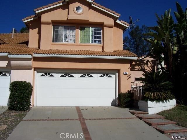
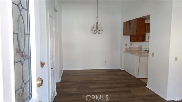
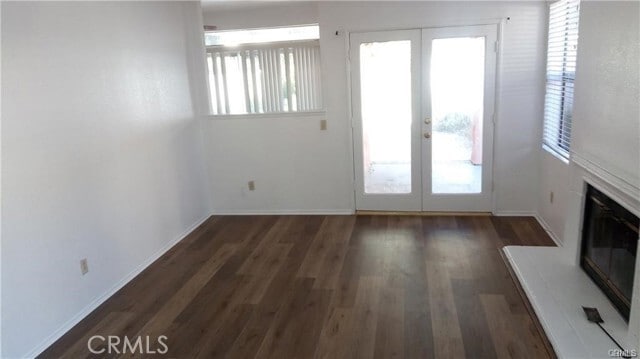
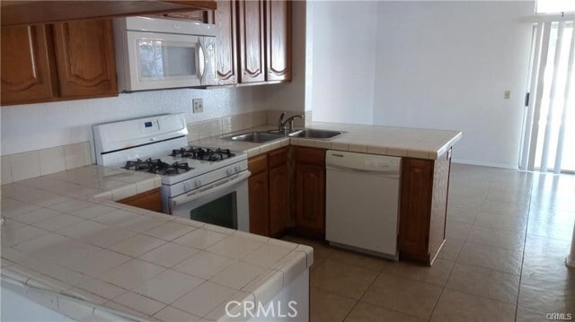
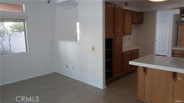
Excellent 3 bedroom home with 2 full bathrooms upstairs and half-bathroom downstairs. Tri-level home has a loft area on the middle level that could be used as an office. Nice, open floorplan with vaulted ceilings and catwalk upstairs separating master suite from 2 other bedrooms.Formal living room with fireplace and french doors leading to the back patio. Separate dining room and spacious family room. Large downstairs closet with storage space under the stairs. Master bedroom has dual fireplace and media center, walk-in closet. Many upgrades: mirrored closet doors, new paint, new carpet, wood floors. Walking distance to highly rated and desired Oak Ridge Elementary school.

2930 Crape Myrtle Cir is a townhome located in San Bernardino County and the 91709 ZIP Code. This area is served by the Chino Valley Unified School District attendance zone.

Townhome Features

  • Air Conditioning
  • Heating
  • Fireplace
Location
2930 Crape Myrtle Cir, Chino Hills,
CA 91709
Get Directions
| Edit

Under 30 minutes

Commute Time is calculated at rush hour.
Neighborhood

A large subdivision with mountain views and a golf course, Los Serranos provides a beautiful location in Chino Hills. Bordered by the Chino Valley Freeway on its east side, commuting from the neighborhood is easy. While it is primarily residential, there's ample shopping in the northwest corner of the neighborhood, near the intersection of Pipeline Avenue and Chino Hills Parkway. Here, you'll find restaurants, banks, grocery stores, specialty shops, and other businesses.

The Los Serranos Country Club covers much of the neighborhood, offering two 18-hole golf courses, a large lake, a clubhouse, and a driving range. For those who prefer hiking to golfing, the Chino Hills State Park is directly south of the neighborhood and provides ample hiking, equestrian, and mountain biking trails. The park covers 14,102 acres and includes an outdoor amphitheater, campgrounds, picnic areas, and an exhibit hall.

Learn more about living in Los Serranos 

Below are rent ranges for similar nearby apartments

Amenities
  • Air Conditioning
  • Heating
  • Fireplace
Education
Colleges & Universities Distance
Drive: 15 min 7.7 mi
Drive: 19 min 10.1 mi
Drive: 21 min 11.1 mi
Drive: 20 min 11.3 mi
2930 Crape Myrtle Cir is within 15 minutes or 7.7 miles from Western Health Scis., Pomono. It is also near Cal Poly Pomona and DeVry University-California.
Schools
Public Elementary School
Grades K-5
535 Students
Nearby
Public Elementary School
Grades K-5
521 Students
Attendance Zone
Public Middle School
Grades 6-8
905 Students
Attendance Zone
Public High School
Grades 9-12
2,748 Students
Attendance Zone
Private Elementary, Middle & High School
Grades K-12
Nearby
Private Elementary School
Grades PK-5
Nearby
Private Elementary & Middle School
Grades K-8
326 Students
Nearby
Transportation

2930 Crape Myrtle Cir is near Ontario International, located 15.0 miles or 25 minutes away, and John Wayne/Orange County, located 29.8 miles or 44 minutes away.

Commuter Rail Distance
Drive: 15 min 7.7 mi
Drive: 18 min 10.0 mi
Drive: 20 min 10.4 mi
Drive: 21 min 11.9 mi
Drive: 20 min 12.2 mi
Airports Distance
Airports Distance
Ontario International
Drive: 25 min 15.0 mi
John Wayne/Orange County
Drive: 44 min 29.8 mi

Walkability Near 2930 Crape Myrtle Cir Chino Hills, CA 91709

Getting Around
Somewhat Walkable
Walkability
20 / 100
Minimal Public Transit
Transit
0 / 100
Exceptionally Drivable
Drivability
90 / 100
Somewhat Bikeable
Bikeability
30 / 100

Scores provided by

What do Walkability, Transit, Drivability, and Bikeability mean? Walkability measures the walking distance to day-to-day needs. Transit measures access to public transportation. Drivability measures congestion, parking availability, and access to major roads. Bikeability measures the suitability for cycling. How It Works
-
Soundscore
- / 100

Traffic

-

Airport

-

Businesses

-

Scores provided by

HowLoud What is a Sound Score Rating? A Sound Score Rating aggregates noise caused by vehicle traffic, airplane traffic and local sources. How It Works
Points of Interest

Time and distance from 2930 Crape Myrtle Cir.

Shopping Centers Distance
Drive: 5 min 2.0 mi
Drive: 6 min 2.8 mi
Drive: 6 min 3.0 mi
2930 Crape Myrtle Cir has 3 shopping centers within 3.0 miles, which is about a 6-minute drive. The miles and minutes will be for the farthest away property.
Parks and Recreation Distance
Chino Creek Wetlands and Educational Park
Drive: 11 min 6.1 mi
Chino Hills State Park
Drive: 29 min 7.1 mi
Frank G. Bonelli Regional Park
Drive: 21 min 12.3 mi
Millikan Planetarium
Drive: 22 min 12.5 mi
Oak Canyon Nature Center
Drive: 34 min 23.6 mi
2930 Crape Myrtle Cir has 5 parks within 23.6 miles, including Chino Creek Wetlands and Educational Park, Chino Hills State Park, and Millikan Planetarium.
Hospitals Distance
Hospitals Distance
Drive: 11 min 6.3 mi
Drive: 14 min 7.5 mi
Drive: 16 min 8.9 mi
2930 Crape Myrtle Cir has 3 hospitals within 8.9 miles, the nearest is Canyon Ridge Hospital which is 6.3 miles away and a 11 minute drive.
Military Bases Distance
Drive: 49 min 32.1 mi
Drive: 61 min 38.3 mi
Drive: 72 min 49.7 mi
2930 Crape Myrtle Cir has 3 military bases within 49.7 miles, the nearest is Los Alamitos Army Airfield which is 32.1 miles away and a 49 minute drive.

You May Also Like

Similar Rentals Nearby