


$1,250
/ Month
29 King Arthur Ct
Westerville, OH 43081
Favorites
29 King Arthur Ct

Favorites
Check Back Soon for Upcoming Availability
| Beds | Baths | Average SF |
|---|---|---|
| 2 Bedrooms 2 Bedrooms 2 Br | 1.5 Baths 1.5 Baths 1.5 Ba | 990 SF |
About This Property
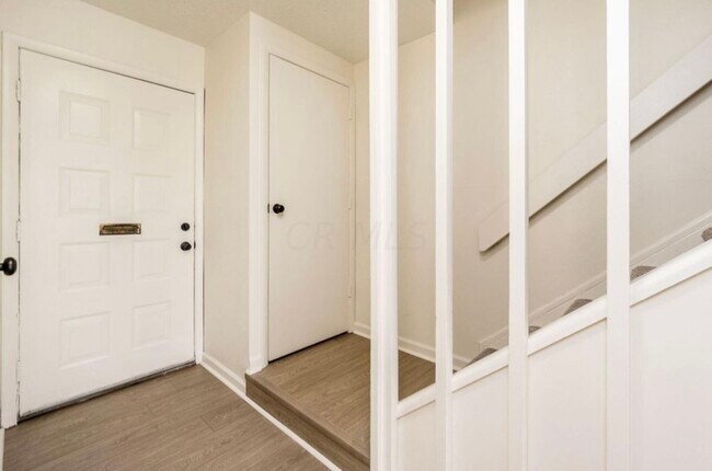
Westerville 2 Bed 1.5 Bath Condo. AVAILABLE NOW TO RENT. Fully updated. Private Patio. Easy access to to 270. Close to Otterbein College, Downtown Westerville and everything else Westerville has to offer. Do not submit an application through Reach out to Jake to schedule a tour and to get an application.
29 King Arthur Ct is a townhome located in Franklin County and the 43081 ZIP Code. This area is served by the Westerville City School District attendance zone.
Townhome Features
Air Conditioning
Dishwasher
Hardwood Floors
Microwave
- Air Conditioning
- Dishwasher
- Microwave
- Range
- Refrigerator
- Hardwood Floors
29 King Arthur Ct,
Westerville,
OH
43081
Westerville combines suburban comfort with historic character throughout its 12.6 square miles. Home to Otterbein University, this Columbus suburb features tree-lined streets and well-maintained parks. The rental market remains steady, with current average rents ranging from $1,007 for studios to $2,034 for three-bedroom homes. The historic Uptown district along State Street offers local shops and restaurants, while the Polaris area provides contemporary housing options.
Westerville's rich history shapes its present-day character. As the former headquarters of the Anti-Saloon League, the city earned the nickname "The Dry Capital of the World" during the Prohibition era. Today, the community offers diverse housing choices, from historic properties near Otterbein University to modern apartment communities in northern Westerville. Residents enjoy an extensive parks system with walking trails throughout the city.
Learn more about living in Westerville
Amenities
- Air Conditioning
- Dishwasher
- Microwave
- Range
- Refrigerator
- Hardwood Floors
Education
| Colleges & Universities | Distance | ||
|---|---|---|---|
| Colleges & Universities | Distance | ||
| Drive: | 3 min | 1.8 mi | |
| Drive: | 14 min | 8.9 mi | |
| Drive: | 20 min | 12.8 mi | |
| Drive: | 19 min | 13.7 mi |
29 King Arthur Ct is within 3 minutes or 1.8 miles from Otterbein College. It is also near Ohio Dominican University and Columbus State C.C., Columbus.
Schools


Public Elementary School
Grades PK-5
331 Students
Nearby
Public Elementary School
Grades K-5
333 Students
Attendance Zone
Public Middle School
Grades 6-8
697 Students
Attendance Zone
Public High School
Grades 9-12
1,429 Students
Attendance Zone
Private Elementary, Middle & High School
Grades K-12
350 Students
Nearby
Private Elementary & Middle School
Grades K-8
65 Students
Nearby
Private Elementary & Middle School
Grades K-8
65 Students
Nearby
School data provided by
 The GreatSchools Rating helps parents compare schools within a state based on a variety of school quality indicators and provides a helpful picture of how effectively each school serves all of its students. Ratings are on a scale of 1 (below average) to 10 (above average) and can include test scores, college readiness, academic progress, advanced courses, equity, discipline and attendance data. We also advise parents to visit schools, consider other information on school performance and programs, and consider family needs as part of the school selection process.
View GreatSchools Rating Methodology
Data provided by GreatSchools.org © 2026. All rights reserved.
View GreatSchools Rating Methodology
Data provided by GreatSchools.org © 2026. All rights reserved.
Walkability Near 29 King Arthur Ct Westerville, OH 43081
Getting Around
 What do Walkability, Transit, Drivability, and Bikeability mean?
Walkability measures the walking distance to day-to-day needs.
Transit measures access to public transportation.
Drivability measures congestion, parking availability, and access to major roads.
Bikeability measures the suitability for cycling.
How It Works
What do Walkability, Transit, Drivability, and Bikeability mean?
Walkability measures the walking distance to day-to-day needs.
Transit measures access to public transportation.
Drivability measures congestion, parking availability, and access to major roads.
Bikeability measures the suitability for cycling.
How It Works
Moderately Walkable
Walkability
60
/ 100
Limited Public Transit
Transit
20
/ 100
Exceptionally Drivable
Drivability
100
/ 100
Fairly Bikeable
Bikeability
50
/ 100
Scores provided by
-
Soundscore™
-
/ 100
Traffic
-Airport
-Businesses
-Scores provided by
HowLoud What is a Sound Score Rating? A Sound Score Rating aggregates noise caused by vehicle traffic, airplane traffic and local sources. How It WorksYou May Also Like
Similar Rentals Nearby


What Are Walk Score®, Transit Score®, and Bike Score® Ratings?
Walk Score® measures the walkability of any address. Transit Score® measures access to public transit. Bike Score® measures the bikeability of any address.
What is a Sound Score Rating?
A Sound Score Rating aggregates noise caused by vehicle traffic, airplane traffic and local sources.

29 King Arthur Ct
Westerville, OH 43081