
10 Halletts Point
10, 20, 30 Halletts Pt,
Astoria, NY 11102
$3,300 - $6,971
Studio - 2 Beds
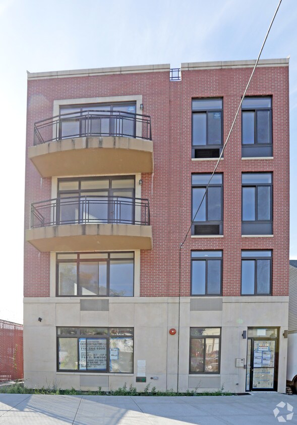
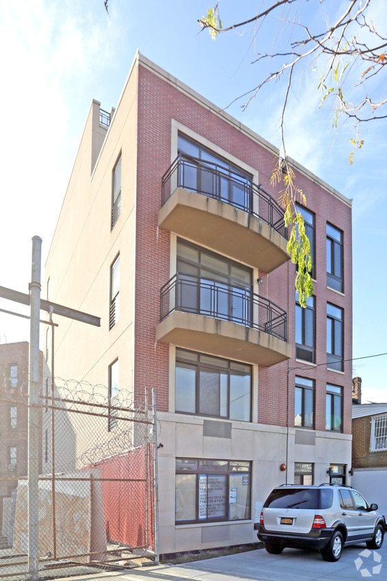

Find your new apartment at 29-11 12th St. This community is located in the Halletts Cove area of Astoria. Let the leasing team show you everything this community has to offer. Come see 29-11 12th St today.
29-11 12th St is an apartment community located in Queens County and the 11102 ZIP Code. This area is served by the New York City Geographic District #30 attendance zone.
Hallett’s Cove stands as a long strip of land along East River, directly below the beloved Astoria Park. This historic neighborhood was once a recreational destination and resort for Manhattan’s wealthy and is now a residential neighborhood lined with single-family homes, semi-detached houses, and numerous apartment buildings.
This riverfront neighborhood houses city parks, playgrounds, and gardens such as Socrates Sculpture Park and Rainey Park. Explore this public artistic space that’s become a cultural hub of Queens. This sculpture garden is a platform for local artists where residents and visitors can explore contemporary public art directly from members of the community.
Overlooking East River, Rainey Park is a great place to take your pup, offering outdoor dog play areas, baseball fields, and a riverside promenade. Discover the available apartment rentals in this riverfront urban neighborhood so you can enjoy the sandy shoreline that awaits you in Hallett’s Cove.
Learn more about living in Hallett's CoveCompare neighborhood and city base rent averages by bedroom.
| Hallett's Cove | Astoria, NY | |
|---|---|---|
| Studio | $2,463 | $2,553 |
| 1 Bedroom | $3,292 | $2,454 |
| 2 Bedrooms | $4,290 | $3,917 |
| 3 Bedrooms | $3,353 | $6,250 |
| Colleges & Universities | Distance | ||
|---|---|---|---|
| Colleges & Universities | Distance | ||
| Drive: | 5 min | 2.6 mi | |
| Drive: | 8 min | 4.0 mi | |
| Drive: | 9 min | 4.1 mi | |
| Drive: | 9 min | 4.3 mi |


Transportation options available in Astoria include 30 Av, located 0.6 mile from 29-11 12th St. 29-11 12th St is near LaGuardia, located 3.4 miles or 8 minutes away, and John F Kennedy International, located 14.6 miles or 21 minutes away.
| Transit / Subway | Distance | ||
|---|---|---|---|
| Transit / Subway | Distance | ||
| Walk: | 12 min | 0.6 mi | |
| Walk: | 13 min | 0.7 mi | |
| Walk: | 19 min | 1.0 mi | |
| Drive: | 3 min | 1.4 mi | |
| Drive: | 3 min | 1.5 mi |
| Commuter Rail | Distance | ||
|---|---|---|---|
| Commuter Rail | Distance | ||
|
|
Drive: | 5 min | 2.6 mi |
|
|
Drive: | 7 min | 3.0 mi |
|
|
Drive: | 7 min | 3.3 mi |
|
|
Drive: | 9 min | 4.3 mi |
|
|
Drive: | 9 min | 4.3 mi |
| Airports | Distance | ||
|---|---|---|---|
| Airports | Distance | ||
|
LaGuardia
|
Drive: | 8 min | 3.4 mi |
|
John F Kennedy International
|
Drive: | 21 min | 14.6 mi |
Scores provided by
Traffic
-Airport
-Businesses
-Scores provided by
HowLoud What is a Sound Score Rating? A Sound Score Rating aggregates noise caused by vehicle traffic, airplane traffic and local sources. How It WorksTime and distance from 29-11 12th St.
| Shopping Centers | Distance | ||
|---|---|---|---|
| Shopping Centers | Distance | ||
| Walk: | 19 min | 1.0 mi | |
| Drive: | 4 min | 1.7 mi | |
| Drive: | 6 min | 2.2 mi |
| Parks and Recreation | Distance | ||
|---|---|---|---|
| Parks and Recreation | Distance | ||
|
Hallets Cove Playground
|
Walk: | 3 min | 0.2 mi |
|
Socrates Sculpture Park
|
Walk: | 10 min | 0.5 mi |
|
Astoria Park
|
Walk: | 14 min | 0.7 mi |
|
John Jay Park
|
Drive: | 10 min | 4.7 mi |
|
Carl Schurz Park
|
Drive: | 12 min | 6.0 mi |
| Hospitals | Distance | ||
|---|---|---|---|
| Hospitals | Distance | ||
| Drive: | 9 min | 4.1 mi | |
| Drive: | 10 min | 4.5 mi | |
| Drive: | 12 min | 5.4 mi |
| Military Bases | Distance | ||
|---|---|---|---|
| Military Bases | Distance | ||
| Drive: | 18 min | 9.8 mi | |
| Drive: | 22 min | 10.6 mi |
What Are Walk Score®, Transit Score®, and Bike Score® Ratings?
Walk Score® measures the walkability of any address. Transit Score® measures access to public transit. Bike Score® measures the bikeability of any address.
What is a Sound Score Rating?
A Sound Score Rating aggregates noise caused by vehicle traffic, airplane traffic and local sources.


