

$1,200
/ Month
2853 State Hwy 11
Mansfield, GA 30055
Favorites
2853 State Hwy 11

Favorites
Check Back Soon for Upcoming Availability
| Beds | Baths | Average SF |
|---|---|---|
| 3 Bedrooms 3 Bedrooms 3 Br | 2 Baths 2 Baths 2 Ba | — |
About This Property
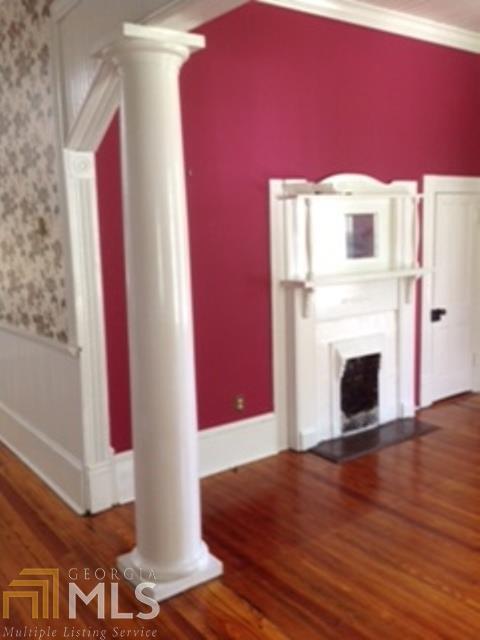
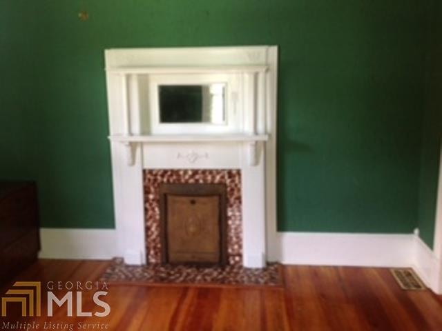
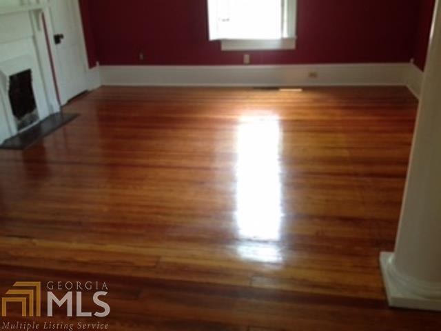
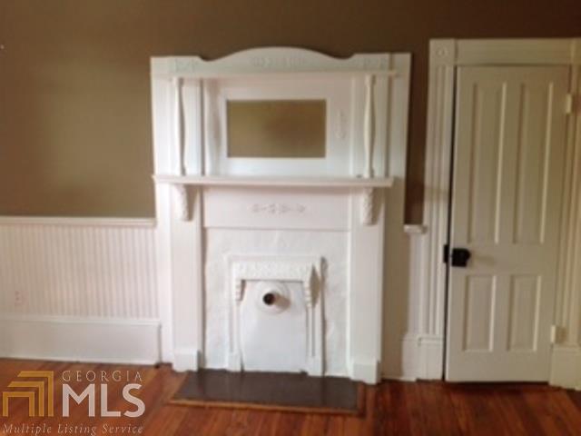
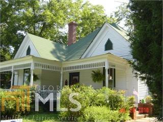
Mansfield historic home- almost 2000 sq. ft., 3 bedrooms and 2 Baths, 10 ft ceilings, large 20 x 20 screened porch with cathedral ceiling, fenced back yard,walk- in attic, excellent school district. Shown by appointment only. Respond by email to get application and list of requirements or call owner: 770-855-7414
2853 State Hwy 11 is a house located in Newton County and the 30055 ZIP Code. This area is served by the Newton County School District attendance zone.
House Features
- Hardwood Floors
- Family Room
2853 State Hwy 11,
Mansfield,
GA
30055
Amenities
- Hardwood Floors
- Family Room
Education
| Colleges & Universities | Distance | ||
|---|---|---|---|
| Colleges & Universities | Distance | ||
| Drive: | 10 min | 6.4 mi | |
| Drive: | 19 min | 11.8 mi | |
| Drive: | 50 min | 41.0 mi | |
| Drive: | 53 min | 43.3 mi |
2853 State Hwy 11 is within 10 minutes or 6.4 miles from Georgia Perim. Coll., Newton. It is also near Emory University, Oxford and Georgia Perim. Coll., Decatur.
Schools


Public Elementary School
Grades PK-5
375 Students
Attendance Zone
Public Middle School
Grades 6-8
760 Students
Attendance Zone
Public High School
Grades 9-12
1,555 Students
Attendance Zone
Private Elementary, Middle & High School
Grades PK-12
Nearby
Private Elementary, Middle & High School
Grades PK-12
24 Students
Nearby
School data provided by
 The GreatSchools Rating helps parents compare schools within a state based on a variety of school quality indicators and provides a helpful picture of how effectively each school serves all of its students. Ratings are on a scale of 1 (below average) to 10 (above average) and can include test scores, college readiness, academic progress, advanced courses, equity, discipline and attendance data. We also advise parents to visit schools, consider other information on school performance and programs, and consider family needs as part of the school selection process.
View GreatSchools Rating Methodology
Data provided by GreatSchools.org © 2026. All rights reserved.
View GreatSchools Rating Methodology
Data provided by GreatSchools.org © 2026. All rights reserved.
Walkability Near 2853 State Hwy 11 Mansfield, GA 30055
Getting Around
 What do Walkability, Transit, Drivability, and Bikeability mean?
Walkability measures the walking distance to day-to-day needs.
Transit measures access to public transportation.
Drivability measures congestion, parking availability, and access to major roads.
Bikeability measures the suitability for cycling.
How It Works
What do Walkability, Transit, Drivability, and Bikeability mean?
Walkability measures the walking distance to day-to-day needs.
Transit measures access to public transportation.
Drivability measures congestion, parking availability, and access to major roads.
Bikeability measures the suitability for cycling.
How It Works
Not Walkable
Walkability
10
/ 100
Exceptionally Drivable
Drivability
100
/ 100
Somewhat Bikeable
Bikeability
20
/ 100
Scores provided by
-
Soundscore™
-
/ 100
Traffic
-Airport
-Businesses
-Scores provided by
HowLoud What is a Sound Score Rating? A Sound Score Rating aggregates noise caused by vehicle traffic, airplane traffic and local sources. How It WorksYou May Also Like
Similar Rentals Nearby
-
-

-

-
-

-

-
 4 Beds$2,490Total Monthly PriceTotal Monthly Price NewPrices include all required monthly fees.House for Rent
 -
 3 Beds$2,095Total Monthly PriceTotal Monthly Price NewPrices include all required monthly fees.House for Rent
 -

-


What Are Walk Score®, Transit Score®, and Bike Score® Ratings?
Walk Score® measures the walkability of any address. Transit Score® measures access to public transit. Bike Score® measures the bikeability of any address.
What is a Sound Score Rating?
A Sound Score Rating aggregates noise caused by vehicle traffic, airplane traffic and local sources.
2853 State Hwy 11
Mansfield, GA 30055