


$615
Total Monthly Price
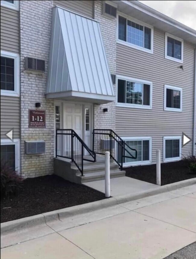
285 Robins Rd Unit C21
Hiawatha, IA 52233
2 Weeks Ago
|
Edit
Favorites
285 Robins Rd Unit C21

Favorites
Check Back Soon for Upcoming Availability
| Beds | Baths | Average SF |
|---|---|---|
| 1 Bedroom 1 Bedroom 1 Br | 1 Bath 1 Bath 1 Ba | 665 SF |
Fees and Policies
The fees listed below are community-provided and may exclude utilities or add-ons. All payments are made directly to the property and are non-refundable unless otherwise specified.
- Cats Allowed
-
Fees not specified
-
Weight limit--
-
Pet Limit--
- Parking
-
Surface Lot--
Details
Utilities Included
-
Water
-
Heat
-
Trash Removal
Lease Options
-
12 Months
Property Information
-
9 units
About This Property
285 Robins Rd is an apartment community located in Linn County and the 52233 ZIP Code.
Apartment Features
- Air Conditioning
- Dishwasher
- Linen Closet
- Laundry Facilities
- Patio
285 Robins Rd,
Hiawatha,
IA
52233
Amenities
- Air Conditioning
- Dishwasher
- Linen Closet
- Laundry Facilities
- Patio
Expenses
Utilities Included
Water, Heat, Trash Removal
Included
Education
| Colleges & Universities | Distance | ||
|---|---|---|---|
| Colleges & Universities | Distance | ||
| Drive: | 9 min | 3.6 mi | |
| Drive: | 19 min | 11.1 mi | |
| Drive: | 44 min | 31.6 mi | |
| Drive: | 47 min | 34.8 mi |
285 Robins Rd Unit C21 is within 9 minutes or 3.6 miles from Mount Mercy University. It is also near Kirkwood C.C., Cedar Rapids and The University of Iowa.
Walkability Near 285 Robins Rd Hiawatha, IA 52233
Getting Around
 What do Walkability, Transit, Drivability, and Bikeability mean?
Walkability measures the walking distance to day-to-day needs.
Transit measures access to public transportation.
Drivability measures congestion, parking availability, and access to major roads.
Bikeability measures the suitability for cycling.
How It Works
What do Walkability, Transit, Drivability, and Bikeability mean?
Walkability measures the walking distance to day-to-day needs.
Transit measures access to public transportation.
Drivability measures congestion, parking availability, and access to major roads.
Bikeability measures the suitability for cycling.
How It Works
Fairly Walkable
Walkability
50
/ 100
Limited Public Transit
Transit
20
/ 100
Exceptionally Drivable
Drivability
100
/ 100
Fairly Bikeable
Bikeability
50
/ 100
Scores provided by
Active
Soundscore™
76
/ 100
Traffic
ActiveAirport
CalmBusinesses
CalmScores provided by
HowLoud What is a Sound Score Rating? A Sound Score Rating aggregates noise caused by vehicle traffic, airplane traffic and local sources. How It WorksYou May Also Like
Similar Rentals Nearby


What Are Walk Score®, Transit Score®, and Bike Score® Ratings?
Walk Score® measures the walkability of any address. Transit Score® measures access to public transit. Bike Score® measures the bikeability of any address.
What is a Sound Score Rating?
A Sound Score Rating aggregates noise caused by vehicle traffic, airplane traffic and local sources.

285 Robins Rd
Hiawatha, IA 52233