285 Bertrand Ave

285 Bertrand Ave, Perth Amboy, NJ 08861

Share Listing
Favorites
285 Bertrand Ave
Share Listing
Favorites

About 285 Bertrand Ave Perth Amboy, NJ 08861

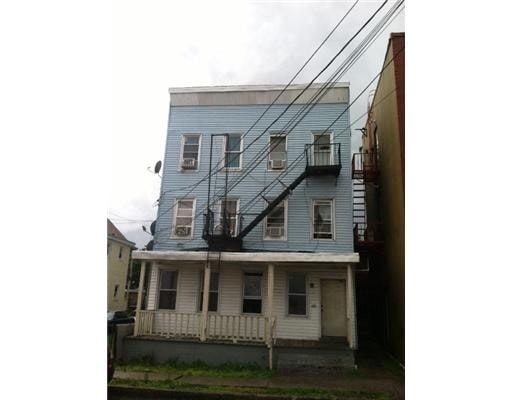
285 Bertrand Ave is ready for your visit. The 08861 location is an ideal place to live. Schedule a time to see the current floorplan options. Here at this community, the leasing staff is ready to help match you with your perfect floorplan. It's all waiting for you at 285 Bertrand Ave. Contact or drop by to find out the availability today.

285 Bertrand Ave is an apartment community located in Middlesex County and the 08861 ZIP Code. This area is served by the Perth Amboy Public School District attendance zone.

Location
285 Bertrand Ave, Perth Amboy,
NJ 08861
Get Directions
Education
Colleges & Universities Distance
Drive: 16 min 7.6 mi
Drive: 22 min 11.5 mi
Drive: 23 min 12.2 mi
Drive: 19 min 12.9 mi
285 Bertrand Ave is within 16 minutes or 7.6 miles from Middlesex Co. Coll., Edison. It is also near Rutgers University and Rutgers University, Livingston.
Schools
Public Elementary School
Grades PK-5
461 Students
Nearby
Public Elementary & Middle School
Grades K-8
1,230 Students
Nearby
Public Elementary School
Grades K-5
458 Students
Nearby
Public High School
Grades 9-12
2,658 Students
Attendance Zone
Private Elementary & Middle School
Grades PK-8
220 Students
Nearby
Private High School
Grades 9-12
284 Students
Nearby
Private High School
Grades 9-12
Nearby
Transportation

285 Bertrand Ave is near Newark Liberty International, located 20.3 miles or 30 minutes away, and John F Kennedy International, located 39.8 miles or 59 minutes away.

Commuter Rail Distance
Walk: 8 min 0.4 mi
Drive: 8 min 3.6 mi
Drive: 9 min 5.5 mi
Drive: 10 min 5.8 mi
Drive: 11 min 6.3 mi
Airports Distance
Airports Distance
Newark Liberty International
Drive: 30 min 20.3 mi
John F Kennedy International
Drive: 59 min 39.8 mi

Walkability Near 285 Bertrand Ave Perth Amboy, NJ 08861

Getting Around
Very Walkable
Walkability
80 / 100
Good Public Transit
Transit
60 / 100
Moderately Drivable
Drivability
70 / 100
Fairly Bikeable
Bikeability
50 / 100

Scores provided by

What do Walkability, Transit, Drivability, and Bikeability mean? Walkability measures the walking distance to day-to-day needs. Transit measures access to public transportation. Drivability measures congestion, parking availability, and access to major roads. Bikeability measures the suitability for cycling. How It Works
-
Soundscore
- / 100

Traffic

-

Airport

-

Businesses

-

Scores provided by

HowLoud What is a Sound Score Rating? A Sound Score Rating aggregates noise caused by vehicle traffic, airplane traffic and local sources. How It Works
Points of Interest

Time and distance from 285 Bertrand Ave.

Shopping Centers Distance
Walk: 13 min 0.7 mi
Drive: 6 min 2.5 mi
Drive: 6 min 3.2 mi
285 Bertrand Ave has 3 shopping centers within 3.2 miles, which is about a 6-minute drive. The miles and minutes will be for the farthest away property.
Parks and Recreation Distance
Alvin P. Williams Memorial Park
Drive: 5 min 2.2 mi
William Warren Park
Drive: 6 min 2.9 mi
Fords Park
Drive: 7 min 3.5 mi
Raritan Bay Waterfront Park
Drive: 10 min 4.2 mi
Conference House Park
Drive: 13 min 7.2 mi
285 Bertrand Ave has 5 parks within 7.2 miles, including Alvin P. Williams Memorial Park, William Warren Park, and Fords Park.
Hospitals Distance
Hospitals Distance
Drive: 3 min 1.2 mi
Drive: 13 min 7.9 mi
Drive: 16 min 9.0 mi
285 Bertrand Ave has 3 hospitals within 9.0 miles, the nearest is Raritan Bay Medical Center Perth Amboy Division which is 1.2 miles away and a 3 minute drive.
Military Bases Distance
Drive: 24 min 13.1 mi
Drive: 22 min 13.4 mi
285 Bertrand Ave is 13.1 miles from Tamdques Reservation, and is convenient to other military bases, including Ash Brook Reservation.

Explore Similar Rentals Nearby