
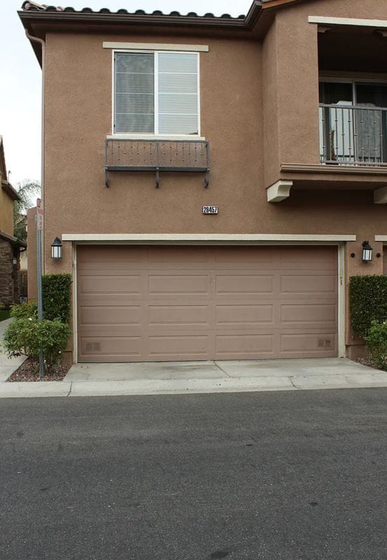
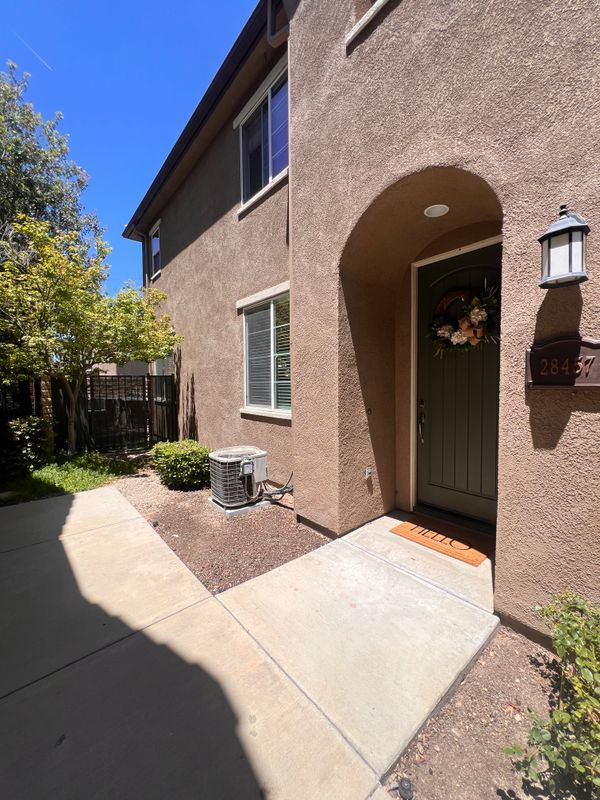
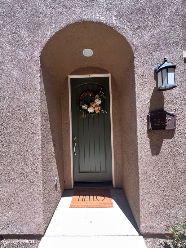
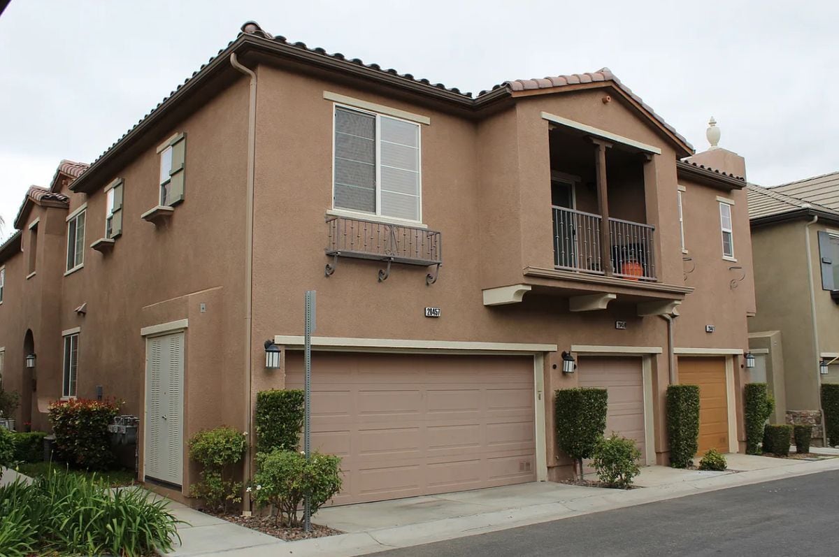
28457 Mirabelle Ln
Santa Clarita, CA 91350
-
Bedrooms
3
-
Bathrooms
2.5
-
Square Feet
1,520 sq ft
-
Available
Available Now

About This Home
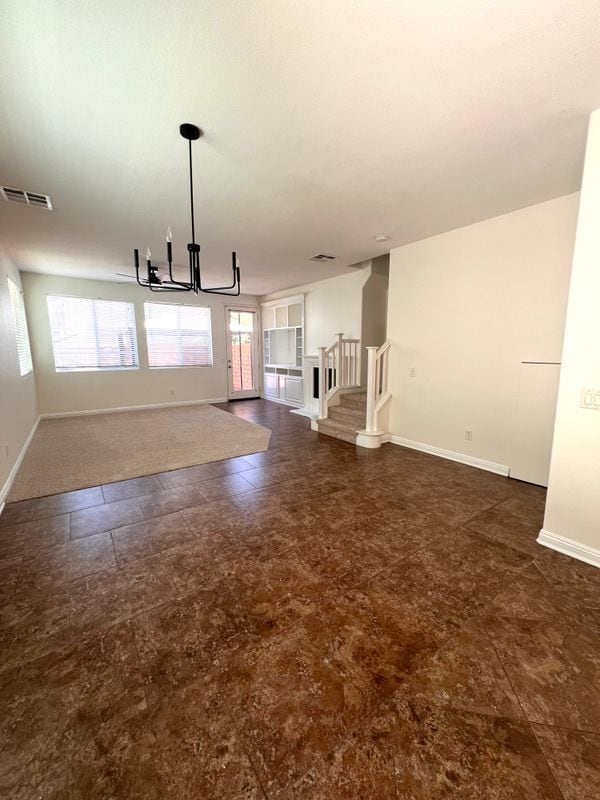
Welcome to your ideal rental townhouse in Santa Clarita! This charming 3-bedroom, 2.5-bath, 1,520 square-foot home offers a perfect blend of comfort and style. Built in 2005, it features modern amenities to suit your lifestyle. Key property highlights include a spacious living area bathed in natural light, a cozy fireplace, and an open-concept kitchen equipped with granite countertops and modern appliances. Enjoy convenience with a separate laundry room and a master bedroom featuring a walk-in closet. The outdoor space is designed for entertaining, complete with a built-in BBQ area. The property is located near a shopping center featuring Starbucks, Jersey Mike's, Del Taco, Piccola Osteria, and Grocery Outlet. Don't miss this incredible opportunity—schedule your viewing today!
28457 Mirabelle Ln is a townhome located in Los Angeles County and the 91350 ZIP Code. This area is served by the William S. Hart Union High attendance zone.
Townhome Features
- Dishwasher
- Disposal
- Renters Insurance Program
Fees and Policies
The fees below are based on community-supplied data and may exclude additional fees and utilities.
Details
Utilities Included
-
Trash Removal
Lease Options
-
12 Months
Contact
- Phone Number
- Website View Property Website
- Contact
-
Source

- Dishwasher
- Disposal
- Renters Insurance Program
Cut by the Santa Clara River, west of the San Gabriel Mountains, and east of Castaic Lake State Park is Santa Clarita. About 35 miles northwest of Downtown Los Angeles, Santa Clarita is widely known as the home of Six Flags Magic Mountain. However, Santa Clarita is much more than just an amusement park destination. It is supported by a strong residential community and unique environment.
Drawing over 10,000 annual visitors, Santa Clarita holds a Cowboy Festival every spring to celebrate the history and culture of the Old West with food, music, and poetry performances. In juxtaposition, the Hart of the West Pow Wow serves as a celebration of Native American Indian culture and history. Summer brings free concerts in the park, fall finds the International Family Film Festival, and winter lights up with a Lighted Boat Parade at Castaic Lagoon.
In addition, Santa Clarita maintains parks and trails for a variety of outdoor activities.
Learn more about living in Santa Clarita| Colleges & Universities | Distance | ||
|---|---|---|---|
| Colleges & Universities | Distance | ||
| Drive: | 15 min | 7.7 mi | |
| Drive: | 24 min | 17.2 mi | |
| Drive: | 30 min | 18.4 mi | |
| Drive: | 33 min | 24.5 mi |


View GreatSchools Rating Methodology
You May Also Like
What Are Walk Score®, Transit Score®, and Bike Score® Ratings?
Walk Score® measures the walkability of any address. Transit Score® measures access to public transit. Bike Score® measures the bikeability of any address.
What is a Sound Score Rating?
A Sound Score Rating aggregates noise caused by vehicle traffic, airplane traffic and local sources
28457 Mirabelle Ln
Santa Clarita, CA 91350