

$1,500
/ Month
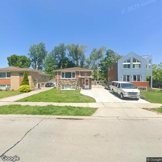
284 E Quincy St
Riverside, IL 60546
2 Weeks Ago
|
Edit
Favorites
284 E Quincy St

Favorites
Check Back Soon for Upcoming Availability
| Beds | Baths | Average SF |
|---|---|---|
| 2 Bedrooms 2 Bedrooms 2 Br | 1 Bath 1 Bath 1 Ba | 1,000 SF |
Fees and Policies
Details
Utilities Included
-
Water
284 E Quincy St is a condo located in Cook County and the 60546 ZIP Code. This area is served by the Riverside School District 96 attendance zone.
Condo Features
- Hardwood Floors
- Storage Space
Location
Get Directions
West Cook is a multicultural neighborhood south of O’Hare International Airport. Golfers in the community enjoy its numerous golf greens, including Oak Park Country Club and Edgewood Valley Country Club.
Public transit abounds in West Cook, attracting renters who wish to live outside the cities in which they work. Residents appreciate the shopping opportunities at Fashion Outlets of Chicago and North Riverside Park Mall.
The Brookfield Zoo is a fun-filled attraction in West Cook which houses hundreds of animals. Locals adore the neighborhood’s lush green spaces – many of which are in walking distance of affordable West Cook apartments. Direct access to Interstate 55 and Interstate 294 makes commuting easy, whether you’re traveling into Chicago or a neighboring state.
Learn more about living in West CookBelow are rent ranges for similar nearby apartments
| Beds | Average Size | Lowest | Typical | Premium |
|---|---|---|---|---|
| Studio Studio Studio | 545-547 Sq Ft | $995 | $1,729 | $3,830 |
| 1 Bed 1 Bed 1 Bed | 793 Sq Ft | $950 | $2,015 | $5,500 |
| 2 Beds 2 Beds 2 Beds | 1119-1121 Sq Ft | $1,100 | $2,588 | $7,820 |
| 3 Beds 3 Beds 3 Beds | 1503 Sq Ft | $1,750 | $3,227 | $19,236 |
| 4 Beds 4 Beds 4 Beds | 2179 Sq Ft | $2,700 | $3,950 | $8,000 |
Amenities
- Hardwood Floors
- Storage Space
Expenses
Utilities Included
Water
Included
Education
| Colleges & Universities | Distance | ||
|---|---|---|---|
| Colleges & Universities | Distance | ||
| Drive: | 12 min | 5.3 mi | |
| Drive: | 12 min | 5.4 mi | |
| Drive: | 13 min | 5.9 mi | |
| Drive: | 17 min | 7.9 mi |
284 E Quincy St is within 12 minutes or 5.4 miles from Concordia University-Chicago. It is also near Dominican University, Priory and Dominican University.
Schools


Public Elementary School
Grades PK-5
435 Students
Nearby
Public Elementary School
Grades PK-5
376 Students
Attendance Zone
Public Middle School
Grades 6-8
562 Students
Attendance Zone
Public High School
Grades 9-12
1,672 Students
Attendance Zone
Private Elementary, Middle & High School
Grades K-12
Nearby
Private Elementary & Middle School
Grades PK-8
350 Students
Nearby
School data provided by
 The GreatSchools Rating helps parents compare schools within a state based on a variety of school quality indicators and provides a helpful picture of how effectively each school serves all of its students. Ratings are on a scale of 1 (below average) to 10 (above average) and can include test scores, college readiness, academic progress, advanced courses, equity, discipline and attendance data. We also advise parents to visit schools, consider other information on school performance and programs, and consider family needs as part of the school selection process.
View GreatSchools Rating Methodology
Data provided by GreatSchools.org © 2025. All rights reserved.
View GreatSchools Rating Methodology
Data provided by GreatSchools.org © 2025. All rights reserved.
Transportation options available in Riverside include Oak Park Station (Blue Line), located 3.9 miles from 284 E Quincy St. 284 E Quincy St is near Chicago Midway International, located 5.5 miles or 10 minutes away, and Chicago O'Hare International, located 15.3 miles or 30 minutes away.
| Transit / Subway | Distance | ||
|---|---|---|---|
| Transit / Subway | Distance | ||
|
|
Drive: | 7 min | 3.9 mi |
|
|
Drive: | 9 min | 3.9 mi |
|
|
Drive: | 9 min | 4.1 mi |
|
|
Drive: | 9 min | 4.6 mi |
|
|
Drive: | 11 min | 5.9 mi |
| Commuter Rail | Distance | ||
|---|---|---|---|
| Commuter Rail | Distance | ||
|
|
Walk: | 5 min | 0.3 mi |
|
|
Walk: | 14 min | 0.7 mi |
|
|
Walk: | 14 min | 0.8 mi |
|
|
Drive: | 5 min | 1.3 mi |
|
|
Drive: | 6 min | 1.6 mi |
| Airports | Distance | ||
|---|---|---|---|
| Airports | Distance | ||
|
Chicago Midway International
|
Drive: | 10 min | 5.5 mi |
|
Chicago O'Hare International
|
Drive: | 30 min | 15.3 mi |
Time and distance from 284 E Quincy St.
| Shopping Centers | Distance | ||
|---|---|---|---|
| Shopping Centers | Distance | ||
| Walk: | 16 min | 0.8 mi | |
| Drive: | 2 min | 1.2 mi | |
| Drive: | 3 min | 1.6 mi |
284 E Quincy St has 3 shopping centers within 1.6 miles, which is about a 3-minute drive. The miles and minutes will be for the farthest away property.
| Parks and Recreation | Distance | ||
|---|---|---|---|
| Parks and Recreation | Distance | ||
|
White Eagle Woods-North
|
Drive: | 2 min | 1.1 mi |
|
White Eagle Woods-South
|
Drive: | 3 min | 1.3 mi |
|
Andrew Toman Grove
|
Drive: | 5 min | 1.7 mi |
|
Brookfield Zoo
|
Drive: | 6 min | 2.0 mi |
|
Schuth's Grove / Callahan Grove
|
Drive: | 6 min | 2.7 mi |
284 E Quincy St has 5 parks within 2.7 miles, including White Eagle Woods-North, White Eagle Woods-South, and Andrew Toman Grove.
| Hospitals | Distance | ||
|---|---|---|---|
| Hospitals | Distance | ||
| Walk: | 15 min | 0.8 mi | |
| Drive: | 7 min | 3.6 mi | |
| Drive: | 8 min | 3.8 mi |
284 E Quincy St has 3 hospitals within 3.8 miles, the nearest is MacNeal Hospital which is 0.8 mile away and a 15 minute walk.
| Military Bases | Distance | ||
|---|---|---|---|
| Military Bases | Distance | ||
| Drive: | 34 min | 21.3 mi |
284 E Quincy St is 21.3 miles and a 34 minute drive from US Military Reservation Naperville.
You May Also Like
Similar Rentals Nearby


What Are Walk Score®, Transit Score®, and Bike Score® Ratings?
Walk Score® measures the walkability of any address. Transit Score® measures access to public transit. Bike Score® measures the bikeability of any address.
What is a Sound Score Rating?
A Sound Score Rating aggregates noise caused by vehicle traffic, airplane traffic and local sources
284 E Quincy St
Riverside, IL 60546