$2,000
/ Month
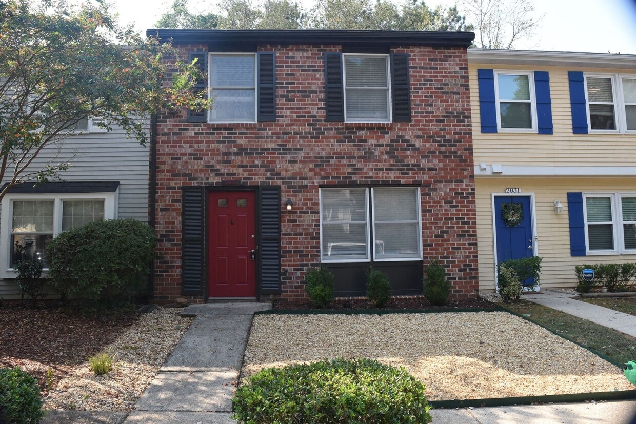
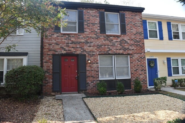
2833 Royal Path Ct
Decatur, GA 30030
2 Weeks Ago
|
Edit
Favorites
2833 Royal Path Ct

Favorites
Check Back Soon for Upcoming Availability
| Beds | Baths | Average SF |
|---|---|---|
| 3 Bedrooms 3 Bedrooms 3 Br | 2.5 Baths 2.5 Baths 2.5 Ba | 1,240 SF |
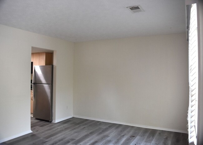
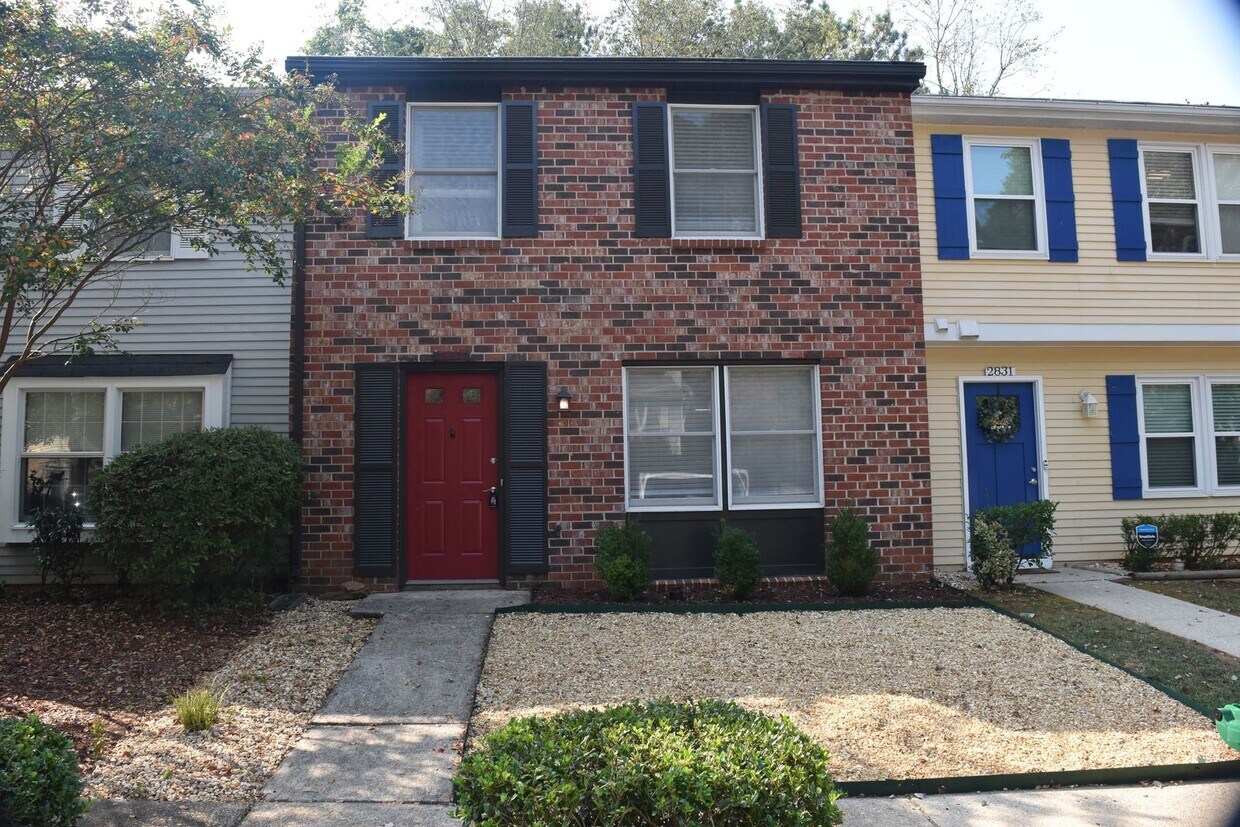
About This Property
Located under 2 miles from Downtown Decatur and minutes from I-285 and I-20, this 3bd/2.5ba townhome is perfect for someone looking needing to commute in and around the city, but also looking for countless options for dining, entertainment and recreation. This home also features laminate hardwoods on the main, carpet upstairs, a kitchen with plenty of cabinet and countertop space, spacious living room, with half bath, a separate dining area, a spacious master with full bath and stand in shower, two good size guest rooms with full hall bath, a fully fenced backyard, a storage shed and closet in back, rear patio, and off street parking at the front doorstep. For more information, please contact: The Highland Residential Group, LLC
2833 Royal Path Ct is a townhome located in DeKalb County and the 30030 ZIP Code. This area is served by the DeKalb County attendance zone.
Location
Get Directions
Nestled in the city of Decatur, Avondale Park is a family-friendly suburb surrounded by upscale residential communities like Oakhurst and East Lake. Avondale Park is mostly residential, other than East Decatur Station, which features restaurants, fitness centers, and small businesses. Check out Three Taverns Craft Brewery, and go next door to Downtown Decatur for a vibrant nightlife scene and delicious local eats!
The Avondale and Kensington Marta Stations are conveniently located in or near town, and will take you through Downtown Atlanta and into West Atlanta. Avondale Park features a community green space with tennis courts, an outdoor pool, and a lake. Families flock to this area for the safe atmosphere and top-notch public schools like Avondale Elementary School. Check out neighboring areas like Oakhurst for community events and seasonal festivals, such as Porchfest.
Learn more about living in Avondale ParkBelow are rent ranges for similar nearby apartments
Education
| Colleges & Universities | Distance | ||
|---|---|---|---|
| Colleges & Universities | Distance | ||
| Drive: | 4 min | 1.9 mi | |
| Drive: | 8 min | 3.8 mi | |
| Drive: | 10 min | 4.4 mi | |
| Drive: | 10 min | 4.7 mi |
2833 Royal Path Ct is within 4 minutes or 1.9 miles from Agnes Scott College. It is also near Emory University, Clairmont and Emory University.
Schools


Public Elementary School
Grades PK-5
395 Students
Attendance Zone
Public Middle School
Grades 6-8
956 Students
Attendance Zone
Public High School
Grades 9-12
1,358 Students
Attendance Zone
Private Elementary & Middle School
Grades PK-8
192 Students
Nearby
Private High School
Grades 9-12
79 Students
Nearby
School data provided by
 The GreatSchools Rating helps parents compare schools within a state based on a variety of school quality indicators and provides a helpful picture of how effectively each school serves all of its students. Ratings are on a scale of 1 (below average) to 10 (above average) and can include test scores, college readiness, academic progress, advanced courses, equity, discipline and attendance data. We also advise parents to visit schools, consider other information on school performance and programs, and consider family needs as part of the school selection process.
View GreatSchools Rating Methodology
Data provided by GreatSchools.org © 2026. All rights reserved.
View GreatSchools Rating Methodology
Data provided by GreatSchools.org © 2026. All rights reserved.
Transportation options available in Decatur include Avondale, located 0.8 mile from 2833 Royal Path Ct. 2833 Royal Path Ct is near Hartsfield - Jackson Atlanta International, located 16.4 miles or 29 minutes away.
| Transit / Subway | Distance | ||
|---|---|---|---|
| Transit / Subway | Distance | ||
|
|
Walk: | 15 min | 0.8 mi |
|
|
Drive: | 4 min | 1.7 mi |
|
|
Drive: | 5 min | 2.4 mi |
|
|
Drive: | 5 min | 2.7 mi |
|
|
Drive: | 10 min | 5.5 mi |
| Commuter Rail | Distance | ||
|---|---|---|---|
| Commuter Rail | Distance | ||
|
|
Drive: | 20 min | 9.5 mi |
| Airports | Distance | ||
|---|---|---|---|
| Airports | Distance | ||
|
Hartsfield - Jackson Atlanta International
|
Drive: | 29 min | 16.4 mi |
Time and distance from 2833 Royal Path Ct.
| Shopping Centers | Distance | ||
|---|---|---|---|
| Shopping Centers | Distance | ||
| Walk: | 18 min | 1.0 mi | |
| Drive: | 3 min | 1.2 mi | |
| Drive: | 4 min | 1.4 mi |
2833 Royal Path Ct has 3 shopping centers within 1.4 miles, which is about a 4-minute drive. The miles and minutes will be for the farthest away property.
| Parks and Recreation | Distance | ||
|---|---|---|---|
| Parks and Recreation | Distance | ||
|
Glenn Creek Nature Preserve
|
Drive: | 4 min | 1.4 mi |
|
Bradley Observatory
|
Drive: | 3 min | 1.6 mi |
|
South River Watershed Alliance
|
Drive: | 5 min | 2.2 mi |
|
Wylde Center and Oakhurst Community Garden
|
Drive: | 4 min | 2.2 mi |
|
Fernbank Forest & Science Center
|
Drive: | 8 min | 3.3 mi |
2833 Royal Path Ct has 5 parks within 3.3 miles, including Glenn Creek Nature Preserve, Bradley Observatory, and Wylde Center and Oakhurst Community Garden.
| Hospitals | Distance | ||
|---|---|---|---|
| Hospitals | Distance | ||
| Drive: | 5 min | 2.4 mi | |
| Drive: | 9 min | 4.2 mi | |
| Drive: | 9 min | 4.3 mi |
2833 Royal Path Ct has 3 hospitals within 4.3 miles, the nearest is Emory Decatur Hospital which is 2.4 miles away and a 5 minute drive.
| Military Bases | Distance | ||
|---|---|---|---|
| Military Bases | Distance | ||
| Drive: | 24 min | 12.9 mi | |
| Drive: | 27 min | 18.1 mi |
2833 Royal Path Ct is 12.9 miles from Fort McPherson, and is convenient to other military bases, including Fort Gillem.
You May Also Like
Similar Rentals Nearby


What Are Walk Score®, Transit Score®, and Bike Score® Ratings?
Walk Score® measures the walkability of any address. Transit Score® measures access to public transit. Bike Score® measures the bikeability of any address.
What is a Sound Score Rating?
A Sound Score Rating aggregates noise caused by vehicle traffic, airplane traffic and local sources
2833 Royal Path Ct
Decatur, GA 30030