$3,400
/ Month
2824 Lewis Ave
Hillcrest Heights, MD 20746
Today
|
Edit
Favorites
301-254-5411
-
Bedrooms
4
-
Bathrooms
3.5
-
Square Feet
--
-
Available
Available Apr 11
Highlight
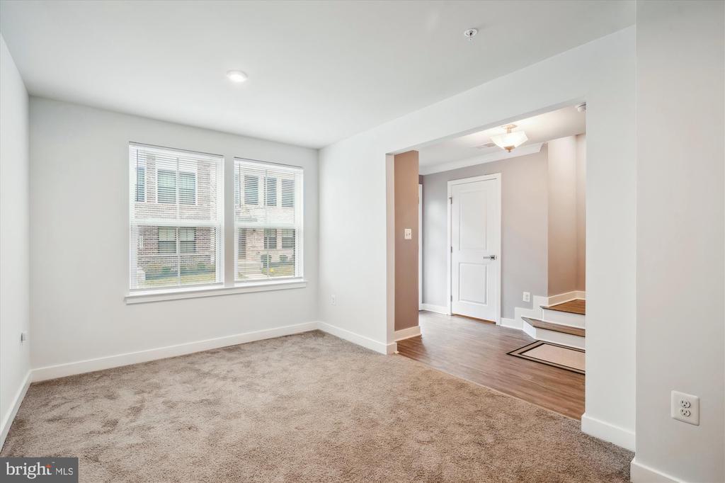
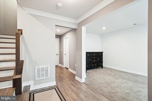
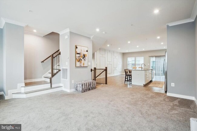
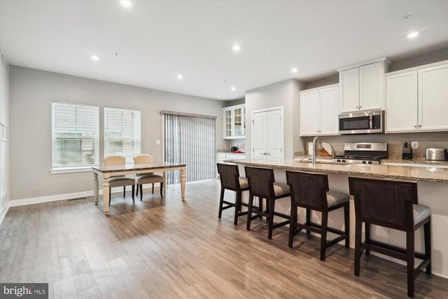
- Basement
2824 Lewis Ave

Favorites
About This Home
Available Apr 11
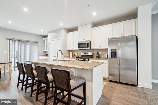
Immediately available beautifully maintained townhouse! This one is right across the street from the Metro this is one you don't want to miss!
2824 Lewis Ave is a townhome located in Prince George's County and the 20746 ZIP Code. This area is served by the Prince George's County Public Schools attendance zone.
* Price shown is base rent. Excludes user-selected optional fees and variable or usage-based fees and required charges due at or prior to move-in or at move-out. Price, availability, fees, and any applicable rent special are subject to change without notice.
* Square footage definitions vary. Displayed square footage is approximate.
Townhome Features
- Basement
Contact
- Listed by CHRISTOPHER PERRY | Compass
- Phone Number
- Contact
-
Source
 Bright MLS, Inc.
Copyright © 2026 Bright MLS, Inc.
Location
Get Directions
Hillcrest Heights is located in Prince George County, just southeast of Washington D.C., across the Anacostia River. Hillcrest Heights' location to the Capital provides a variety of unique shopping destinations, international and local cuisines, and cool sites to see! The Shops at Iverson are located inside Hillcrest Heights, and nearby you’ll discover Phoenix Theatres-Marlow 6, Marlow Heights Shopping Center, plus dine-in and quick-bite restaurants.
Thanks to close proximity to I-495 and I-295, residents can travel with ease to Virginia, Washington D.C., and Maryland. The Metro subway is also a suitable commuting option, since convenient train access points are stationed at Naylord Road and Southern Avenue. Hillcrest Park and Oxon Run are extensive green spaces in the area, ideal for recreational sports.
Learn more about living in Hillcrest Heights
Amenities
- Basement
Education
| Colleges & Universities | Distance | ||
|---|---|---|---|
| Colleges & Universities | Distance | ||
| Drive: | 14 min | 6.8 mi | |
| Drive: | 14 min | 6.8 mi | |
| Drive: | 16 min | 7.3 mi | |
| Drive: | 16 min | 8.6 mi |
2824 Lewis Ave is within 14 minutes or 6.8 miles from Georgetown Law. It is also near Georgetown and Gallaudet University.
Schools


Public Elementary School
Grades PK-5
470 Students
Nearby
Public High School
Grades 9-12
1,834 Students
Nearby
School data provided by
 The GreatSchools Rating helps parents compare schools within a state based on a variety of school quality indicators and provides a helpful picture of how effectively each school serves all of its students. Ratings are on a scale of 1 (below average) to 10 (above average) and can include test scores, college readiness, academic progress, advanced courses, equity, discipline and attendance data. We also advise parents to visit schools, consider other information on school performance and programs, and consider family needs as part of the school selection process.
View GreatSchools Rating Methodology
Data provided by GreatSchools.org © 2026. All rights reserved.
View GreatSchools Rating Methodology
Data provided by GreatSchools.org © 2026. All rights reserved.
Transportation options available in Hillcrest Heights include Suitland, located 1.3 miles from 2824 Lewis Ave. 2824 Lewis Ave is near Ronald Reagan Washington Ntl, located 10.4 miles or 20 minutes away, and Baltimore/Washington International Thurgood Marshall, located 32.3 miles or 50 minutes away.
| Transit / Subway | Distance | ||
|---|---|---|---|
| Transit / Subway | Distance | ||
|
|
Drive: | 5 min | 1.3 mi |
|
|
Drive: | 6 min | 2.6 mi |
|
Capitol Heights, Blue/Silver Line Center Platform
|
Drive: | 9 min | 3.4 mi |
|
|
Drive: | 9 min | 3.5 mi |
|
|
Drive: | 10 min | 4.2 mi |
| Commuter Rail | Distance | ||
|---|---|---|---|
| Commuter Rail | Distance | ||
|
|
Drive: | 15 min | 6.2 mi |
|
|
Drive: | 13 min | 6.4 mi |
|
|
Drive: | 14 min | 6.5 mi |
| Drive: | 21 min | 11.5 mi | |
|
|
Drive: | 21 min | 11.5 mi |
| Airports | Distance | ||
|---|---|---|---|
| Airports | Distance | ||
|
Ronald Reagan Washington Ntl
|
Drive: | 20 min | 10.4 mi |
|
Baltimore/Washington International Thurgood Marshall
|
Drive: | 50 min | 32.3 mi |
Getting Around
 What do Walkability, Transit, Drivability, and Bikeability mean?
Walkability measures the walking distance to day-to-day needs.
Transit measures access to public transportation.
Drivability measures congestion, parking availability, and access to major roads.
Bikeability measures the suitability for cycling.
How It Works
What do Walkability, Transit, Drivability, and Bikeability mean?
Walkability measures the walking distance to day-to-day needs.
Transit measures access to public transportation.
Drivability measures congestion, parking availability, and access to major roads.
Bikeability measures the suitability for cycling.
How It Works
Moderately Walkable
Walkability
60
/ 100
Some Public Transit
Transit
40
/ 100
Exceptionally Drivable
Drivability
90
/ 100
Fairly Bikeable
Bikeability
40
/ 100
Scores provided by
-
Soundscore™
-
/ 100
Traffic
-Airport
-Businesses
-Scores provided by
HowLoud What is a Sound Score Rating? A Sound Score Rating aggregates noise caused by vehicle traffic, airplane traffic and local sources. How It WorksTime and distance from 2824 Lewis Ave.
| Shopping Centers | Distance | ||
|---|---|---|---|
| Shopping Centers | Distance | ||
| Walk: | 9 min | 0.5 mi | |
| Walk: | 10 min | 0.5 mi | |
| Walk: | 17 min | 0.9 mi |
2824 Lewis Ave has 3 shopping centers within 0.9 mile, which is about a 17-minute walk. The miles and minutes will be for the farthest away property.
| Parks and Recreation | Distance | ||
|---|---|---|---|
| Parks and Recreation | Distance | ||
|
Suitland Bog
|
Drive: | 4 min | 2.1 mi |
|
Fort Dupont Park
|
Drive: | 8 min | 3.0 mi |
|
Oxon Cove Park
|
Drive: | 9 min | 3.7 mi |
|
Walker Mill Regional Park
|
Drive: | 8 min | 4.0 mi |
|
Frederick Douglass National Historic Site
|
Drive: | 10 min | 4.0 mi |
2824 Lewis Ave has 5 parks within 4.0 miles, including Suitland Bog, Fort Dupont Park, and Oxon Cove Park.
| Hospitals | Distance | ||
|---|---|---|---|
| Hospitals | Distance | ||
| Drive: | 11 min | 4.5 mi | |
| Drive: | 10 min | 4.6 mi | |
| Drive: | 15 min | 7.5 mi |
2824 Lewis Ave has 3 hospitals within 7.5 miles, the nearest is St. Elizabeth's Hospital which is 4.5 miles away and a 11 minute drive.
| Military Bases | Distance | ||
|---|---|---|---|
| Military Bases | Distance | ||
| Drive: | 11 min | 4.7 mi | |
| Drive: | 11 min | 5.1 mi |
2824 Lewis Ave is 4.7 miles from Washington Navy Yard, and is convenient to other military bases, including Andrews Airforce Base.
You May Also Like
Similar Rentals Nearby
-
-
-
-
1 / 49

-
-

-
-

-

-


What Are Walk Score®, Transit Score®, and Bike Score® Ratings?
Walk Score® measures the walkability of any address. Transit Score® measures access to public transit. Bike Score® measures the bikeability of any address.
What is a Sound Score Rating?
A Sound Score Rating aggregates noise caused by vehicle traffic, airplane traffic and local sources.

2824 Lewis Ave
Hillcrest Heights, MD 20746