2802 Chelan Ct
Antelope, CA 95843
-
Bedrooms
3
-
Bathrooms
2
-
Square Feet
1,887 sq ft
Contact
- Listed by Locayt
Antelope is a suburban community situated just over 15 miles northeast of Sacramento along Interstate 80. This spacious residential area is home to wide boulevards and wooded areas that shroud idyllic homes and a variety of apartment rentals. Popular among families who want to escape the sprawl of Sacramento or anyone who just wants some peace and quiet, Antelope has it all. Five community parks add to the outdoorsy feel of Antelope, while the stores and restaurants along Elverta Road keep residents entertained and well taken care of. Locals head northeast to the shops at the Westfield Galleria, or down to Sacramento for both work and leisure.
Learn more about living in Antelope| Colleges & Universities | Distance | ||
|---|---|---|---|
| Colleges & Universities | Distance | ||
| Drive: | 16 min | 7.6 mi | |
| Drive: | 26 min | 13.4 mi | |
| Drive: | 22 min | 13.9 mi | |
| Drive: | 25 min | 15.9 mi |
Transportation options available in Antelope include Watt/I-80, located 5.5 miles from 2802 Chelan Ct. 2802 Chelan Ct is near Sacramento International, located 15.7 miles or 25 minutes away.
| Transit / Subway | Distance | ||
|---|---|---|---|
| Transit / Subway | Distance | ||
|
|
Drive: | 11 min | 5.5 mi |
|
|
Drive: | 14 min | 6.7 mi |
|
|
Drive: | 14 min | 6.8 mi |
| Drive: | 14 min | 7.2 mi | |
|
|
Drive: | 17 min | 8.8 mi |
| Commuter Rail | Distance | ||
|---|---|---|---|
| Commuter Rail | Distance | ||
|
|
Drive: | 15 min | 7.8 mi |
|
|
Drive: | 21 min | 13.1 mi |
| Drive: | 23 min | 14.2 mi | |
| Drive: | 34 min | 25.3 mi | |
|
|
Drive: | 34 min | 25.3 mi |
| Airports | Distance | ||
|---|---|---|---|
| Airports | Distance | ||
|
Sacramento International
|
Drive: | 25 min | 15.7 mi |
Time and distance from 2802 Chelan Ct.
| Shopping Centers | Distance | ||
|---|---|---|---|
| Shopping Centers | Distance | ||
| Walk: | 7 min | 0.4 mi | |
| Walk: | 9 min | 0.5 mi | |
| Drive: | 3 min | 1.2 mi |
| Parks and Recreation | Distance | ||
|---|---|---|---|
| Parks and Recreation | Distance | ||
|
Gibson Ranch County Park
|
Drive: | 5 min | 1.6 mi |
|
Aerospace Museum of California
|
Drive: | 9 min | 3.6 mi |
|
Mahan Park
|
Drive: | 12 min | 6.8 mi |
|
Luken Park
|
Drive: | 12 min | 6.9 mi |
|
Roccucci Park
|
Drive: | 14 min | 8.1 mi |
| Hospitals | Distance | ||
|---|---|---|---|
| Hospitals | Distance | ||
| Drive: | 14 min | 6.9 mi | |
| Drive: | 13 min | 7.0 mi | |
| Drive: | 18 min | 9.0 mi |
| Military Bases | Distance | ||
|---|---|---|---|
| Military Bases | Distance | ||
| Drive: | 14 min | 4.2 mi | |
| Drive: | 61 min | 37.0 mi | |
| Drive: | 70 min | 52.2 mi |
You May Also Like
Similar Rentals Nearby
-
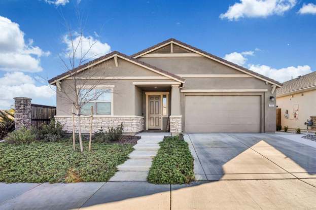
3 Beds, 2 Baths, 1,261 sq ft$2,599Total Monthly Price12 Month LeaseTotal Monthly Price NewPrices include all required monthly fees.10001 Woodcreek Oaks Blvd Unit 1721
-
-
-
-
-
-
-
-
-
Condo for Rent3 Beds | 2.5 Baths | 1,354 sq ft
What Are Walk Score®, Transit Score®, and Bike Score® Ratings?
Walk Score® measures the walkability of any address. Transit Score® measures access to public transit. Bike Score® measures the bikeability of any address.
What is a Sound Score Rating?
A Sound Score Rating aggregates noise caused by vehicle traffic, airplane traffic and local sources.