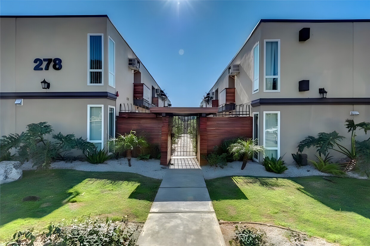
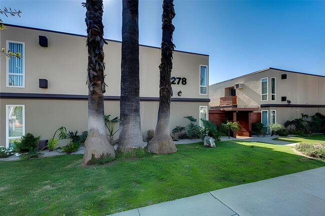
278 E Washington Blvd
278 E Washington Blvd,
Pasadena,
CA
91104
-
Monthly Rent
$2,645 - $2,895
-
Bedrooms
2 bd
-
Bathrooms
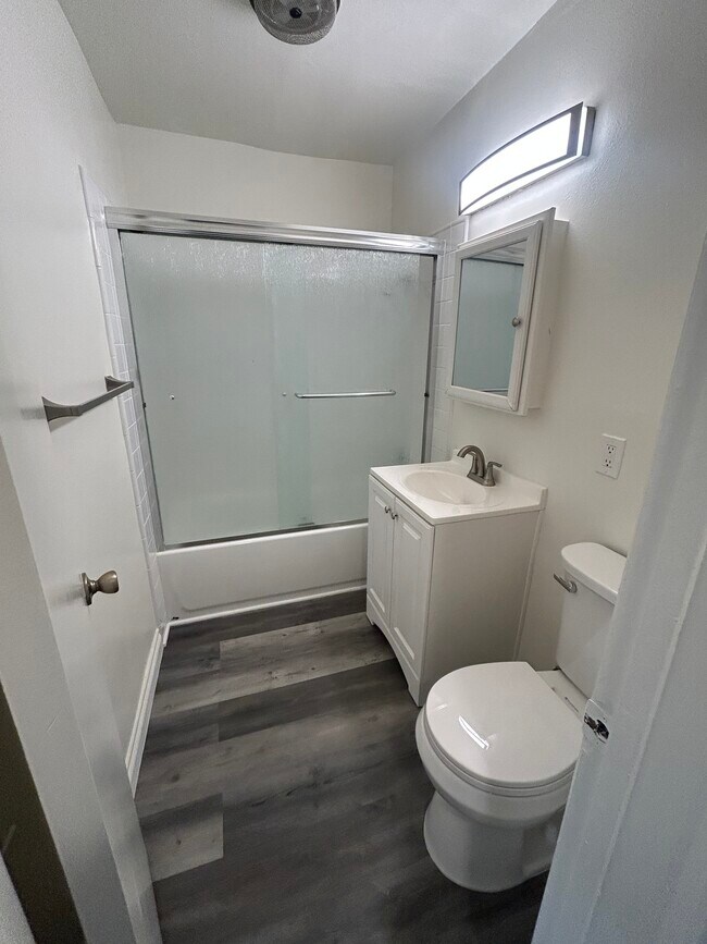
1 ba
-
Square Feet
1,025 sq ft

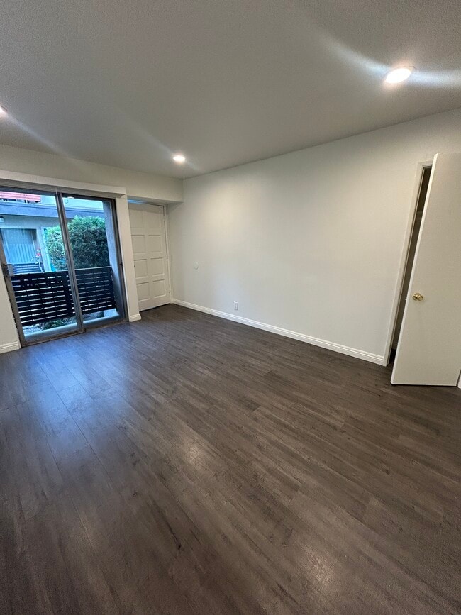
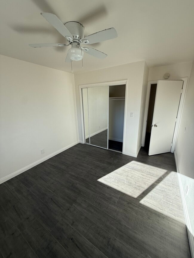
This is a special downstairs unit - Large 2 bedroom in secure building located in a Prime Pasadena location. Recently remodelled with high end finishes, including chef's kitchen with stainless steel appliances and quartz countertops, fireplace, open floor plan, A/C and heat wall units, small balcony and hardwood laminate flooring. Apartment includes dishwasher and in unit washer and dryer. Apartment comes with gated assigned parking space. Close to Old Town Pasadena. Simply a great opportunity.
Highlights
- English and Spanish Speaking Staff
- Security System
- High Ceilings
- Controlled Access
- Fenced Lot
- Fireplace
- Gated
- Balcony
- Property Manager on Site
Pricing & Floor Plans
-
Unit 1305-5price $2,895square feet 1,025availibility Now
-
Unit 1305-5price $2,895square feet 1,025availibility Now
Fees and Policies
The fees listed below are community-provided and may exclude utilities or add-ons. All payments are made directly to the property and are non-refundable unless otherwise specified. Use the Cost Calculator to determine costs based on your needs.
-
One-Time Basics
-
Due at Move-In
-
Security Deposit - RefundableCharged per unit.$2,995
-
-
Due at Move-In
-
CoveredApartment comes with 1 secured parking space.
-
Storage - LargeStorage area included in monthly rent above parking spot
Property Fee Disclaimer: Based on community-supplied data and independent market research. Subject to change without notice. May exclude fees for mandatory or optional services and usage-based utilities.
Details
Utilities Included
-
Water
-
Trash Removal
-
Sewer
Lease Options
-
12 mo
Property Information
-
Built in 1964
-
24 units/2 stories
About 278 E Washington Blvd Pasadena, CA 91104
This is a special downstairs unit - Large 2 bedroom in secure building located in a Prime Pasadena location. Recently remodelled with high end finishes, including chef's kitchen with stainless steel appliances and quartz countertops, fireplace, open floor plan, A/C and heat wall units, small balcony and hardwood laminate flooring. Apartment includes dishwasher and in unit washer and dryer. Apartment comes with gated assigned parking space. Close to Old Town Pasadena. Simply a great opportunity.
278 E Washington Blvd is an apartment community located in Los Angeles County and the 91104 ZIP Code. This area is served by the Pasadena Unified attendance zone.
Unique Features
- 1 Assigned Parking Space In Secure Area
- Additional Storage Space Outside Unit
Contact
Community Amenities
Controlled Access
Gated
24 Hour Access
Property Manager on Site
- Wi-Fi
- Controlled Access
- Maintenance on site
- Property Manager on Site
- Security System
- 24 Hour Access
- Storage Space
- Walk-Up
- Gated
- Fenced Lot
- Courtyard
Apartment Features
Washer/Dryer
Air Conditioning
Dishwasher
High Speed Internet Access
Hardwood Floors
Granite Countertops
Microwave
Refrigerator
Indoor Features
- High Speed Internet Access
- Wi-Fi
- Washer/Dryer
- Air Conditioning
- Heating
- Ceiling Fans
- Smoke Free
- Cable Ready
- Security System
- Storage Space
- Tub/Shower
- Fireplace
Kitchen Features & Appliances
- Dishwasher
- Disposal
- Granite Countertops
- Stainless Steel Appliances
- Eat-in Kitchen
- Kitchen
- Microwave
- Oven
- Range
- Refrigerator
- Freezer
- Breakfast Nook
- Quartz Countertops
- Gas Range
Model Details
- Hardwood Floors
- Dining Room
- High Ceilings
- Family Room
- Linen Closet
- Double Pane Windows
- Window Coverings
- Large Bedrooms
- Balcony
- Patio
- Garden
Near the San Gabriel Mountains, where I-210 meets State Route 134 and becomes the Foothill Freeway, rests Pasadena’s Garfield Heights neighborhood. Primarily a residential area, Garfield Heights contains a number of markets, churches, and temples. Garfield Heights residents enjoy access to neighboring parks such as La Pintoresca Park and City of Pasadena Robinson Park.
There are a host of amenities located within close proximity to Garfield Heights. Among the many amenities are the Rose Bowl Stadium, Kidspace Children’s Museum, Norton Simon Museum, Brookside Golf and Country Club, Pasadena Convention Center, Paseo Colorado, and the California Institute of Technology.
Served by several Metro Local lines and Pasadena Transit routes, getting around Garfield Height is a breeze.
Learn more about living in Garfield HeightsCompare neighborhood and city base rent averages by bedroom.
| Garfield Heights | Pasadena, CA | |
|---|---|---|
| Studio | $890 | $1,956 |
| 1 Bedroom | $1,269 | $2,336 |
| 2 Bedrooms | $1,761 | $3,036 |
| 3 Bedrooms | $1,686 | $3,785 |
- Wi-Fi
- Controlled Access
- Maintenance on site
- Property Manager on Site
- Security System
- 24 Hour Access
- Storage Space
- Walk-Up
- Gated
- Fenced Lot
- Courtyard
- 1 Assigned Parking Space In Secure Area
- Additional Storage Space Outside Unit
- High Speed Internet Access
- Wi-Fi
- Washer/Dryer
- Air Conditioning
- Heating
- Ceiling Fans
- Smoke Free
- Cable Ready
- Security System
- Storage Space
- Tub/Shower
- Fireplace
- Dishwasher
- Disposal
- Granite Countertops
- Stainless Steel Appliances
- Eat-in Kitchen
- Kitchen
- Microwave
- Oven
- Range
- Refrigerator
- Freezer
- Breakfast Nook
- Quartz Countertops
- Gas Range
- Hardwood Floors
- Dining Room
- High Ceilings
- Family Room
- Linen Closet
- Double Pane Windows
- Window Coverings
- Large Bedrooms
- Balcony
- Patio
- Garden
| Monday | By Appointment |
|---|---|
| Tuesday | By Appointment |
| Wednesday | By Appointment |
| Thursday | By Appointment |
| Friday | By Appointment |
| Saturday | By Appointment |
| Sunday | By Appointment |
| Colleges & Universities | Distance | ||
|---|---|---|---|
| Colleges & Universities | Distance | ||
| Drive: | 4 min | 1.8 mi | |
| Drive: | 7 min | 3.2 mi | |
| Drive: | 10 min | 3.4 mi | |
| Drive: | 8 min | 3.5 mi |


View GreatSchools Rating Methodology
Data provided by GreatSchools.org © 2026. All rights reserved.
Transportation options available in Pasadena include Memorial Park Station, located 1.8 miles from 278 E Washington Blvd. 278 E Washington Blvd is near Bob Hope, located 18.1 miles or 25 minutes away, and Los Angeles International, located 26.4 miles or 43 minutes away.
| Transit / Subway | Distance | ||
|---|---|---|---|
| Transit / Subway | Distance | ||
|
|
Drive: | 5 min | 1.8 mi |
|
|
Drive: | 5 min | 2.2 mi |
|
|
Drive: | 6 min | 2.5 mi |
|
|
Drive: | 6 min | 3.0 mi |
|
|
Drive: | 7 min | 3.3 mi |
| Commuter Rail | Distance | ||
|---|---|---|---|
| Commuter Rail | Distance | ||
|
|
Drive: | 15 min | 10.6 mi |
|
|
Drive: | 20 min | 11.3 mi |
|
|
Drive: | 22 min | 11.4 mi |
|
|
Drive: | 22 min | 12.0 mi |
| Drive: | 24 min | 15.4 mi |
| Airports | Distance | ||
|---|---|---|---|
| Airports | Distance | ||
|
Bob Hope
|
Drive: | 25 min | 18.1 mi |
|
Los Angeles International
|
Drive: | 43 min | 26.4 mi |
Time and distance from 278 E Washington Blvd.
| Shopping Centers | Distance | ||
|---|---|---|---|
| Shopping Centers | Distance | ||
| Walk: | 5 min | 0.3 mi | |
| Walk: | 14 min | 0.8 mi | |
| Drive: | 3 min | 1.1 mi |
| Parks and Recreation | Distance | ||
|---|---|---|---|
| Parks and Recreation | Distance | ||
|
Kidspace Children's Museum
|
Drive: | 6 min | 2.3 mi |
|
Jet Propulsion Laboratory
|
Drive: | 5 min | 2.5 mi |
|
Eaton Canyon Nature Center
|
Drive: | 7 min | 3.4 mi |
|
Huntington Botanical Gardens
|
Drive: | 11 min | 4.6 mi |
|
Descanso Gardens
|
Drive: | 11 min | 5.9 mi |
| Hospitals | Distance | ||
|---|---|---|---|
| Hospitals | Distance | ||
| Drive: | 6 min | 3.1 mi | |
| Drive: | 9 min | 5.0 mi | |
| Drive: | 10 min | 5.9 mi |
| Military Bases | Distance | ||
|---|---|---|---|
| Military Bases | Distance | ||
| Drive: | 40 min | 28.0 mi | |
| Drive: | 50 min | 31.7 mi |
278 E Washington Blvd Photos
278 E Washington Blvd has units with in‑unit washers and dryers, making laundry day simple for residents.
Select utilities are included in rent at 278 E Washington Blvd, including water, trash removal, and sewer. Residents are responsible for any other utilities not listed.
Parking is available at 278 E Washington Blvd. Contact this property for details.
278 E Washington Blvd has two-bedrooms available with rent ranges from $2,645/mo. to $2,895/mo.
278 E Washington Blvd does not allow pets, though service animals are always welcome in accordance with applicable laws.
A good rule of thumb is to spend no more than 30% of your gross income on rent. Based on the lowest available rent of $2,645 for a two-bedrooms, you would need to earn about $105,800 per year to qualify. Want to double-check your budget? Calculate how much rent you can afford with our Rent Affordability Calculator.
278 E Washington Blvd is not currently offering any rent specials. Check back soon, as promotions change frequently.
While 278 E Washington Blvd does not offer Matterport 3D tours, renters can request a tour directly through our online platform.
What Are Walk Score®, Transit Score®, and Bike Score® Ratings?
Walk Score® measures the walkability of any address. Transit Score® measures access to public transit. Bike Score® measures the bikeability of any address.
What is a Sound Score Rating?
A Sound Score Rating aggregates noise caused by vehicle traffic, airplane traffic and local sources

278 E Washington Blvd
Pasadena, CA 91104
Property Manager Responded