

$2,295 / Month
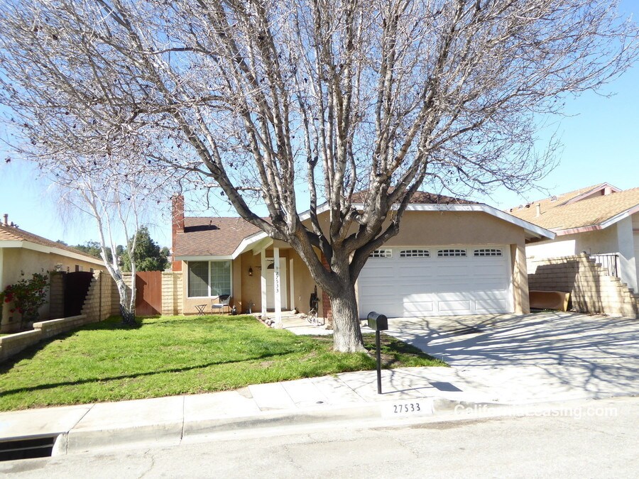
27533 Falling Star Ln
Santa Clarita, CA 91350
2 Weeks Ago
Favorites
27533 Falling Star Ln

Favorites
Check Back Soon for Upcoming Availability
| Beds | Baths | Average SF |
|---|---|---|
| 3 Bedrooms 3 Bedrooms 3 Br | 2 Baths 2 Baths 2 Ba | 1,227 SF |
About This Property
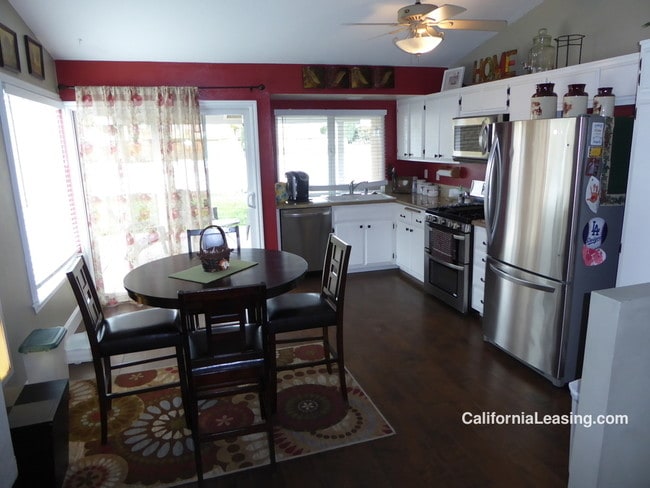
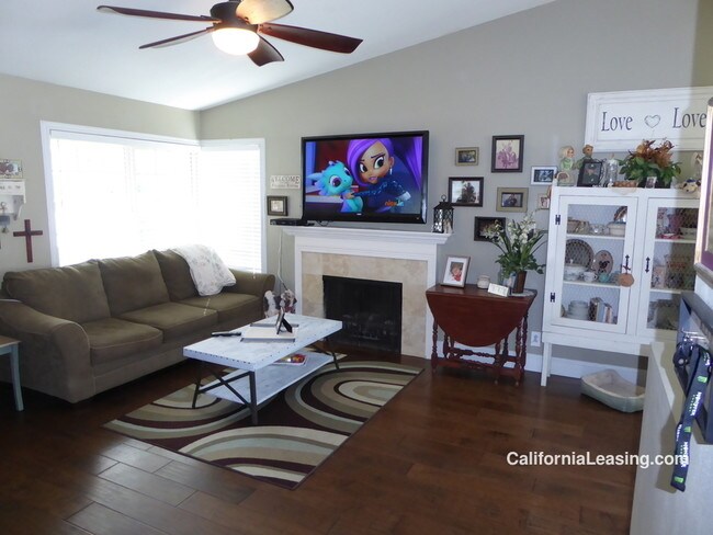
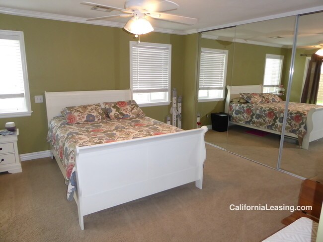
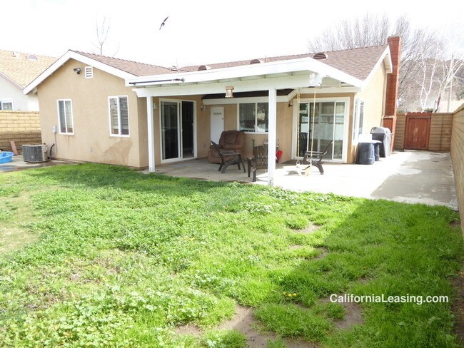
---- SCHEDULE A SHOWING ONLINE AT: http://showmojo.com/lac/088850f0da ---- Santa Clarita Rental home located off of Haskell Cyn Rd and Bouquet Cyn Rd. This home offers 3 Bedrooms, 2 Bathrooms and 1227 sq. ft. of living space. Available March 21st. Californialeasing.com California Leasing 661.294.8500 Cats Allowed Ceiling Fan Central Ac/Heat Covered Patio Dogs Allowed Gardener Services Included Kitchen Open To Family Room Laundry In Garage Mirrored Closet Doors Neutral Carpet Office Area Pets Considered Reccessed Lighting Refrigerator Included Remodeled Granite Kitchen Rv Parking Single Story Washer And Dryer Included Wood Floors
27533 Falling Star Ln is a house located in Los Angeles County and the 91350 ZIP Code. This area is served by the William S. Hart Union High attendance zone.
Location
Get Directions
Saugus grants residents a laid-back lifestyle that allows them to take in the natural beauty of the region without the noise and crowds of the big city. Driving around the neighborhood, you can see the vast expanses of open space and sense of historic charm that made this area the site of so many early Western films.
East of Interstate 5, Saugus sits about five miles from Downtown Santa Clarita. The neighborhood’s central location provides easy access to all the amenities of the city while also giving residents a peaceful place to call home. Multiple high-quality school districts and a strong sense of community make Saugus a top choice for numerous families.
Learn more about living in SaugusBelow are rent ranges for similar nearby apartments
Education
| Colleges & Universities | Distance | ||
|---|---|---|---|
| Colleges & Universities | Distance | ||
| Drive: | 11 min | 5.1 mi | |
| Drive: | 24 min | 15.9 mi | |
| Drive: | 31 min | 17.2 mi | |
| Drive: | 41 min | 29.2 mi |
27533 Falling Star Ln is within 11 minutes or 5.1 miles from College of the Canyons. It is also near Mission College and Cal State Northridge.
Schools


Charter Elementary, Middle & High School
Grades K-12
2,877 Students
Nearby
Public Elementary School
Grades K-6
561 Students
Attendance Zone
Public Middle School
Grades 7-8
1,217 Students
Attendance Zone
Public High School
Grades 9-12
2,378 Students
Attendance Zone
Private Elementary School
Grades PK-1
Nearby
Private Elementary, Middle & High School
Grades K-12
Nearby
Private Elementary School
Grades K-6
Nearby
School data provided by
 The GreatSchools Rating helps parents compare schools within a state based on a variety of school quality indicators and provides a helpful picture of how effectively each school serves all of its students. Ratings are on a scale of 1 (below average) to 10 (above average) and can include test scores, college readiness, academic progress, advanced courses, equity, discipline and attendance data. We also advise parents to visit schools, consider other information on school performance and programs, and consider family needs as part of the school selection process.
View GreatSchools Rating Methodology
Data provided by GreatSchools.org © 2025. All rights reserved.
View GreatSchools Rating Methodology
Data provided by GreatSchools.org © 2025. All rights reserved.
You May Also Like
Similar Rentals Nearby


What Are Walk Score®, Transit Score®, and Bike Score® Ratings?
Walk Score® measures the walkability of any address. Transit Score® measures access to public transit. Bike Score® measures the bikeability of any address.
What is a Sound Score Rating?
A Sound Score Rating aggregates noise caused by vehicle traffic, airplane traffic and local sources
27533 Falling Star Ln
Santa Clarita, CA 91350