
Skyline On Stokes
2132 Stokes Blvd,
Cleveland, OH 44106
$1,310 - $3,506
Studio - 2 Beds
6 condo like units ; in suite washer dryers; newer kitchens with dishwahser /disposal; ceiling fans; miniblinds 1800 square feet plus front balcony. hardwood floors and/or carpeting. Natural woodwork; Beautiful crown molding Ceiling fans, miniblinds. 1 12, 2 or 2 1/2 bath units. $1595-$1675 includes heat, water, sewer and cooking gas. located in Coventry area. 1.27 miles from University Circle. 2 economy suites; one bedroom $695 2 bedroom --$795 These re modified English Basements. floorplans and photos upon request Rent must not be more than 30% of gross monthly income
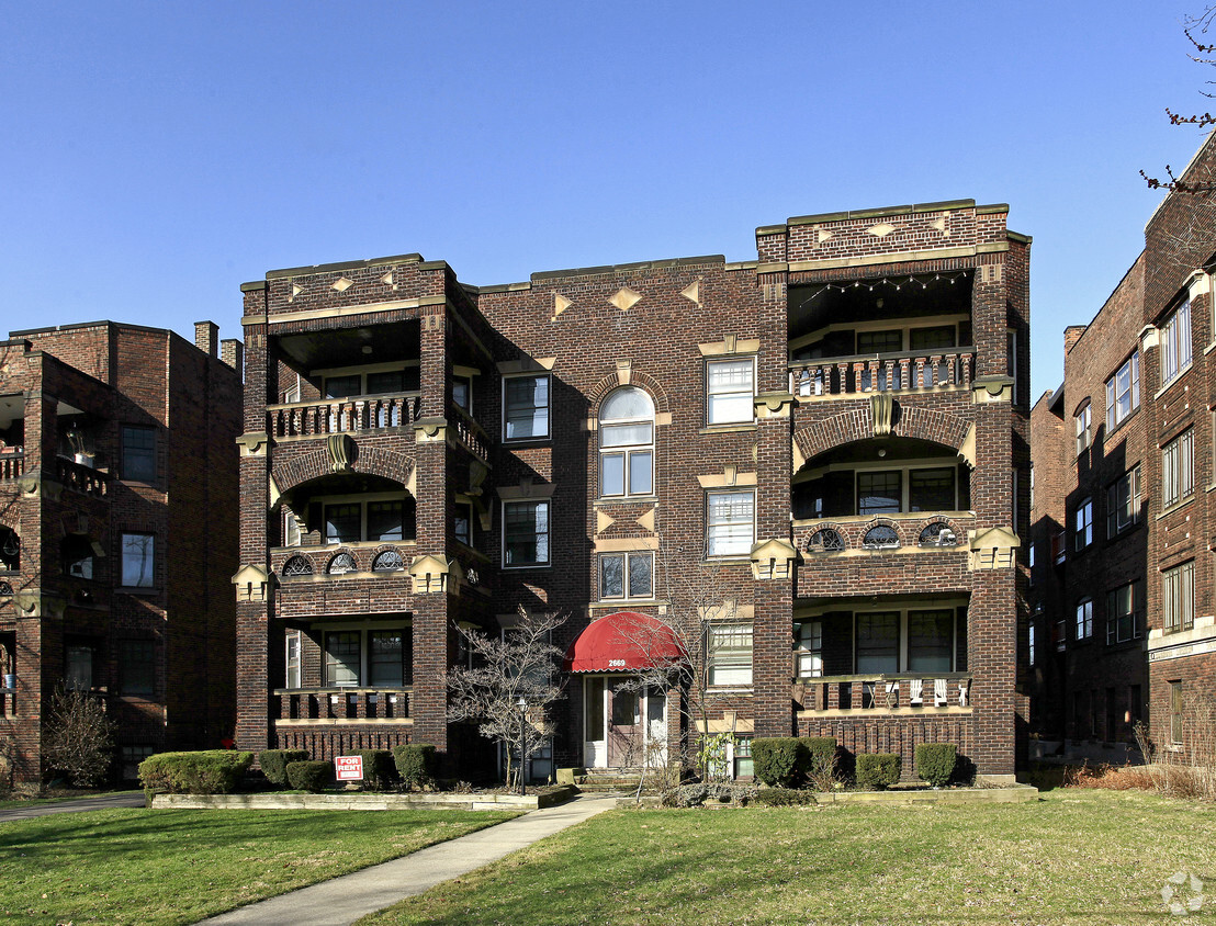
2669 Euclid Heights Blvd is an apartment community located in Cuyahoga County and the 44106 ZIP Code. This area is served by the Cleveland Heights-University Heights City attendance zone.
Unique Features
Laundry Facilities
Controlled Access
Public Transportation
Walk To Campus
Washer/Dryer
Air Conditioning
Dishwasher
High Speed Internet Access
Rich in personality, the Cedar-Fairmount district of Cleveland provides shopping in an environment that incorporates historic style with modern trends. Lying only six miles east of downtown, the area is convenient for commuters and those that love urban life. Investment in independent businesses, the arts and transportation has brought young professionals to the neighborhood. Residents as well as consumers gather on sidewalks to enjoy the Tudor style structures or share lunch.
Learn more about living in Cedar-FairmountCompare neighborhood and city base rent averages by bedroom.
| Cedar-Fairmount | Cleveland, OH | |
|---|---|---|
| Studio | $1,127 | $1,189 |
| 1 Bedroom | $1,165 | $1,376 |
| 2 Bedrooms | $1,350 | $1,731 |
| 3 Bedrooms | $1,579 | $2,102 |
| Colleges & Universities | Distance | ||
|---|---|---|---|
| Colleges & Universities | Distance | ||
| Drive: | 3 min | 1.3 mi | |
| Drive: | 3 min | 1.4 mi | |
| Drive: | 4 min | 1.8 mi | |
| Drive: | 12 min | 4.3 mi |


Transportation options available in Cleveland include Cedar - University, located 1.3 miles from 2669 Euclid Heights Blvd. 2669 Euclid Heights Blvd is near Cleveland-Hopkins International, located 18.2 miles or 32 minutes away.
| Transit / Subway | Distance | ||
|---|---|---|---|
| Transit / Subway | Distance | ||
|
|
Drive: | 2 min | 1.3 mi |
| Drive: | 3 min | 1.4 mi | |
|
|
Drive: | 5 min | 2.0 mi |
|
|
Drive: | 7 min | 2.5 mi |
|
|
Drive: | 7 min | 3.5 mi |
| Commuter Rail | Distance | ||
|---|---|---|---|
| Commuter Rail | Distance | ||
|
|
Drive: | 18 min | 8.9 mi |
| Drive: | 23 min | 12.1 mi | |
| Drive: | 26 min | 13.9 mi | |
| Drive: | 34 min | 19.8 mi | |
|
Boston Mill
|
Drive: | 41 min | 24.8 mi |
| Airports | Distance | ||
|---|---|---|---|
| Airports | Distance | ||
|
Cleveland-Hopkins International
|
Drive: | 32 min | 18.2 mi |
Scores provided by
Traffic
-Airport
-Businesses
-Scores provided by
HowLoud What is a Sound Score Rating? A Sound Score Rating aggregates noise caused by vehicle traffic, airplane traffic and local sources. How It WorksTime and distance from 2669 Euclid Heights Blvd.
| Shopping Centers | Distance | ||
|---|---|---|---|
| Shopping Centers | Distance | ||
| Drive: | 4 min | 1.4 mi | |
| Drive: | 4 min | 1.8 mi | |
| Drive: | 5 min | 2.1 mi |
| Parks and Recreation | Distance | ||
|---|---|---|---|
| Parks and Recreation | Distance | ||
|
Cleveland Botanical Garden
|
Drive: | 4 min | 1.7 mi |
|
Children's Museum of Cleveland
|
Drive: | 3 min | 1.8 mi |
|
Cleveland Museum of Natural History
|
Drive: | 5 min | 2.5 mi |
|
Nature Center at Shaker Lakes
|
Drive: | 6 min | 2.5 mi |
|
Euclid Creek Reservation
|
Drive: | 15 min | 6.4 mi |
| Hospitals | Distance | ||
|---|---|---|---|
| Hospitals | Distance | ||
| Drive: | 3 min | 1.4 mi | |
| Drive: | 3 min | 1.4 mi | |
| Drive: | 5 min | 2.5 mi |
| Military Bases | Distance | ||
|---|---|---|---|
| Military Bases | Distance | ||
| Drive: | 107 min | 87.0 mi | |
| Drive: | 109 min | 88.2 mi |
Pets Allowed Fitness Center Pool Kitchen In Unit Washer & Dryer Clubhouse Maintenance on site
What Are Walk Score®, Transit Score®, and Bike Score® Ratings?
Walk Score® measures the walkability of any address. Transit Score® measures access to public transit. Bike Score® measures the bikeability of any address.
What is a Sound Score Rating?
A Sound Score Rating aggregates noise caused by vehicle traffic, airplane traffic and local sources.

2669 Euclid Heights Blvd
Cleveland, OH 44106


