$1,985
Total Monthly Price
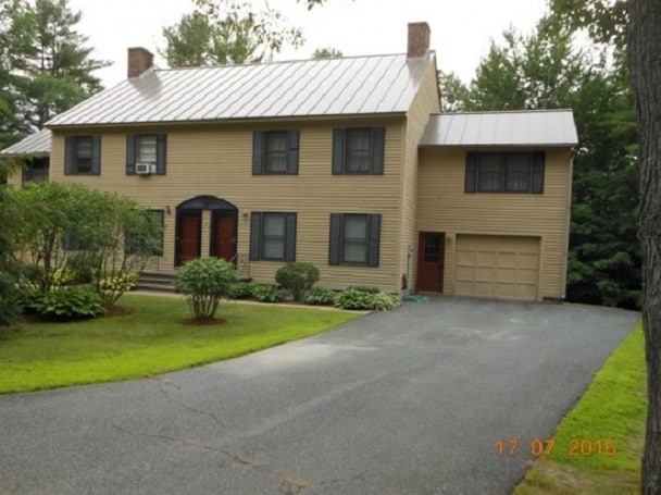
266 Poverty Ln
Lebanon, NH 03766
Favorites
266 Poverty Ln

Favorites
Check Back Soon for Upcoming Availability
| Beds | Baths | Average SF |
|---|---|---|
| 3 Bedrooms 3 Bedrooms 3 Br | 2.5 Baths 2.5 Baths 2.5 Ba | 1,744 SF |
Fees and Policies
The fees listed below are community-provided and may exclude utilities or add-ons. All payments are made directly to the property and are non-refundable unless otherwise specified.
- Parking
-
Garage--
Details
Lease Options
-
12 Months
About This Property
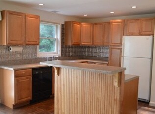
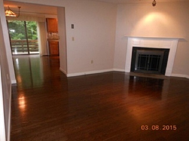
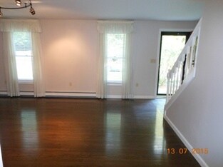
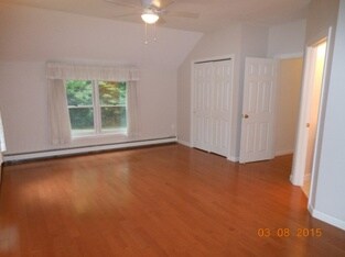
Spacious 3 bedroom 2.5 bath Townhome located within close proximity of DHMC and Dartmouth college. Very convenient yet peaceful location (266 Poverty Lane) Route 4 Lebanon NH to Poverty Lane, 2.5mi to Martin Brook on right. Entire home has been freshly painted and is exceptionally clean. 3 very spacious bedrooms all with new hardwood flooring. Master with en suite. Open concept kitchen and dining. Walk out basement with plenty of storage room. Washer and dryer. 1 car heated attached garage with room for 2 more cars in driveway Included in rent: water, sewer, trash collection, landscaping, plowing of driveway and shoveling of walkway in winter. 4 Zone oil forced hot water baseboard heat. NO SMOKING & NO PETS
266 Poverty Ln is a townhome located in Grafton County and the 03766 ZIP Code. This area is served by the Lebanon School District attendance zone.
Townhome Features
- Washer/Dryer
- Smoke Free
266 Poverty Ln,
Lebanon,
NH
03766
With a convenient and charming location in the Connecticut River Valley, Lebanon offers an abundantly active lifestyle for residents. Boating, canoeing, and kayaking are favored water sports in Mascoma Lake – and you can hit the diamond or bunny slopes at Storrs Hill Ski. Golfers can enjoy their tee-time at a number of nearby country clubs. Quechee Gorge – dubbed “New England’s Grand Canyon” – attracts visitors with its breathtaking views and hiking trails.
Back in town, the Lebanon Opera House, just north of Colburn Park, puts on excellent stage performances throughout the year. Colorful hot-air balloons are center spotlight at the summer Quechee Balloon Festival. At the Alliance for the Visual Arts, you’ll be in awe by the expansive displays showcasing native artists’ personal creations.
Fine dining establishments and casual eateries are plentiful in Lebanon.
Learn more about living in Lebanon
Amenities
- Washer/Dryer
- Smoke Free
Education
| Colleges & Universities | Distance | ||
|---|---|---|---|
| Colleges & Universities | Distance | ||
| Drive: | 17 min | 8.6 mi | |
| Drive: | 42 min | 30.0 mi | |
| Drive: | 84 min | 46.3 mi |
266 Poverty Ln is within 17 minutes or 8.6 miles from Dartmouth College. It is also near Colby-Sawyer College and Plymouth State University.
Schools


Public Elementary & Middle School
Grades K-8
471 Students
Attendance Zone
Public Elementary School
Grades PK-5
234 Students
Attendance Zone
Public High School
Grades 9-12
598 Students
Attendance Zone
School data provided by
 The GreatSchools Rating helps parents compare schools within a state based on a variety of school quality indicators and provides a helpful picture of how effectively each school serves all of its students. Ratings are on a scale of 1 (below average) to 10 (above average) and can include test scores, college readiness, academic progress, advanced courses, equity, discipline and attendance data. We also advise parents to visit schools, consider other information on school performance and programs, and consider family needs as part of the school selection process.
View GreatSchools Rating Methodology
Data provided by GreatSchools.org © 2026. All rights reserved.
View GreatSchools Rating Methodology
Data provided by GreatSchools.org © 2026. All rights reserved.
Walkability Near 266 Poverty Ln Lebanon, NH 03766
Getting Around
 What do Walkability, Transit, Drivability, and Bikeability mean?
Walkability measures the walking distance to day-to-day needs.
Transit measures access to public transportation.
Drivability measures congestion, parking availability, and access to major roads.
Bikeability measures the suitability for cycling.
How It Works
What do Walkability, Transit, Drivability, and Bikeability mean?
Walkability measures the walking distance to day-to-day needs.
Transit measures access to public transportation.
Drivability measures congestion, parking availability, and access to major roads.
Bikeability measures the suitability for cycling.
How It Works
Not Walkable
Walkability
0
/ 100
Minimal Public Transit
Transit
0
/ 100
Exceptionally Drivable
Drivability
100
/ 100
Not Bikeable
Bikeability
10
/ 100
Scores provided by
Calm
Soundscore™
99
/ 100
Traffic
CalmAirport
ActiveBusinesses
CalmScores provided by
HowLoud What is a Sound Score Rating? A Sound Score Rating aggregates noise caused by vehicle traffic, airplane traffic and local sources. How It WorksSimilar Rentals Nearby

What Are Walk Score®, Transit Score®, and Bike Score® Ratings?
Walk Score® measures the walkability of any address. Transit Score® measures access to public transit. Bike Score® measures the bikeability of any address.
What is a Sound Score Rating?
A Sound Score Rating aggregates noise caused by vehicle traffic, airplane traffic and local sources.

266 Poverty Ln
Lebanon, NH 03766