
The Riverdale Tower
3745 Riverdale Ave,
The Bronx, NY 10463
$2,200 - $4,500
Studio - 2 Beds
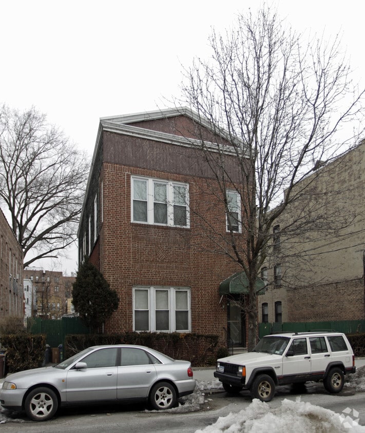
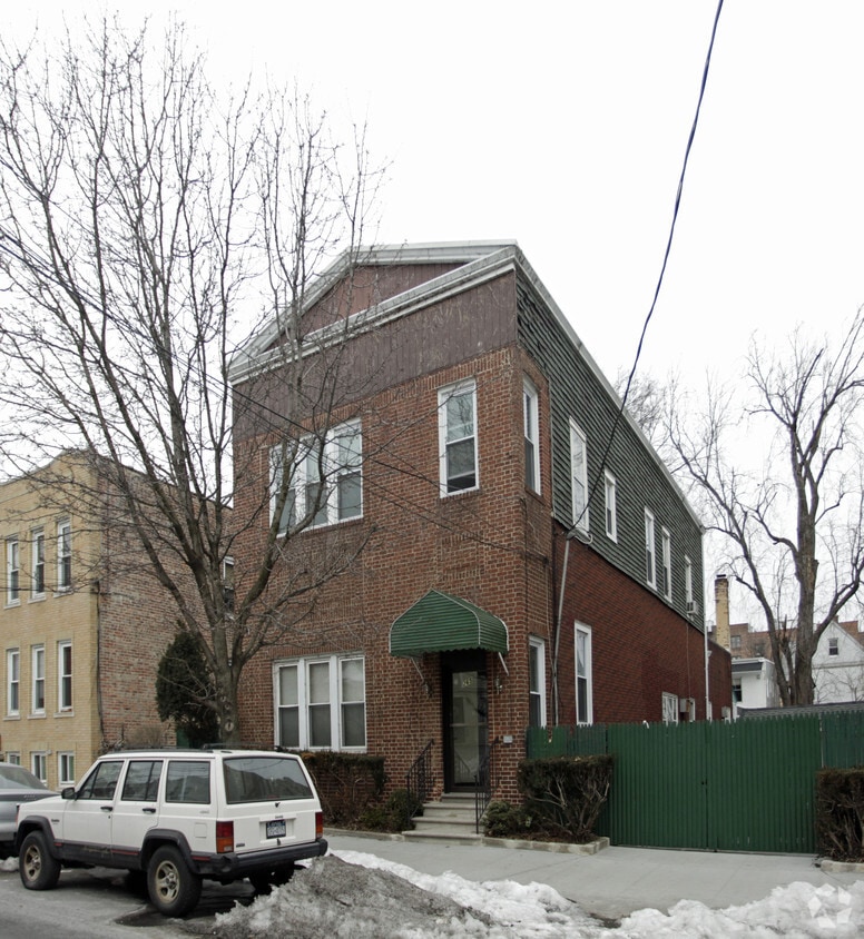

At 265 E 235th St in Bronx, NY, you've discovered your new home. In a convenient location on E. 235th St. in Bronx's 10470 area, local residents can easily connect with a number of nearby points of interest. The community staff is ready to show you our community. Be sure to come for a visit to view the available floorplans. Get a head start on moving now. Contact or stop by the 265 E 235th St leasing office to check the availability and schedule a tour today.
265 E 235th St is an apartment community located in Bronx County and the 10470 ZIP Code. This area is served by the Yonkers City School District attendance zone.
Nestled at the northern tip of the Bronx, Woodlawn Heights disrupts a square of green space occupied by Van Cortlandt Park and the historic Woodlawn Cemetery. As one of New York’s most famous residential areas, Woodlawn Heights provides easy access to the city and surrounding areas by bus and subway. The neighborhood features a boot-like shape, with 233rd Street forming the southern edge. Katonah Avenue runs north-south through the center of the neighborhood, serving as Woodlawn Heights’ major thoroughfare, and is lined with local restaurants, bars, and shops. Woodlawn Heights is very walkable with excellent public transit options. The rent average is lower in the neighborhood than it is in the Bronx as a whole, making it a great place for renters to find their next home.
Learn more about living in Woodlawn HeightsCompare neighborhood and city base rent averages by bedroom.
| Woodlawn Heights | Bronx, NY | |
|---|---|---|
| Studio | $1,155 | $1,628 |
| 1 Bedroom | $1,527 | $1,632 |
| 2 Bedrooms | $1,888 | $2,099 |
| 3 Bedrooms | - | $2,368 |
| Colleges & Universities | Distance | ||
|---|---|---|---|
| Colleges & Universities | Distance | ||
| Drive: | 6 min | 2.8 mi | |
| Drive: | 6 min | 2.9 mi | |
| Drive: | 8 min | 3.8 mi | |
| Drive: | 8 min | 4.5 mi |


Transportation options available in Bronx include 233 Street, located 0.7 mile from 265 E 235th St. 265 E 235th St is near LaGuardia, located 14.2 miles or 25 minutes away, and Westchester County, located 19.7 miles or 31 minutes away.
| Transit / Subway | Distance | ||
|---|---|---|---|
| Transit / Subway | Distance | ||
|
|
Walk: | 13 min | 0.7 mi |
|
|
Drive: | 2 min | 1.3 mi |
|
|
Drive: | 3 min | 1.3 mi |
|
|
Drive: | 2 min | 1.4 mi |
|
|
Drive: | 5 min | 1.6 mi |
| Commuter Rail | Distance | ||
|---|---|---|---|
| Commuter Rail | Distance | ||
|
|
Walk: | 13 min | 0.7 mi |
|
|
Drive: | 3 min | 1.8 mi |
|
|
Drive: | 4 min | 1.8 mi |
|
|
Drive: | 5 min | 2.4 mi |
|
|
Drive: | 6 min | 3.0 mi |
| Airports | Distance | ||
|---|---|---|---|
| Airports | Distance | ||
|
LaGuardia
|
Drive: | 25 min | 14.2 mi |
|
Westchester County
|
Drive: | 31 min | 19.7 mi |
Scores provided by
Traffic
-Airport
-Businesses
-Scores provided by
HowLoud What is a Sound Score Rating? A Sound Score Rating aggregates noise caused by vehicle traffic, airplane traffic and local sources. How It WorksTime and distance from 265 E 235th St.
| Shopping Centers | Distance | ||
|---|---|---|---|
| Shopping Centers | Distance | ||
| Drive: | 3 min | 1.7 mi | |
| Drive: | 5 min | 2.4 mi | |
| Drive: | 6 min | 3.4 mi |
| Parks and Recreation | Distance | ||
|---|---|---|---|
| Parks and Recreation | Distance | ||
|
Seton Falls Park
|
Drive: | 4 min | 2.0 mi |
|
Williamsbridge Oval
|
Drive: | 5 min | 2.3 mi |
|
Van Cortlandt Park
|
Drive: | 5 min | 2.9 mi |
|
New York Botanical Garden
|
Drive: | 11 min | 3.9 mi |
|
Wave Hill
|
Drive: | 9 min | 4.7 mi |
| Hospitals | Distance | ||
|---|---|---|---|
| Hospitals | Distance | ||
| Drive: | 4 min | 2.0 mi | |
| Drive: | 5 min | 2.7 mi | |
| Drive: | 8 min | 4.1 mi |
| Military Bases | Distance | ||
|---|---|---|---|
| Military Bases | Distance | ||
| Drive: | 22 min | 12.1 mi |
What Are Walk Score®, Transit Score®, and Bike Score® Ratings?
Walk Score® measures the walkability of any address. Transit Score® measures access to public transit. Bike Score® measures the bikeability of any address.
What is a Sound Score Rating?
A Sound Score Rating aggregates noise caused by vehicle traffic, airplane traffic and local sources.


