
Kinect at Southport
2301 Jefferson Blvd,
Sacramento, CA 95691
$1,550 - $3,044
Studio - 3 Beds
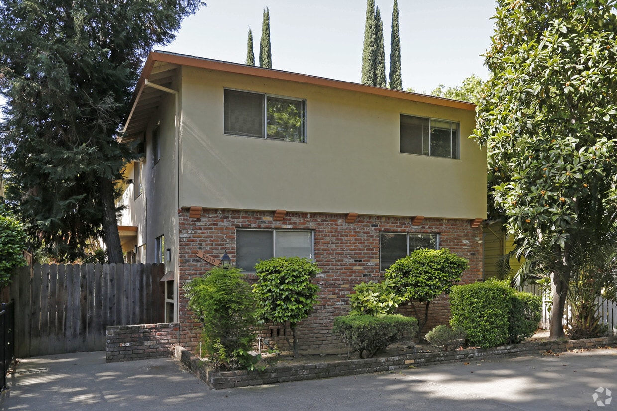
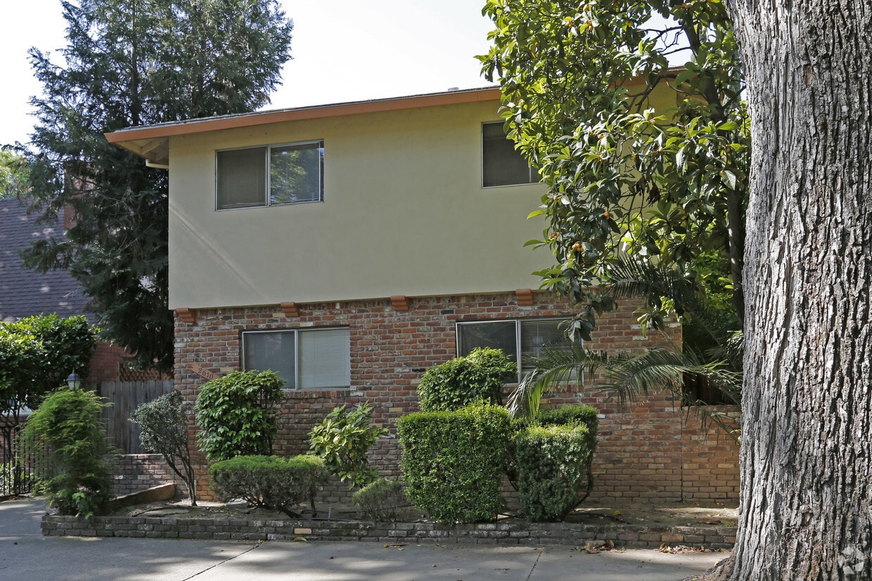


At 2610 D St in Sacramento, CA, experience great living. The address for this community is in Sacramento on D St.. The community staff is ready to match you with your perfect new home. Be sure to come for a visit to check out the apartment floorplan options. Drop by the leasing office to check the current floorplan availability.
2610 D St is an apartment community located in Sacramento County and the 95816 ZIP Code. This area is served by the Sacramento City Unified School District attendance zone.
Located next to the American River, the scenic neighborhood of Central Sacramento, California features historic single-family homes, affordable double and triple deckers, green lawns, and wide tree-lined streets. The area is mostly residential and is home to several historical landmarks. In fact, the Governor’s Mansion State Historic Park borders the neighborhood. Wedged between Midtown and East Sacramento and just minutes away from downtown, residents enjoy access to bars, restaurants, and entertainment venues found in these neighborhoods. Catch an intimate small-scale show at B Street Theatre or sip on a tropical cocktail at the Jungle Bird, a vintage tiki theme bar. The proximity to amenities makes Central Sacramento a sought-after area in the city.
In addition to families, residents include those who enjoy the active nightlife scene. Several large parks provide residents with opportunities for recreation and outdoor activities.
Learn more about living in Central SacramentoCompare neighborhood and city base rent averages by bedroom.
| Central Sacramento | Sacramento, CA | |
|---|---|---|
| Studio | $1,089 | $1,487 |
| 1 Bedroom | $1,085 | $1,574 |
| 2 Bedrooms | $1,241 | $1,876 |
| 3 Bedrooms | $1,075 | $2,426 |
| Colleges & Universities | Distance | ||
|---|---|---|---|
| Colleges & Universities | Distance | ||
| Drive: | 7 min | 3.4 mi | |
| Drive: | 7 min | 3.8 mi | |
| Drive: | 16 min | 9.6 mi | |
| Drive: | 16 min | 10.6 mi |


Transportation options available in Sacramento include Alkali Flat/La Valentina, located 1.3 miles from 2610 D St. 2610 D St is near Sacramento International, located 12.7 miles or 20 minutes away.
| Transit / Subway | Distance | ||
|---|---|---|---|
| Transit / Subway | Distance | ||
|
|
Drive: | 4 min | 1.3 mi |
|
|
Drive: | 2 min | 1.3 mi |
|
|
Drive: | 4 min | 1.4 mi |
|
|
Drive: | 3 min | 1.4 mi |
|
|
Drive: | 4 min | 1.7 mi |
| Commuter Rail | Distance | ||
|---|---|---|---|
| Commuter Rail | Distance | ||
| Drive: | 5 min | 2.1 mi | |
| Drive: | 21 min | 17.0 mi | |
|
|
Drive: | 25 min | 18.2 mi |
|
|
Drive: | 26 min | 20.3 mi |
|
|
Drive: | 39 min | 32.6 mi |
| Airports | Distance | ||
|---|---|---|---|
| Airports | Distance | ||
|
Sacramento International
|
Drive: | 20 min | 12.7 mi |
Scores provided by
Traffic
-Airport
-Businesses
-Scores provided by
HowLoud What is a Sound Score Rating? A Sound Score Rating aggregates noise caused by vehicle traffic, airplane traffic and local sources. How It WorksTime and distance from 2610 D St.
| Shopping Centers | Distance | ||
|---|---|---|---|
| Shopping Centers | Distance | ||
| Walk: | 10 min | 0.5 mi | |
| Walk: | 12 min | 0.6 mi | |
| Walk: | 13 min | 0.7 mi |
| Parks and Recreation | Distance | ||
|---|---|---|---|
| Parks and Recreation | Distance | ||
|
Sutter's Fort State Historical Monument
|
Walk: | 13 min | 0.7 mi |
|
Governor's Mansion State Historic Park
|
Drive: | 3 min | 1.2 mi |
|
California State Capitol Museum
|
Drive: | 5 min | 2.0 mi |
|
Leland Stanford Mansion State Historic Park
|
Drive: | 5 min | 2.0 mi |
|
Old Sacramento Historic District
|
Drive: | 6 min | 2.3 mi |
| Hospitals | Distance | ||
|---|---|---|---|
| Hospitals | Distance | ||
| Walk: | 16 min | 0.8 mi | |
| Drive: | 3 min | 1.5 mi | |
| Drive: | 5 min | 2.3 mi |
| Military Bases | Distance | ||
|---|---|---|---|
| Military Bases | Distance | ||
| Drive: | 23 min | 10.5 mi | |
| Drive: | 55 min | 42.9 mi | |
| Drive: | 70 min | 49.4 mi |
What Are Walk Score®, Transit Score®, and Bike Score® Ratings?
Walk Score® measures the walkability of any address. Transit Score® measures access to public transit. Bike Score® measures the bikeability of any address.
What is a Sound Score Rating?
A Sound Score Rating aggregates noise caused by vehicle traffic, airplane traffic and local sources.


