
$4,995 / Month
260 Los Altos Ave
Los Altos, CA 94022
2 Weeks Ago
Favorites
260 Los Altos Ave

Favorites
Check Back Soon for Upcoming Availability
| Beds | Baths | Average SF |
|---|---|---|
| 2 Bedrooms 2 Bedrooms 2 Br | 2 Baths 2 Baths 2 Ba | 1,326 SF |
About This Property
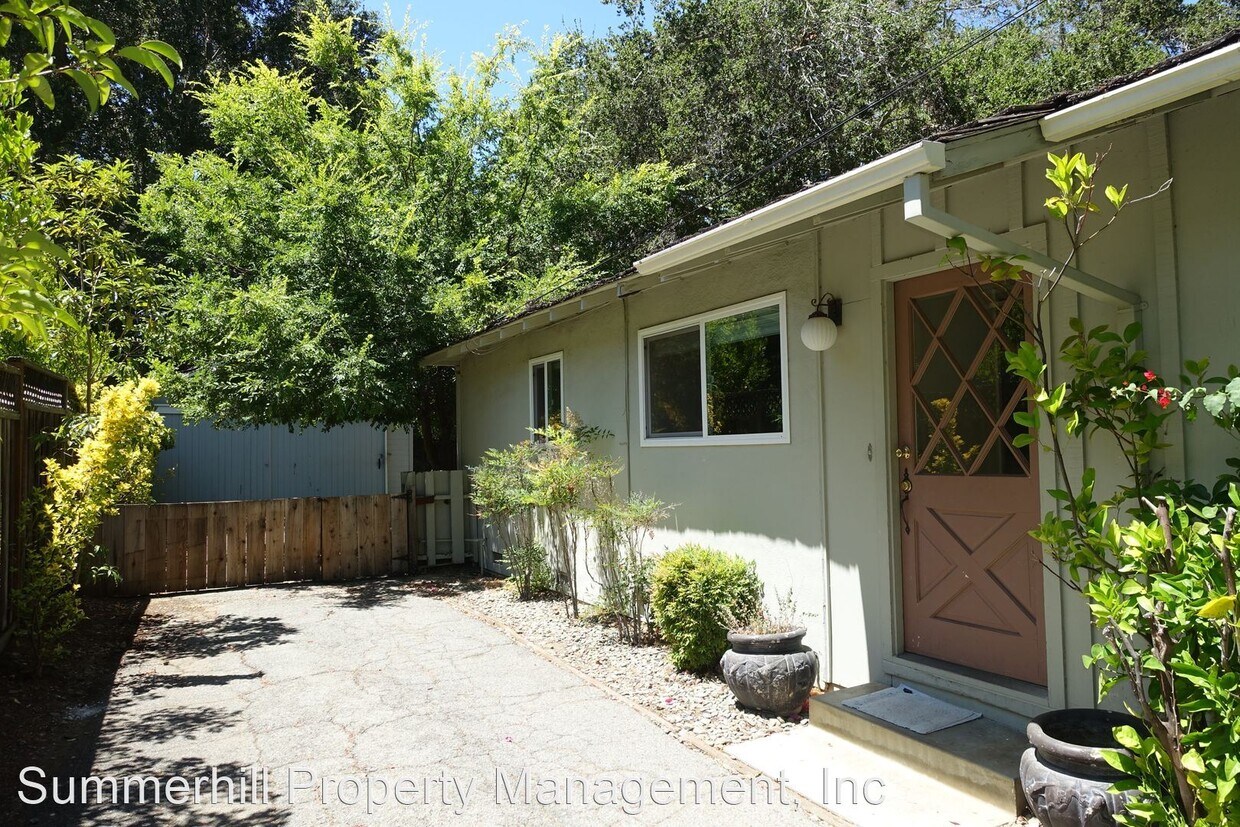
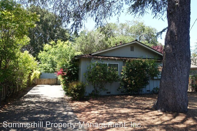
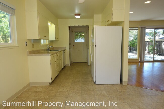
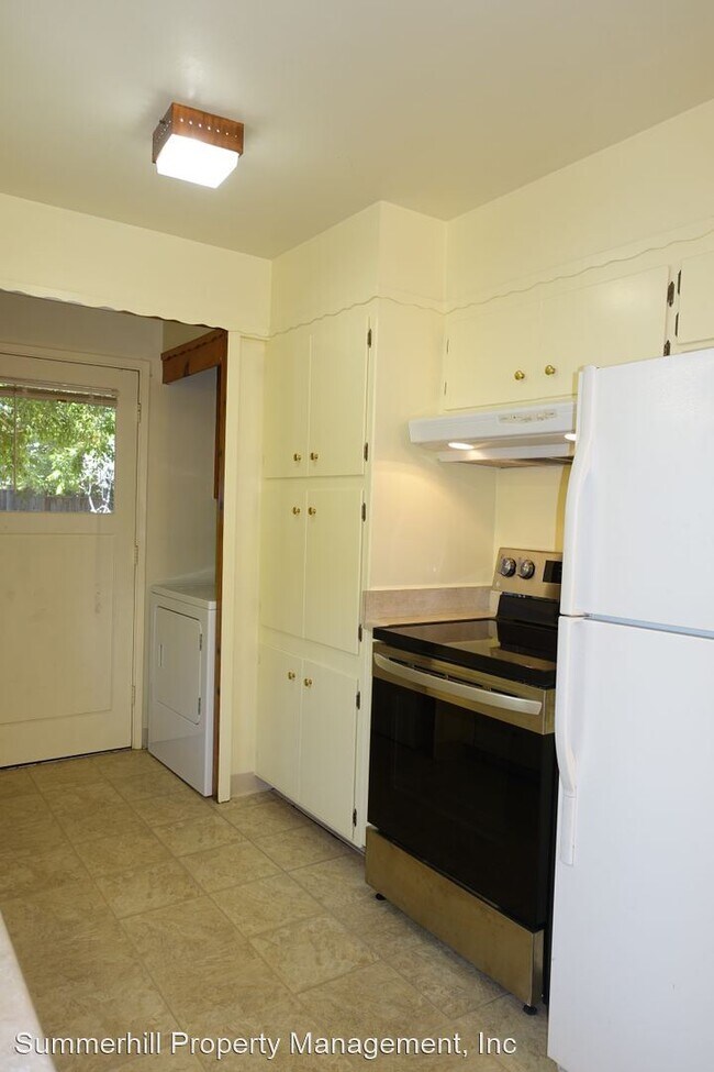
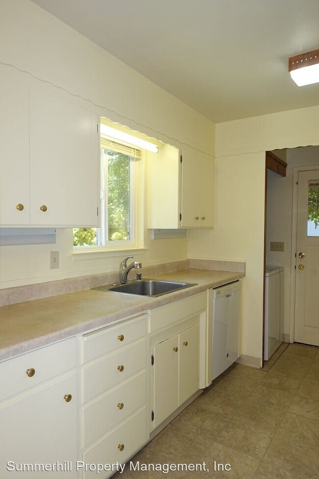
- Cute vintage single family home, walk to town location, NICE big yard. Fresh paint, move in ready! - Super great location.....a few blocks to downtown! Gleaming hardwood floors and all fresh paint. Move in ready! Spacious living room with huge window looking out on the great backyard. Two bedrooms, two bathrooms (one ensuite). Third room could be a formal dining room, an office, or if you wanted to use as a third bedroom, the owner will install doors as needed. Laundry inside the house. Highly rated Los Altos Public Schools: (Tenants to verify availability) 9/10 Gardner Bullis Elementary School Grades: K-6 Distance: 0.6 mi 8/10 Ardis G. Egan Junior High School Grades: 7-8 Distance: 0.7 mi 9/10 Los Altos High School Grades: 9-12 Distance: 0.6 mi Please: no smoking, no pets. Contact: Teri Berwick (BRE 01705674) at for an appointment to view. Professionally leased by Summerhill Property Management, Inc. (BRE 01523660) (RLNE8177322)
260 Los Altos Ave is a house located in Santa Clara County and the 94022 ZIP Code. This area is served by the Los Altos Elementary attendance zone.
Location
Get Directions
North Los Altos contains the city’s vibrant commercial centers. The many shops and eateries of Main Street are in the southern portion of North Los Altos, while the diverse restaurants and cafes of San Antonio Road are in the northern stretches near San Antonio Center.
Outside of these commercial areas, North Los Altos is predominantly residential, offering an array of apartments available for rent along tree-lined avenues. Many of the rentals in North Los Altos feature stunning mountain views, as well as close proximity to Mountain View, Foothill College, Stanford University, and Palo Alto. Getting around from North Los Altos is simple with access to El Camino Real, Interstate 280, and San Antonio Station.
Learn more about living in North Los AltosBelow are rent ranges for similar nearby apartments
| Beds | Average Size | Lowest | Typical | Premium |
|---|---|---|---|---|
| Studio Studio Studio | 443 Sq Ft | $2,150 | $2,426 | $3,070 |
| 1 Bed 1 Bed 1 Bed | 759-764 Sq Ft | $2,495 | $3,606 | $5,608 |
| 2 Beds 2 Beds 2 Beds | 1150-1158 Sq Ft | $3,295 | $4,946 | $7,423 |
| 3 Beds 3 Beds 3 Beds | 1437 Sq Ft | $4,441 | $4,570 | $4,695 |
| 4 Beds 4 Beds 4 Beds | 2547 Sq Ft | $6,020 | $9,404 | $11,000 |
Education
| Colleges & Universities | Distance | ||
|---|---|---|---|
| Colleges & Universities | Distance | ||
| Drive: | 6 min | 2.6 mi | |
| Drive: | 8 min | 3.0 mi | |
| Drive: | 11 min | 5.1 mi | |
| Drive: | 18 min | 7.2 mi |
260 Los Altos Ave is within 6 minutes or 2.6 miles from Foothill Coll., Los Altos. It is also near Foothill College, Middlefield and Stanford University.
Schools

Public Elementary School
Grades K-5
367 Students
Nearby
Public Elementary School
Grades K-6
259 Students
Attendance Zone
Public Middle School
Grades 7-8
497 Students
Attendance Zone
Public High School
Grades 9-12
2,141 Students
Attendance Zone
Private Elementary & Middle School
Grades K-8
250 Students
Nearby
Private Elementary & Middle School
Grades K-8
268 Students
Nearby
Private Elementary, Middle & High School
Grades K-12
612 Students
Nearby
Private Elementary School
Grades K-1
Nearby
School data provided by
 The GreatSchools Rating helps parents compare schools within a state based on a variety of school quality indicators and provides a helpful picture of how effectively each school serves all of its students. Ratings are on a scale of 1 (below average) to 10 (above average) and can include test scores, college readiness, academic progress, advanced courses, equity, discipline and attendance data. We also advise parents to visit schools, consider other information on school performance and programs, and consider family needs as part of the school selection process.
View GreatSchools Rating Methodology
Data provided by GreatSchools.org © 2025. All rights reserved.
View GreatSchools Rating Methodology
Data provided by GreatSchools.org © 2025. All rights reserved.
Transportation options available in Los Altos include Mountain View Station, located 3.9 miles from 260 Los Altos Ave. 260 Los Altos Ave is near Norman Y Mineta San Jose International, located 13.4 miles or 22 minutes away, and San Francisco International, located 25.7 miles or 36 minutes away.
| Transit / Subway | Distance | ||
|---|---|---|---|
| Transit / Subway | Distance | ||
| Drive: | 8 min | 3.9 mi | |
|
|
Drive: | 8 min | 3.9 mi |
|
|
Drive: | 11 min | 5.2 mi |
|
|
Drive: | 12 min | 5.2 mi |
| Drive: | 12 min | 5.8 mi |
| Commuter Rail | Distance | ||
|---|---|---|---|
| Commuter Rail | Distance | ||
| Drive: | 5 min | 2.0 mi | |
| Drive: | 9 min | 3.4 mi | |
| Drive: | 10 min | 3.6 mi | |
| Drive: | 10 min | 3.8 mi | |
| Drive: | 10 min | 4.0 mi |
| Airports | Distance | ||
|---|---|---|---|
| Airports | Distance | ||
|
Norman Y Mineta San Jose International
|
Drive: | 22 min | 13.4 mi |
|
San Francisco International
|
Drive: | 36 min | 25.7 mi |
Time and distance from 260 Los Altos Ave.
| Shopping Centers | Distance | ||
|---|---|---|---|
| Shopping Centers | Distance | ||
| Drive: | 4 min | 1.4 mi | |
| Drive: | 4 min | 1.6 mi | |
| Drive: | 4 min | 1.7 mi |
260 Los Altos Ave has 3 shopping centers within 1.7 miles, which is about a 4-minute drive. The miles and minutes will be for the farthest away property.
| Parks and Recreation | Distance | ||
|---|---|---|---|
| Parks and Recreation | Distance | ||
|
Redwood Grove
|
Walk: | 20 min | 1.0 mi |
|
Terman Park
|
Drive: | 5 min | 2.5 mi |
|
Esther Clark Nature Preserve
|
Drive: | 5 min | 2.5 mi |
|
Foothill College Observatory
|
Drive: | 7 min | 2.9 mi |
|
Bol Park
|
Drive: | 9 min | 3.4 mi |
260 Los Altos Ave has 5 parks within 3.4 miles, including Redwood Grove, Terman Park, and Esther Clark Nature Preserve.
| Hospitals | Distance | ||
|---|---|---|---|
| Hospitals | Distance | ||
| Drive: | 8 min | 3.3 mi | |
| Drive: | 12 min | 6.0 mi | |
| Drive: | 13 min | 6.2 mi |
260 Los Altos Ave has 3 hospitals within 6.2 miles, the nearest is El Camino Hospital which is 3.3 miles away and a 8 minute drive.
| Military Bases | Distance | ||
|---|---|---|---|
| Military Bases | Distance | ||
| Drive: | 15 min | 6.2 mi |
260 Los Altos Ave is 6.2 miles and a 15 minute drive from Ames Research Center.
You May Also Like
Similar Rentals Nearby


What Are Walk Score®, Transit Score®, and Bike Score® Ratings?
Walk Score® measures the walkability of any address. Transit Score® measures access to public transit. Bike Score® measures the bikeability of any address.
What is a Sound Score Rating?
A Sound Score Rating aggregates noise caused by vehicle traffic, airplane traffic and local sources

260 Los Altos Ave
Los Altos, CA 94022