$1,900
/ Month
26 Benway Ct
Catonsville, MD 21228
2 Weeks Ago
|
Edit
Favorites
26 Benway Ct

Favorites
Check Back Soon for Upcoming Availability
| Beds | Baths | Average SF |
|---|---|---|
| 3 Bedrooms 3 Bedrooms 3 Br | 3 Baths 3 Baths 3 Ba | — |
About This Property
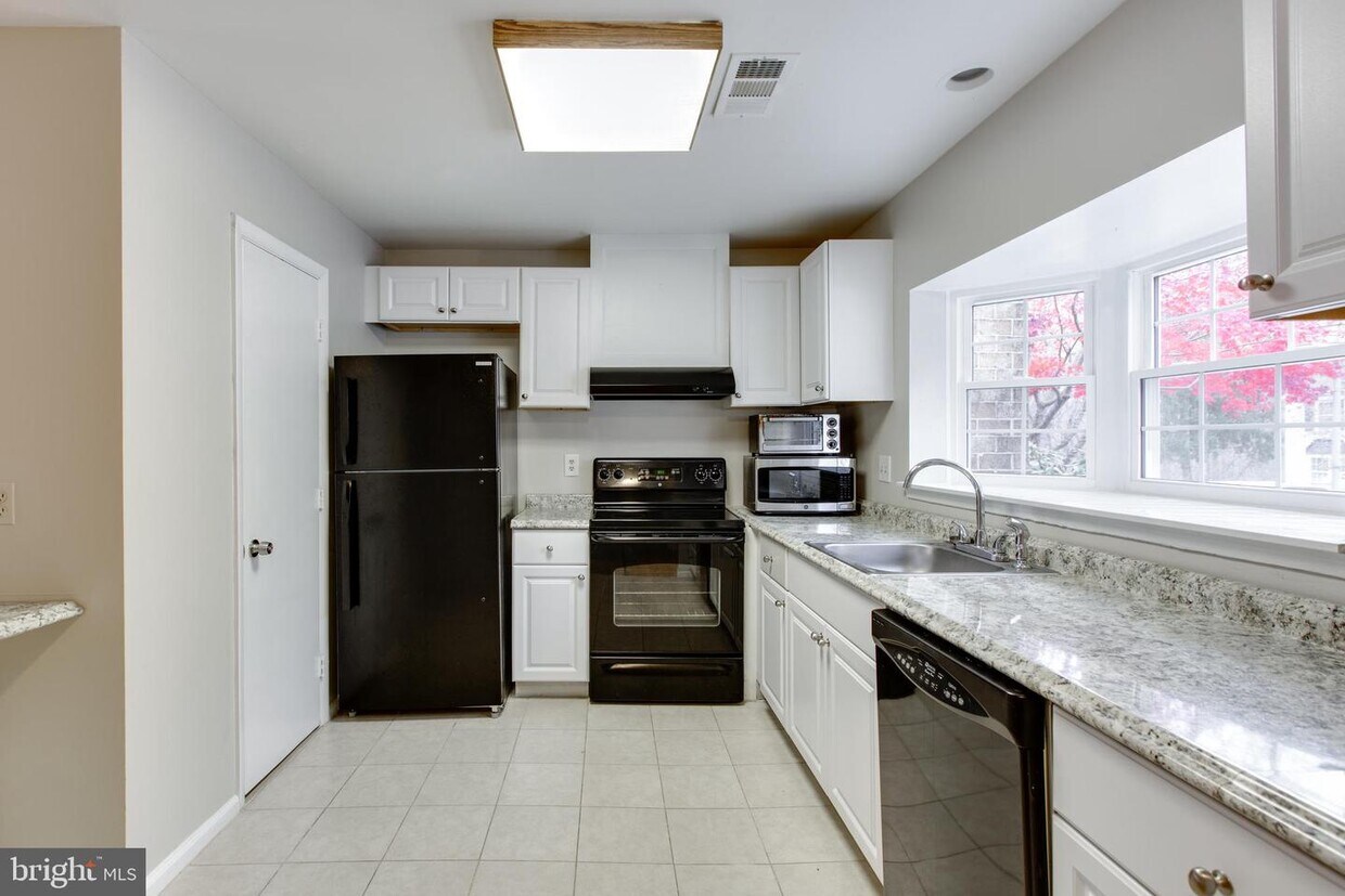
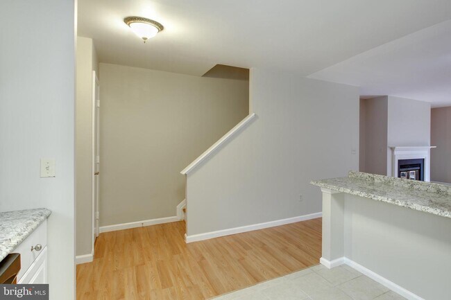
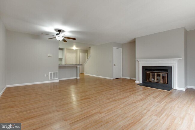
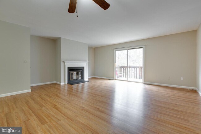
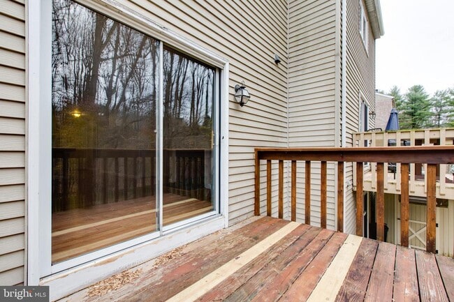
Exquisitely Updated 3BR Brick Front TH Surrounded by State Park, walking distance to Trolley Trail * Neutral paint color , New Roof, New Windows, New Floors, Newly Painted, New Kitchen, Open Concept, LR w/FP & Sliders to Deck. Vaulted Ceiling & New Skylights. Spacious Master Bedroom with two big closets with it's own bathroom. Huge Lower Level as a Rec Room. Rear Deck & Fenced Yard Facing Woods. Ready to move iin condition. ** NO PETS, please ** Credit score must above 700 + and providing the proof of income(paystubs)**
26 Benway Ct is a townhome located in Baltimore County and the 21228 ZIP Code. This area is served by the Baltimore County Public Schools attendance zone.
Townhome Features
- Fireplace
- Basement
26 Benway Ct,
Catonsville,
MD
21228
Catonsville sits just west of Baltimore along the Patapsco River corridor, earning the official nickname "Music City, Maryland" for its deep-rooted love of live performance and local arts culture. The community of roughly 44,000 spans 15 square miles in Baltimore County, offering a pace that feels distinctly residential while keeping downtown Baltimore within easy reach. The University of Maryland, Baltimore County anchors much of the city's intellectual and creative energy, bringing a steady presence of students, faculty, and cultural programming to the area. Frederick Road serves as the beating heart of the community, lined with galleries, cafes, and locally owned shops that give the streetscape real character.
Learn more about living in Catonsville
Amenities
- Fireplace
- Basement
Education
| Colleges & Universities | Distance | ||
|---|---|---|---|
| Colleges & Universities | Distance | ||
| Drive: | 11 min | 4.2 mi | |
| Drive: | 14 min | 5.3 mi | |
| Drive: | 22 min | 8.7 mi | |
| Drive: | 17 min | 9.1 mi |
26 Benway Ct is within 11 minutes or 4.2 miles from CCBC Cantonsville. It is also near UMBC and Howard Community College.
Schools


Public Elementary School
Grades PK-5
659 Students
Attendance Zone
Public Middle School
Grades 6-8
805 Students
Attendance Zone
Public High School
Grades 9-12
1,729 Students
Attendance Zone
Private Elementary School
Grades PK-5
134 Students
Nearby
Private Elementary, Middle & High School
Grades K-12
48 Students
Nearby
Private Middle & High School
Grades 6-12
Nearby
School data provided by
 The GreatSchools Rating helps parents compare schools within a state based on a variety of school quality indicators and provides a helpful picture of how effectively each school serves all of its students. Ratings are on a scale of 1 (below average) to 10 (above average) and can include test scores, college readiness, academic progress, advanced courses, equity, discipline and attendance data. We also advise parents to visit schools, consider other information on school performance and programs, and consider family needs as part of the school selection process.
View GreatSchools Rating Methodology
Data provided by GreatSchools.org © 2026. All rights reserved.
View GreatSchools Rating Methodology
Data provided by GreatSchools.org © 2026. All rights reserved.
Transportation options available in Catonsville include Rogers Avenue, located 8.3 miles from 26 Benway Ct. 26 Benway Ct is near Baltimore/Washington International Thurgood Marshall, located 10.2 miles or 19 minutes away, and Ronald Reagan Washington Ntl, located 36.5 miles or 60 minutes away.
| Transit / Subway | Distance | ||
|---|---|---|---|
| Transit / Subway | Distance | ||
| Drive: | 22 min | 8.3 mi | |
| Drive: | 20 min | 9.6 mi | |
| Drive: | 22 min | 9.9 mi | |
|
|
Drive: | 20 min | 10.0 mi |
| Drive: | 22 min | 10.4 mi |
| Commuter Rail | Distance | ||
|---|---|---|---|
| Commuter Rail | Distance | ||
| Drive: | 14 min | 7.0 mi | |
| Drive: | 14 min | 7.0 mi | |
| Drive: | 15 min | 7.2 mi | |
| Drive: | 20 min | 10.0 mi | |
| Drive: | 20 min | 10.1 mi |
| Airports | Distance | ||
|---|---|---|---|
| Airports | Distance | ||
|
Baltimore/Washington International Thurgood Marshall
|
Drive: | 19 min | 10.2 mi |
|
Ronald Reagan Washington Ntl
|
Drive: | 60 min | 36.5 mi |
Walkability Near 26 Benway Ct Catonsville, MD 21228
Getting Around
 What do Walkability, Transit, Drivability, and Bikeability mean?
Walkability measures the walking distance to day-to-day needs.
Transit measures access to public transportation.
Drivability measures congestion, parking availability, and access to major roads.
Bikeability measures the suitability for cycling.
How It Works
What do Walkability, Transit, Drivability, and Bikeability mean?
Walkability measures the walking distance to day-to-day needs.
Transit measures access to public transportation.
Drivability measures congestion, parking availability, and access to major roads.
Bikeability measures the suitability for cycling.
How It Works
Somewhat Walkable
Walkability
30
/ 100
Minimal Public Transit
Transit
0
/ 100
Exceptionally Drivable
Drivability
90
/ 100
Moderately Bikeable
Bikeability
70
/ 100
Scores provided by
-
Soundscore™
-
/ 100
Traffic
-Airport
-Businesses
-Scores provided by
HowLoud What is a Sound Score Rating? A Sound Score Rating aggregates noise caused by vehicle traffic, airplane traffic and local sources. How It WorksTime and distance from 26 Benway Ct.
| Shopping Centers | Distance | ||
|---|---|---|---|
| Shopping Centers | Distance | ||
| Drive: | 7 min | 2.2 mi | |
| Drive: | 7 min | 2.5 mi | |
| Drive: | 7 min | 2.7 mi |
26 Benway Ct has 3 shopping centers within 2.7 miles, which is about a 7-minute drive. The miles and minutes will be for the farthest away property.
| Parks and Recreation | Distance | ||
|---|---|---|---|
| Parks and Recreation | Distance | ||
|
Benjamin Banneker Historical Park and Museum
|
Walk: | 11 min | 0.6 mi |
|
Banneker Planetarium
|
Drive: | 11 min | 4.2 mi |
|
Gwynns Falls Trail
|
Drive: | 15 min | 6.0 mi |
|
Carrie Murray Nature Center
|
Drive: | 15 min | 6.1 mi |
|
Gwynns Falls - Leakin Park
|
Drive: | 15 min | 6.2 mi |
26 Benway Ct has 5 parks within 6.2 miles, including Benjamin Banneker Historical Park and Museum, Banneker Planetarium, and Gwynns Falls Trail.
| Hospitals | Distance | ||
|---|---|---|---|
| Hospitals | Distance | ||
| Drive: | 10 min | 3.9 mi | |
| Drive: | 13 min | 5.8 mi | |
| Drive: | 16 min | 7.1 mi |
26 Benway Ct has 3 hospitals within 7.1 miles, the nearest is Spring Grove Hospital Center which is 3.9 miles away and a 10 minute drive.
| Military Bases | Distance | ||
|---|---|---|---|
| Military Bases | Distance | ||
| Drive: | 33 min | 16.8 mi |
26 Benway Ct is 16.8 miles and a 33 minute drive from Fort George Meade.
You May Also Like
Similar Rentals Nearby


What Are Walk Score®, Transit Score®, and Bike Score® Ratings?
Walk Score® measures the walkability of any address. Transit Score® measures access to public transit. Bike Score® measures the bikeability of any address.
What is a Sound Score Rating?
A Sound Score Rating aggregates noise caused by vehicle traffic, airplane traffic and local sources.

26 Benway Ct
Catonsville, MD 21228