

$1,250 / Month
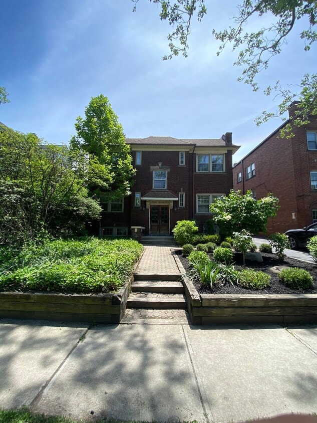
2592 Mayfield Rd Unit 1
Cleveland Heights, OH 44106
Today
Favorites
440-941-5884
-
Bedrooms
2
-
Bathrooms
1
-
Square Feet
1,000 sq ft
-
Available
Available Sep 1
2592 Mayfield Rd Unit 1

Favorites
About This Home
Available Sep 1
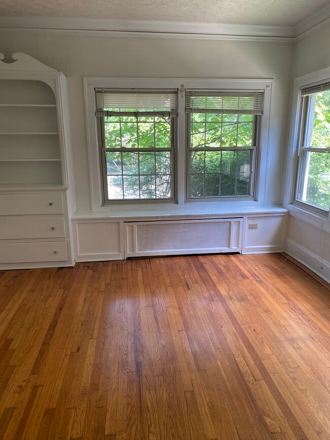
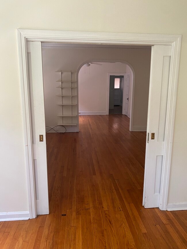
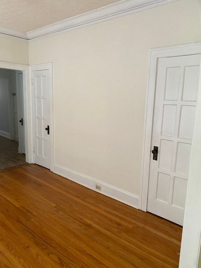
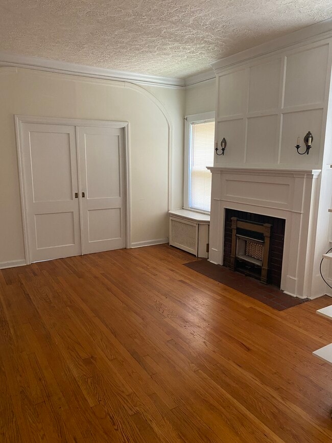
Spacious 2 bedroom apartment in an excellent location between Little Italy and Coventry Village. Come see the tall ceilings and built in cabinetry along with the beautiful hardwood floors throughout. On site laundy and pet friendly. Tenant pays electric and cooking gas. Parking permits available for the city lot next door.
2592 Mayfield Rd is a condo located in Cuyahoga County and the 44106 ZIP Code. This area is served by the Cleveland Heights-University Heights City attendance zone.
* Price shown is base rent and may not include non-optional fees and utilities.
Price, availability, fees, and any applicable rent special are subject to change without notice.
* Square footage definitions vary. Displayed square footage is approximate.
Condo Features
- Dishwasher
- Hardwood Floors
- Laundry Facilities
- Storage Space
Fees and Policies
The fees below are based on community-supplied data and may exclude additional fees and utilities.
- Dogs Allowed
-
Fees not specified
- Cats Allowed
-
Fees not specified
Contact
- Listed by CLE Rentals LLC
- Phone Number
- Contact
Location
Get Directions
Amenities
- Dishwasher
- Hardwood Floors
- Laundry Facilities
- Storage Space
Rich in personality, the Cedar-Fairmount district of Cleveland provides shopping in an environment that incorporates historic style with modern trends. Lying only six miles east of downtown, the area is convenient for commuters and those that love urban life. Investment in independent businesses, the arts and transportation has brought young professionals to the neighborhood. Residents as well as consumers gather on sidewalks to enjoy the Tudor style structures or share lunch.
Learn more about living in Cedar-Fairmount
Education
| Colleges & Universities | Distance | ||
|---|---|---|---|
| Colleges & Universities | Distance | ||
| Walk: | 17 min | 0.9 mi | |
| Walk: | 19 min | 1.0 mi | |
| Drive: | 3 min | 1.3 mi | |
| Drive: | 12 min | 4.4 mi |
2592 Mayfield Rd Unit 1 is within 17 minutes or 0.9 mile from Cleveland Institute of Art. It is also near Case Western Reserve and Cleveland Institute of Music.
Schools


Public Elementary School
Grades PK-6
304 Students
Nearby
Public Elementary School
Grades K-5
229 Students
Attendance Zone
Public Middle School
Grades 6-8
588 Students
Attendance Zone
Public High School
Grades 9-12
1,664 Students
Attendance Zone
Private Elementary & Middle School
Grades PK-8
85 Students
Nearby
Private Elementary School
Grades PK-3
Nearby
Private High School
Grades 9-12
34 Students
Nearby
School data provided by
 The GreatSchools Rating helps parents compare schools within a state based on a variety of school quality indicators and provides a helpful picture of how effectively each school serves all of its students. Ratings are on a scale of 1 (below average) to 10 (above average) and can include test scores, college readiness, academic progress, advanced courses, equity, discipline and attendance data. We also advise parents to visit schools, consider other information on school performance and programs, and consider family needs as part of the school selection process.
View GreatSchools Rating Methodology
Data provided by GreatSchools.org © 2025. All rights reserved.
View GreatSchools Rating Methodology
Data provided by GreatSchools.org © 2025. All rights reserved.
Transportation options available in Cleveland Heights include Little Italy-Univ Circle Station, located 0.9 mile from 2592 Mayfield Rd Unit 1. 2592 Mayfield Rd Unit 1 is near Cleveland-Hopkins International, located 18.2 miles or 33 minutes away.
| Transit / Subway | Distance | ||
|---|---|---|---|
| Transit / Subway | Distance | ||
| Walk: | 16 min | 0.9 mi | |
|
|
Drive: | 3 min | 1.2 mi |
|
|
Drive: | 4 min | 1.7 mi |
|
|
Drive: | 6 min | 2.2 mi |
|
|
Drive: | 8 min | 3.5 mi |
| Commuter Rail | Distance | ||
|---|---|---|---|
| Commuter Rail | Distance | ||
|
|
Drive: | 18 min | 8.2 mi |
| Drive: | 24 min | 12.1 mi | |
| Drive: | 26 min | 13.9 mi | |
| Drive: | 34 min | 19.8 mi | |
|
Boston Mill
|
Drive: | 41 min | 24.8 mi |
| Airports | Distance | ||
|---|---|---|---|
| Airports | Distance | ||
|
Cleveland-Hopkins International
|
Drive: | 33 min | 18.2 mi |
Time and distance from 2592 Mayfield Rd Unit 1.
| Shopping Centers | Distance | ||
|---|---|---|---|
| Shopping Centers | Distance | ||
| Walk: | 18 min | 1.0 mi | |
| Drive: | 3 min | 1.5 mi | |
| Drive: | 6 min | 2.2 mi |
2592 Mayfield Rd Unit 1 has 3 shopping centers within 2.2 miles, which is about a 6-minute walk. The miles and minutes will be for the farthest away property.
| Parks and Recreation | Distance | ||
|---|---|---|---|
| Parks and Recreation | Distance | ||
|
Cleveland Botanical Garden
|
Drive: | 3 min | 1.2 mi |
|
Cleveland Museum of Natural History
|
Drive: | 4 min | 1.6 mi |
|
Children's Museum of Cleveland
|
Drive: | 4 min | 1.8 mi |
|
Nature Center at Shaker Lakes
|
Drive: | 7 min | 2.7 mi |
|
Euclid Creek Reservation
|
Drive: | 14 min | 6.1 mi |
2592 Mayfield Rd Unit 1 has 5 parks within 6.1 miles, including Cleveland Botanical Garden, Children's Museum of Cleveland, and Cleveland Museum of Natural History.
| Hospitals | Distance | ||
|---|---|---|---|
| Hospitals | Distance | ||
| Walk: | 20 min | 1.1 mi | |
| Walk: | 20 min | 1.1 mi | |
| Drive: | 5 min | 2.4 mi |
2592 Mayfield Rd Unit 1 has 3 hospitals within 2.4 miles, the nearest is University Hospitals of Cleveland which is 1.1 miles away and a 20 minute walk.
| Military Bases | Distance | ||
|---|---|---|---|
| Military Bases | Distance | ||
| Drive: | 107 min | 87.0 mi | |
| Drive: | 110 min | 88.2 mi |
2592 Mayfield Rd Unit 1 is 87.0 miles from Mansfield Lahm Airport Air Guard Station, and is convenient to other military bases, including Camp Perry Air Guard Station.
You May Also Like
Similar Rentals Nearby
-
-

-

-

-
 $1,3002 Beds, 1 Bath, 1,350 sq ftApartment for Rent
 -
 $9602 Beds, 1 Bath, 1,092 sq ftApartment for Rent
 -

-

-
 $2,0003 Beds, 1 Bath, 1,150 sq ftApartment for Rent
 -

What Are Walk Score®, Transit Score®, and Bike Score® Ratings?
Walk Score® measures the walkability of any address. Transit Score® measures access to public transit. Bike Score® measures the bikeability of any address.
What is a Sound Score Rating?
A Sound Score Rating aggregates noise caused by vehicle traffic, airplane traffic and local sources
2592 Mayfield Rd
Cleveland Heights, OH 44106