2590 Emerson St
Palo Alto, CA 94301
-
Bedrooms
2
-
Bathrooms
1
-
Square Feet
1,049 sq ft
-
Available
Available Now

About This Home
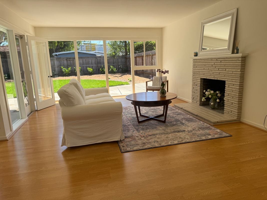
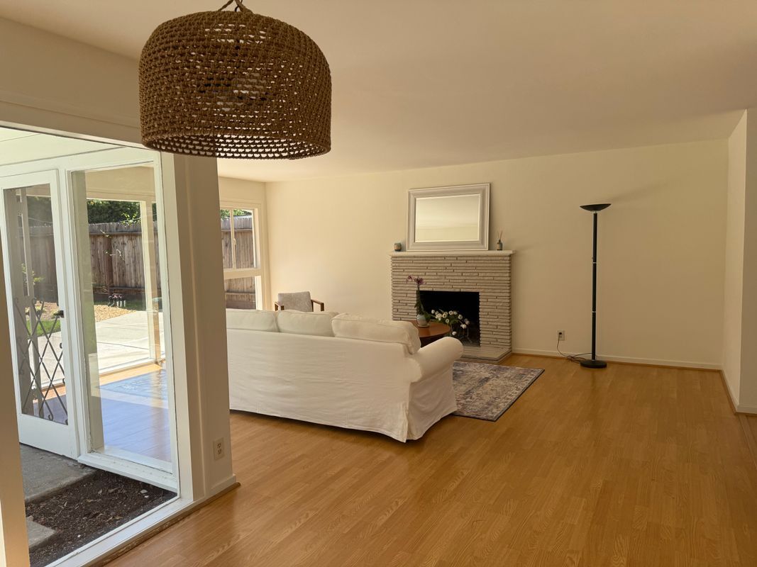
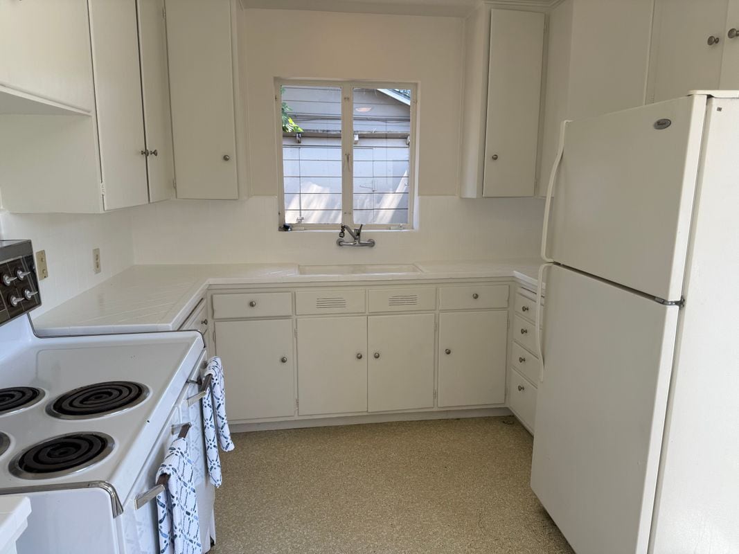
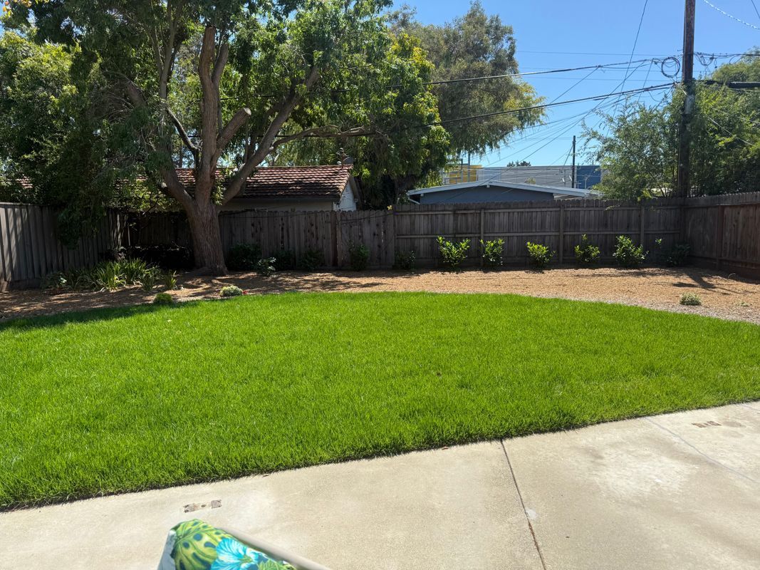
Welcome to your new home in the heart of Midtown, Palo Alto! This inviting property is ideally situated, offering convenient access to a vibrant array of nearby restaurants and a department store. Plus, you're just a short drive away from El Camino Health - Mountain View Hospital and Challenger School - Middlefield. For outdoor enthusiasts, Peers Park and Hoover Park are within walking distance, perfect for leisurely strolls and weekend activities. Experience comfort and convenience with the spacious layout of this property. Although utilities are not included in the rent, you will have the freedom to set up services according to your preferences. Don't miss this opportunity to enjoy a prime location with essential amenities at your fingertips. Whether you're a busy professional or a family looking for the perfect community, this property is ready to welcome you home. Contact us today to schedule a viewing!
2590 Emerson St is a house located in Santa Clara County and the 94301 ZIP Code. This area is served by the Palo Alto Unified attendance zone.
House Features
- Washer/Dryer
- Heating
- Refrigerator
- Renters Insurance Program
Fees and Policies
The fees below are based on community-supplied data and may exclude additional fees and utilities.
- Parking
-
Other--Assigned Parking
Details
Lease Options
-
12 Months
Contact
- Phone Number
- Website View Property Website
- Contact
-
Source

- Washer/Dryer
- Heating
- Refrigerator
- Renters Insurance Program
Located along the San Francisco Bay, Palo Alto is one of the state's top-rated cities. Home to a variety of high-tech companies and only about a block from Stanford University, Midtown Palo Alto is a great neighborhood. Midtown features a shopping district along Middlefield Road and three large parks: Hoover Park, Henry Seale Park, and Greer Park. Midtown is a walkable neighborhood close to the Palo Alto Junior Museum and Zoo, Stanford Stadium, the Palo Alto Golf Course, and the Palo Alto Airport.
Learn more about living in Midtown Palo Alto| Colleges & Universities | Distance | ||
|---|---|---|---|
| Colleges & Universities | Distance | ||
| Drive: | 7 min | 2.5 mi | |
| Drive: | 7 min | 2.5 mi | |
| Drive: | 10 min | 4.3 mi | |
| Drive: | 13 min | 7.3 mi |


View GreatSchools Rating Methodology
Data provided by GreatSchools.org © 2025. All rights reserved.
Transportation options available in Palo Alto include Mountain View Station, located 4.1 miles from 2590 Emerson St. 2590 Emerson St is near Norman Y Mineta San Jose International, located 14.5 miles or 21 minutes away, and San Francisco International, located 22.4 miles or 31 minutes away.
| Transit / Subway | Distance | ||
|---|---|---|---|
| Transit / Subway | Distance | ||
| Drive: | 8 min | 4.1 mi | |
|
|
Drive: | 8 min | 4.1 mi |
|
|
Drive: | 11 min | 5.3 mi |
| Drive: | 11 min | 7.0 mi | |
|
|
Drive: | 11 min | 7.1 mi |
| Commuter Rail | Distance | ||
|---|---|---|---|
| Commuter Rail | Distance | ||
| Walk: | 9 min | 0.5 mi | |
| Walk: | 11 min | 0.6 mi | |
| Drive: | 5 min | 2.0 mi | |
| Drive: | 6 min | 2.6 mi | |
| Drive: | 9 min | 3.7 mi |
| Airports | Distance | ||
|---|---|---|---|
| Airports | Distance | ||
|
Norman Y Mineta San Jose International
|
Drive: | 21 min | 14.5 mi |
|
San Francisco International
|
Drive: | 31 min | 22.4 mi |
Time and distance from 2590 Emerson St.
| Shopping Centers | Distance | ||
|---|---|---|---|
| Shopping Centers | Distance | ||
| Walk: | 19 min | 1.0 mi | |
| Drive: | 5 min | 1.8 mi | |
| Drive: | 5 min | 2.0 mi |
| Parks and Recreation | Distance | ||
|---|---|---|---|
| Parks and Recreation | Distance | ||
|
Gamble Garden
|
Drive: | 3 min | 1.4 mi |
|
Junior Museum and Zoo
|
Drive: | 4 min | 1.7 mi |
|
Rinconada Park
|
Drive: | 5 min | 1.8 mi |
|
J. Pearce Mitchell Park
|
Drive: | 5 min | 1.9 mi |
|
Bol Park
|
Drive: | 5 min | 2.0 mi |
| Hospitals | Distance | ||
|---|---|---|---|
| Hospitals | Distance | ||
| Drive: | 7 min | 2.8 mi | |
| Drive: | 9 min | 3.3 mi | |
| Drive: | 13 min | 8.5 mi |
| Military Bases | Distance | ||
|---|---|---|---|
| Military Bases | Distance | ||
| Drive: | 14 min | 7.4 mi |
You May Also Like
What Are Walk Score®, Transit Score®, and Bike Score® Ratings?
Walk Score® measures the walkability of any address. Transit Score® measures access to public transit. Bike Score® measures the bikeability of any address.
What is a Sound Score Rating?
A Sound Score Rating aggregates noise caused by vehicle traffic, airplane traffic and local sources

2590 Emerson St
Palo Alto, CA 94301