
The Marquee
697 Bronx River Rd,
Yonkers, NY 10704
$2,400 - $3,700
1-3 Beds


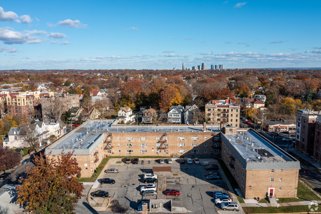
Experience Mount Vernon living at 256-266 Franklin Ave. You'll find this community in the South Side area of Mount Vernon. From amenities to availability, the professional leasing team will assist you in finding your new home. Your new home awaits you at 256-266 Franklin Ave. Contact us or stop by the leasing office to discuss your new apartment.
256-266 Franklin Ave is an apartment community located in Westchester County and the 10553 ZIP Code. This area is served by the Mt Vernon School District attendance zone.
Resting just over six miles north of the Bronx and 15 miles north of the heart of Manhattan, South Side is a relatively quiet suburban section of the city of Mount Vernon, New York. There’s a vibrant charm to this part of the city, with dense tree-lined streets and a thriving community atmosphere. Long-standing apartment buildings and architecturally historic neighborhoods and houses give South Side an incredible Upstate feel. With a thriving downtown business district, a diverse dining scene, and a burgeoning arts scene, it’s easy to see why many former New Yorkers retreat here to get a bigger slice of the pie. South Side is far from secluded, however. Midtown Manhattan is accessible via Interstate 87 or a combination of buses and the 5 Metro train.
Learn more about living in South SideCompare neighborhood and city base rent averages by bedroom.
| South Side | Mount Vernon, NY | |
|---|---|---|
| Studio | $1,401 | $1,707 |
| 1 Bedroom | $1,294 | $1,738 |
| 2 Bedrooms | $1,442 | $2,177 |
| 3 Bedrooms | $1,487 | $2,502 |
| Colleges & Universities | Distance | ||
|---|---|---|---|
| Colleges & Universities | Distance | ||
| Drive: | 7 min | 3.1 mi | |
| Drive: | 8 min | 3.7 mi | |
| Drive: | 8 min | 3.7 mi | |
| Drive: | 8 min | 3.9 mi |


Transportation options available in Mount Vernon include Eastchester-Dyre Ave, located 1.6 miles from 256-266 Franklin Ave. 256-266 Franklin Ave is near LaGuardia, located 13.6 miles or 24 minutes away, and Westchester County, located 17.2 miles or 27 minutes away.
| Transit / Subway | Distance | ||
|---|---|---|---|
| Transit / Subway | Distance | ||
|
|
Drive: | 3 min | 1.6 mi |
|
|
Drive: | 3 min | 1.8 mi |
|
|
Drive: | 4 min | 2.2 mi |
|
|
Drive: | 4 min | 2.4 mi |
|
|
Drive: | 5 min | 2.6 mi |
| Commuter Rail | Distance | ||
|---|---|---|---|
| Commuter Rail | Distance | ||
|
|
Walk: | 8 min | 0.5 mi |
|
|
Drive: | 4 min | 1.6 mi |
|
|
Drive: | 4 min | 2.0 mi |
|
|
Drive: | 8 min | 4.0 mi |
|
|
Drive: | 9 min | 4.5 mi |
| Airports | Distance | ||
|---|---|---|---|
| Airports | Distance | ||
|
LaGuardia
|
Drive: | 24 min | 13.6 mi |
|
Westchester County
|
Drive: | 27 min | 17.2 mi |
Scores provided by
Traffic
-Airport
-Businesses
-Scores provided by
HowLoud What is a Sound Score Rating? A Sound Score Rating aggregates noise caused by vehicle traffic, airplane traffic and local sources. How It WorksTime and distance from 256-266 Franklin Ave.
| Shopping Centers | Distance | ||
|---|---|---|---|
| Shopping Centers | Distance | ||
| Walk: | 13 min | 0.7 mi | |
| Walk: | 20 min | 1.0 mi | |
| Drive: | 3 min | 1.2 mi |
| Parks and Recreation | Distance | ||
|---|---|---|---|
| Parks and Recreation | Distance | ||
|
Seton Falls Park
|
Drive: | 4 min | 2.0 mi |
|
Pelham Bay Park
|
Drive: | 7 min | 3.6 mi |
|
Bartow-Pell Woods
|
Drive: | 8 min | 4.1 mi |
|
Davenport Neck Bird Sanctuary
|
Drive: | 9 min | 4.6 mi |
|
Van Cortlandt Park
|
Drive: | 10 min | 6.1 mi |
| Hospitals | Distance | ||
|---|---|---|---|
| Hospitals | Distance | ||
| Walk: | 19 min | 1.0 mi | |
| Drive: | 7 min | 3.4 mi | |
| Drive: | 9 min | 4.8 mi |
| Military Bases | Distance | ||
|---|---|---|---|
| Military Bases | Distance | ||
| Drive: | 21 min | 11.6 mi | |
| Drive: | 41 min | 22.7 mi | |
| Drive: | 47 min | 30.2 mi |
What Are Walk Score®, Transit Score®, and Bike Score® Ratings?
Walk Score® measures the walkability of any address. Transit Score® measures access to public transit. Bike Score® measures the bikeability of any address.
What is a Sound Score Rating?
A Sound Score Rating aggregates noise caused by vehicle traffic, airplane traffic and local sources.
256-266 Franklin Ave
Mount Vernon, NY 10553


