
Seaview Apartments
520-550 Seaview Ave,
Staten Island, NY 10305
Call for Rent
2 Beds
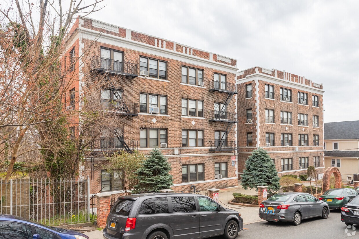

Enjoy Staten Island living at 25 Sherman Ave. This community is located in the St. George area of Staten Island. The professional leasing staff is ready to help you find your ideal place. Come see 25 Sherman Ave today.
25 Sherman Ave is an apartment community located in Richmond County and the 10301 ZIP Code. This area is served by the New York City Geographic District #31 attendance zone.
Hardwood Floors
Refrigerator
Tub/Shower
Double Pane Windows
Nestled along the northeastern tip of Staten Island, Saint George is a historic neighborhood with an array of rental options, many of which overlook the glistening New York Upper Bay. Saint George has a great combination of old and new with Victorian and Tudor-style houses, cozy apartments, charming studios, waterfront condos, and other styles available for rent. Saint George is one of the most populated neighborhoods in Staten Island and its scenic rental options aren’t the only reason why it’s so trendy.
This historic neighborhood is home to the National Lighthouse Museum, the Staten Island Yankees Ball Park, and the Saint George Theatre, an ornate venue used for concerts, plays, and even television shoots. Global eateries are scattered throughout the neighborhood while Empire Outlets is filled with popular brands and eateries. Along with plenty of parks like North Shore Waterfront Esplanade Park, families appreciate having access to some of the best schools in New York City.
Learn more about living in St GeorgeCompare neighborhood and city base rent averages by bedroom.
| St George | Staten Island, NY | |
|---|---|---|
| Studio | $1,536 | $1,595 |
| 1 Bedroom | $1,728 | $1,703 |
| 2 Bedrooms | $2,496 | $2,360 |
| 3 Bedrooms | $1,973 | $2,139 |
| Colleges & Universities | Distance | ||
|---|---|---|---|
| Colleges & Universities | Distance | ||
| Drive: | 10 min | 2.4 mi | |
| Drive: | 16 min | 5.8 mi | |
| Drive: | 25 min | 12.3 mi | |
| Drive: | 27 min | 13.7 mi |


Transportation options available in Staten Island include 8Th Street Light Rail Station, located 6.5 miles from 25 Sherman Ave. 25 Sherman Ave is near Newark Liberty International, located 14.8 miles or 27 minutes away, and LaGuardia, located 23.0 miles or 42 minutes away.
| Transit / Subway | Distance | ||
|---|---|---|---|
| Transit / Subway | Distance | ||
| Drive: | 15 min | 6.5 mi | |
|
|
Drive: | 16 min | 7.3 mi |
|
|
Drive: | 17 min | 7.8 mi |
|
|
Drive: | 18 min | 8.6 mi |
|
|
Drive: | 21 min | 10.0 mi |
| Commuter Rail | Distance | ||
|---|---|---|---|
| Commuter Rail | Distance | ||
|
|
Walk: | 10 min | 0.5 mi |
|
|
Walk: | 13 min | 0.7 mi |
|
|
Drive: | 4 min | 1.2 mi |
|
|
Drive: | 5 min | 1.6 mi |
|
|
Drive: | 10 min | 3.3 mi |
| Airports | Distance | ||
|---|---|---|---|
| Airports | Distance | ||
|
Newark Liberty International
|
Drive: | 27 min | 14.8 mi |
|
LaGuardia
|
Drive: | 42 min | 23.0 mi |
Scores provided by
Traffic
-Airport
-Businesses
-Scores provided by
HowLoud What is a Sound Score Rating? A Sound Score Rating aggregates noise caused by vehicle traffic, airplane traffic and local sources. How It WorksTime and distance from 25 Sherman Ave.
| Shopping Centers | Distance | ||
|---|---|---|---|
| Shopping Centers | Distance | ||
| Walk: | 13 min | 0.7 mi | |
| Drive: | 8 min | 2.4 mi | |
| Drive: | 17 min | 7.8 mi |
| Parks and Recreation | Distance | ||
|---|---|---|---|
| Parks and Recreation | Distance | ||
|
Staten Island Museum
|
Walk: | 7 min | 0.4 mi |
|
Mahoney Playground
|
Walk: | 8 min | 0.5 mi |
|
Silver Lake Park
|
Drive: | 5 min | 1.5 mi |
|
Snug Harbor Cultural Center & Botanical Garden
|
Drive: | 5 min | 1.6 mi |
|
Staten Island Children's Museum
|
Drive: | 5 min | 1.6 mi |
| Hospitals | Distance | ||
|---|---|---|---|
| Hospitals | Distance | ||
| Drive: | 5 min | 1.8 mi | |
| Drive: | 15 min | 5.2 mi | |
| Drive: | 14 min | 5.2 mi |
| Military Bases | Distance | ||
|---|---|---|---|
| Military Bases | Distance | ||
| Drive: | 5 min | 1.3 mi | |
| Drive: | 17 min | 7.0 mi | |
| Drive: | 21 min | 9.7 mi |
What Are Walk Score®, Transit Score®, and Bike Score® Ratings?
Walk Score® measures the walkability of any address. Transit Score® measures access to public transit. Bike Score® measures the bikeability of any address.
What is a Sound Score Rating?
A Sound Score Rating aggregates noise caused by vehicle traffic, airplane traffic and local sources.

25 Sherman Ave
Staten Island, NY 10301


