
$2,499
/ Month
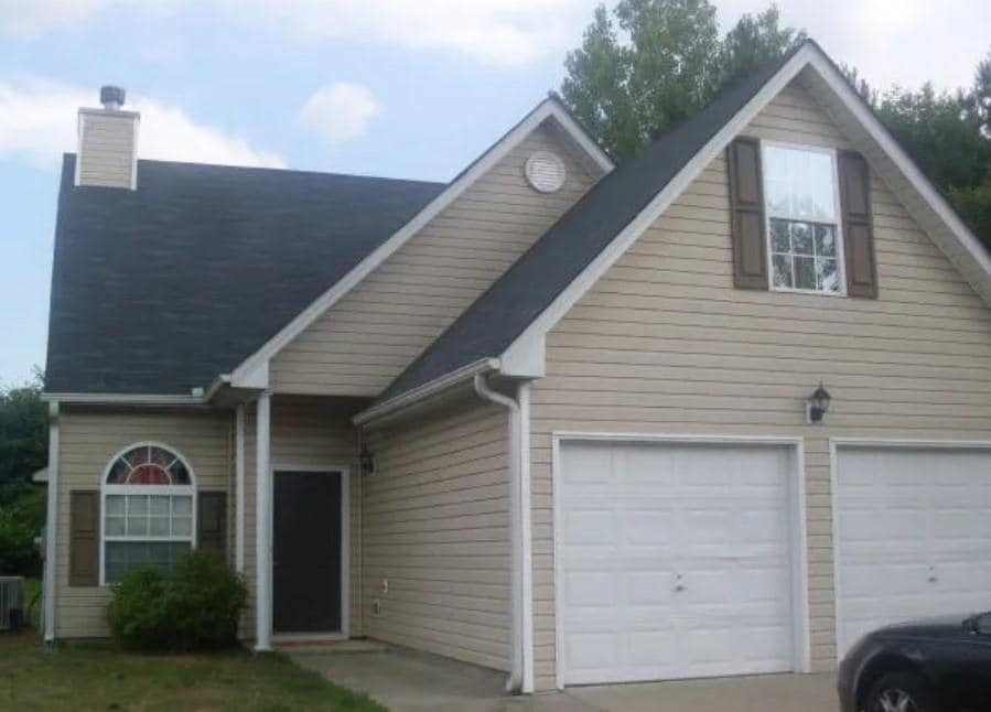
2499 Brookgate Way
Ellenwood, GA 30294
Today
|
Edit
Favorites
770-982-7575
-
Bedrooms
4
-
Bathrooms
2.5
-
Square Feet
1,634 sq ft
-
Available
Available Now
2499 Brookgate Way

Favorites
About This Home
Available Now
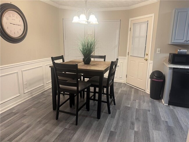
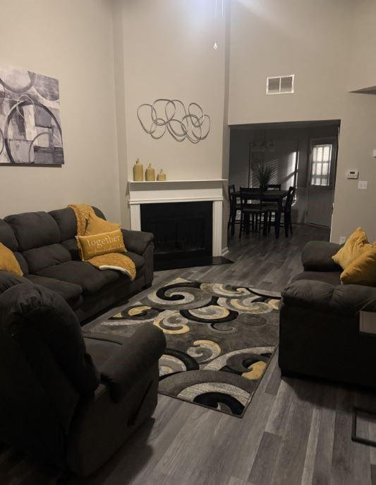
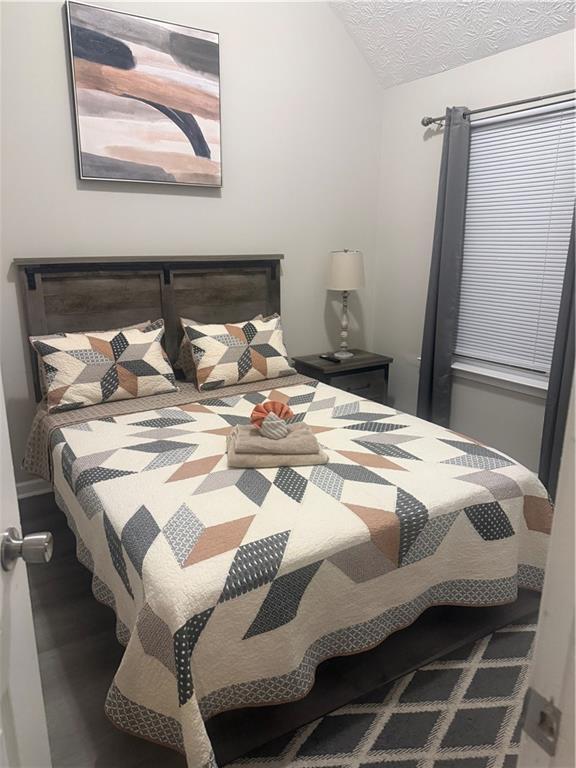
is move-in ready and available for rent. The property offers a comfortable and functional layout with spacious living areas and ample natural light. The home is currently furnished; however,furnishings are negotiable based on tenant preference. Located in a quiet residential neighborhood with convenient access to local amenities,schools,and major roadways. No pets allowed. Schedule a showing today to make this home yours. MLS ID 7702749
2499 Brookgate Way is a house located in Clayton County and the 30294 ZIP Code. This area is served by the Clayton County attendance zone.
* Price shown is base rent. Excludes user-selected optional fees and variable or usage-based fees and required charges due at or prior to move-in or at move-out. Price, availability, fees, and any applicable rent special are subject to change without notice.
* Square footage definitions vary. Displayed square footage is approximate.
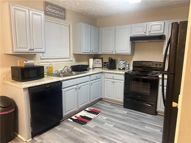
House Features
Dishwasher
Microwave
Refrigerator
Range
- Dishwasher
- Microwave
- Range
- Refrigerator
Contact
- Listed by FELICIA WALTERS | Main Source Realty,LLC.
- Phone Number
- Contact
-
Source
 First Multiple Listing Service, Inc.
Copyright © 2026 First Multiple Listing Service, Inc. All rights reserved. All information provided by the listing agent/broker is deemed reliable but is not guaranteed and should be independently verified.
Location
Get Directions
Amenities
- Dishwasher
- Microwave
- Range
- Refrigerator
Ellenwood is a southeast suburb of Atlanta nestled along Interstate 675. With obvious commuter benefits, Ellenwood is a quick 10 miles east of the Hartsfield-Jackson International Airport, and is about 15 miles southeast of Downtown Atlanta. Ellenwood is filled with winding suburban streets and several industrial centers. The Ellenwood Town Center features a few restaurants, shops, and supermarkets, and there are a few community parks and playgrounds around town.
Ellenwood sits near Clayton State University and Panola Mountain State Park in Stockbridge. So though this city is mainly industrial and residential, there are plenty of amenities and attractions nearby. Residents appreciate Ellenwood’s proximity to Downtown Atlanta and the city’s affordable rental rates in comparison to central and north Atlanta.
Learn more about living in Ellenwood
Education
| Colleges & Universities | Distance | ||
|---|---|---|---|
| Colleges & Universities | Distance | ||
| Drive: | 13 min | 5.9 mi | |
| Drive: | 20 min | 9.6 mi | |
| Drive: | 18 min | 10.0 mi | |
| Drive: | 24 min | 10.4 mi |
2499 Brookgate Way is within 13 minutes or 5.9 miles from Clayton State University. It is also near Georgia Perim. Coll., Decatur and Atlanta Metropolitan State.
Schools


Public Elementary School
Grades PK-5
504 Students
Attendance Zone
Public Middle School
Grades 6-8
557 Students
Attendance Zone
Public High School
Grades 9-12
1,980 Students
Attendance Zone
Private Elementary School
Grades PK-2
Nearby
Private Elementary, Middle & High School
Grades 1-12
23 Students
Nearby
School data provided by
 The GreatSchools Rating helps parents compare schools within a state based on a variety of school quality indicators and provides a helpful picture of how effectively each school serves all of its students. Ratings are on a scale of 1 (below average) to 10 (above average) and can include test scores, college readiness, academic progress, advanced courses, equity, discipline and attendance data. We also advise parents to visit schools, consider other information on school performance and programs, and consider family needs as part of the school selection process.
View GreatSchools Rating Methodology
Data provided by GreatSchools.org © 2026. All rights reserved.
View GreatSchools Rating Methodology
Data provided by GreatSchools.org © 2026. All rights reserved.
Transportation options available in Ellenwood include East Point, located 10.1 miles from 2499 Brookgate Way. 2499 Brookgate Way is near Hartsfield - Jackson Atlanta International, located 7.6 miles or 18 minutes away.
| Transit / Subway | Distance | ||
|---|---|---|---|
| Transit / Subway | Distance | ||
|
|
Drive: | 23 min | 10.1 mi |
|
|
Drive: | 20 min | 10.2 mi |
|
|
Drive: | 22 min | 10.4 mi |
|
|
Drive: | 21 min | 10.9 mi |
|
|
Drive: | 22 min | 13.6 mi |
| Commuter Rail | Distance | ||
|---|---|---|---|
| Commuter Rail | Distance | ||
|
|
Drive: | 27 min | 14.2 mi |
| Airports | Distance | ||
|---|---|---|---|
| Airports | Distance | ||
|
Hartsfield - Jackson Atlanta International
|
Drive: | 18 min | 7.6 mi |
Time and distance from 2499 Brookgate Way.
| Shopping Centers | Distance | ||
|---|---|---|---|
| Shopping Centers | Distance | ||
| Drive: | 4 min | 1.4 mi | |
| Drive: | 9 min | 4.0 mi | |
| Drive: | 9 min | 4.2 mi |
2499 Brookgate Way has 3 shopping centers within 4.2 miles, which is about a 9-minute drive. The miles and minutes will be for the farthest away property.
| Parks and Recreation | Distance | ||
|---|---|---|---|
| Parks and Recreation | Distance | ||
|
Ferns of the World Garden
|
Drive: | 16 min | 6.6 mi |
|
Zoo Atlanta
|
Drive: | 18 min | 9.1 mi |
|
Trees Atlanta
|
Drive: | 19 min | 9.6 mi |
|
Panola Mountain State Park
|
Drive: | 19 min | 9.8 mi |
|
Wylde Center and Oakhurst Community Garden
|
Drive: | 23 min | 13.6 mi |
2499 Brookgate Way has 5 parks within 13.6 miles, including Ferns of the World Garden, Zoo Atlanta, and Trees Atlanta.
| Hospitals | Distance | ||
|---|---|---|---|
| Hospitals | Distance | ||
| Drive: | 15 min | 9.4 mi | |
| Drive: | 19 min | 9.7 mi | |
| Drive: | 20 min | 9.8 mi |
2499 Brookgate Way has 3 hospitals within 9.8 miles, the nearest is Georgia Regional Hospital Atlanta which is 9.4 miles away and a 15 minute drive.
| Military Bases | Distance | ||
|---|---|---|---|
| Military Bases | Distance | ||
| Drive: | 9 min | 3.3 mi | |
| Drive: | 22 min | 11.1 mi |
2499 Brookgate Way is 3.3 miles from Fort Gillem, and is convenient to other military bases, including Fort McPherson.
You May Also Like
Similar Rentals Nearby
-
-
1 / 58

-
-
-
-
-
-
-
-


What Are Walk Score®, Transit Score®, and Bike Score® Ratings?
Walk Score® measures the walkability of any address. Transit Score® measures access to public transit. Bike Score® measures the bikeability of any address.
What is a Sound Score Rating?
A Sound Score Rating aggregates noise caused by vehicle traffic, airplane traffic and local sources

2499 Brookgate Way
Ellenwood, GA 30294