
$2,795
/ Month
249 De Soto Dr
Fairfield, CA 94533
Favorites
707-422-9269
-
Bedrooms
4
-
Bathrooms
2
-
Square Feet
1,248 sq ft
-
Available
Available Jun 15
249 De Soto Dr

Favorites
About This Home
$2,795 deposit,
Available Jun 15
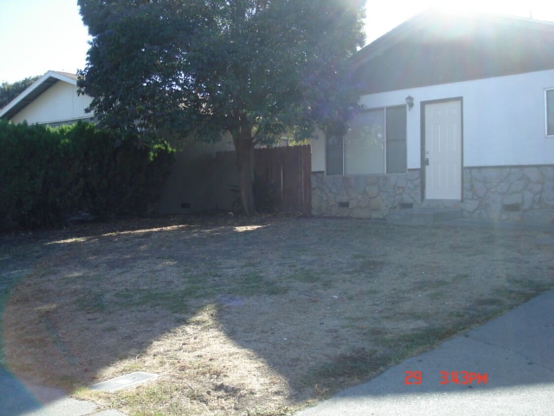
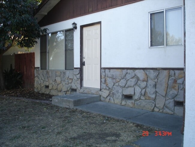
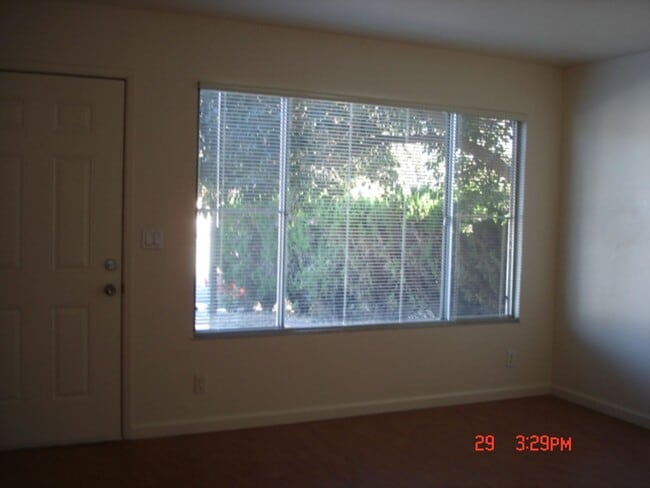
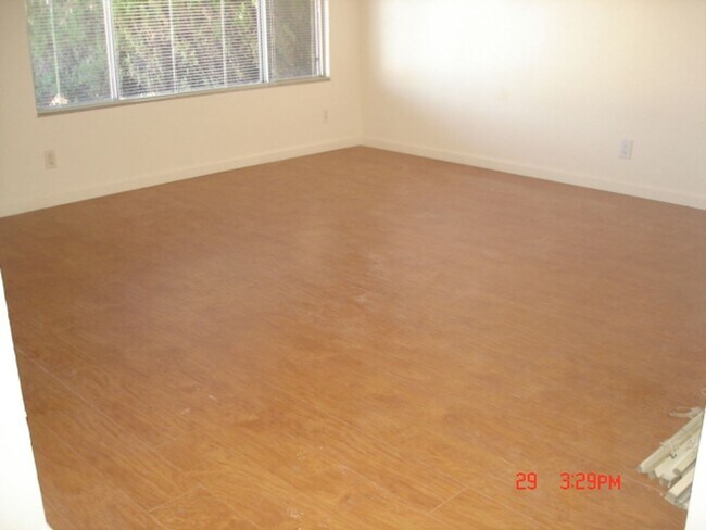
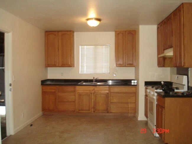
Discover DESOTO, 249 in Fairfield, CA — a spacious 4-bedroom, 2-bath home offering generous front and back yards and an inviting patio finished with paver flooring and a pergola. The interior features a mix of laminate, tile, and carpet flooring and a kitchen equipped with a gas stove. Practical washer/dryer hookups add convenience. Located close to shopping and with easy access to I-80 and Highway 12, this home combines functional living spaces with a convenient location. Renters Insurance required. Appointments coming soon. Must apply to view at: We do not accept 3rd party applications (Zillow, etc.)
Unique Features
- close to shopping/I80/Hwy 12
- laminate/tile/carpet through out
- Large front/back yards
- patio has pavers as flooring and a pergola over it
249 De Soto Dr is a house located in Solano County and the 94533 ZIP Code. This area is served by the Fairfield-Suisun Unified School District attendance zone.
* Price shown is base rent. Excludes user-selected optional fees and variable or usage-based fees and required charges due at or prior to move-in or at move-out. Price, availability, fees, and any applicable rent special are subject to change without notice.
* Square footage definitions vary. Displayed square footage is approximate.
Contact
- Listed by Camellia Realty | Camellia Realty
- Phone Number
- Contact
Location
Get Directions
Fairfield sits at the center of Solano County as its county seat, planted squarely along Interstate 80 between Sacramento and San Francisco—making it a practical home base for people who work in either direction. Founded in 1856 by clipper ship captain Robert H. Waterman, who named it after his Connecticut hometown, the city has grown into a place with real economic range. Travis Air Force Base anchors a significant portion of the local economy, while the Jelly Belly Candy Company and Anheuser-Busch brewery add to a workforce that also draws from healthcare, retail, and commercial sectors. Solano Community College serves students throughout the region and adds an educational presence to the community.
Neighborhoods shift noticeably from one part of the city to another. Downtown and the West Texas Street corridor offer walkable blocks with local shops and a more urban rhythm, while Cordelia and Green Valley lean toward hillside settings with open space nearby.
Learn more about living in Fairfield
Amenities
- close to shopping/I80/Hwy 12
- laminate/tile/carpet through out
- Large front/back yards
- patio has pavers as flooring and a pergola over it
Education
| Colleges & Universities | Distance | ||
|---|---|---|---|
| Colleges & Universities | Distance | ||
| Drive: | 11 min | 5.3 mi | |
| Drive: | 21 min | 15.4 mi | |
| Drive: | 26 min | 18.7 mi | |
| Drive: | 34 min | 24.7 mi |
249 De Soto Dr is within 11 minutes or 5.3 miles from Solano Community College. It is also near Napa Valley College and Touro University California.
Schools

Public Middle & High School
Grades 6-12
201 Students
Nearby
Private Elementary School
Grades PK-2
16 Students
Nearby
School data provided by
 The GreatSchools Rating helps parents compare schools within a state based on a variety of school quality indicators and provides a helpful picture of how effectively each school serves all of its students. Ratings are on a scale of 1 (below average) to 10 (above average) and can include test scores, college readiness, academic progress, advanced courses, equity, discipline and attendance data. We also advise parents to visit schools, consider other information on school performance and programs, and consider family needs as part of the school selection process.
View GreatSchools Rating Methodology
Data provided by GreatSchools.org © 2026. All rights reserved.
View GreatSchools Rating Methodology
Data provided by GreatSchools.org © 2026. All rights reserved.
Getting Around
 What do Walkability, Transit, Drivability, and Bikeability mean?
Walkability measures the walking distance to day-to-day needs.
Transit measures access to public transportation.
Drivability measures congestion, parking availability, and access to major roads.
Bikeability measures the suitability for cycling.
How It Works
What do Walkability, Transit, Drivability, and Bikeability mean?
Walkability measures the walking distance to day-to-day needs.
Transit measures access to public transportation.
Drivability measures congestion, parking availability, and access to major roads.
Bikeability measures the suitability for cycling.
How It Works
Fairly Walkable
Walkability
40
/ 100
Limited Public Transit
Transit
20
/ 100
Exceptionally Drivable
Drivability
100
/ 100
Fairly Bikeable
Bikeability
40
/ 100
Scores provided by
Active
Soundscore™
72
/ 100
Traffic
BusyAirport
CalmBusinesses
CalmScores provided by
HowLoud What is a Sound Score Rating? A Sound Score Rating aggregates noise caused by vehicle traffic, airplane traffic and local sources. How It WorksYou May Also Like
Similar Rentals Nearby


What Are Walk Score®, Transit Score®, and Bike Score® Ratings?
Walk Score® measures the walkability of any address. Transit Score® measures access to public transit. Bike Score® measures the bikeability of any address.
What is a Sound Score Rating?
A Sound Score Rating aggregates noise caused by vehicle traffic, airplane traffic and local sources.

249 De Soto Dr
Fairfield, CA 94533