
$3,300 / Month
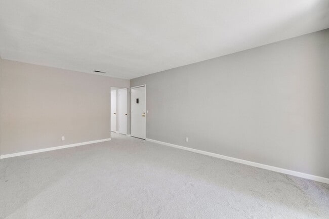
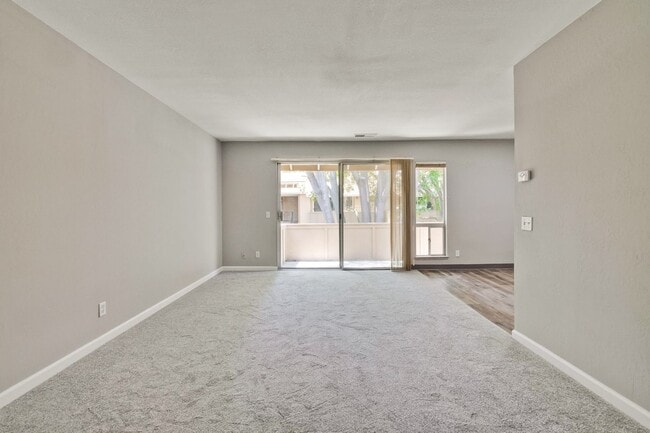
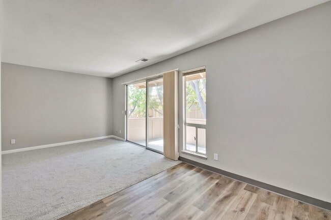
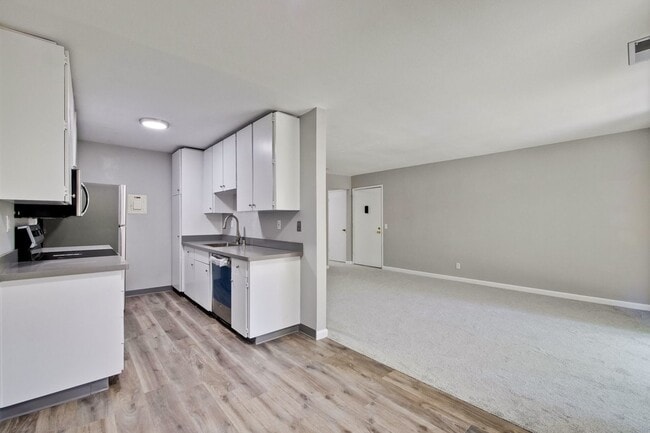
2466 W Bayshore Rd Unit 1
Palo Alto, CA 94303
Today
Favorites
650-331-1515
-
Bedrooms
2
-
Bathrooms
1
-
Square Feet
906 sq ft
-
Available
Available Jul 25
2466 W Bayshore Rd Unit 1

Favorites
Contact
- Listed by Midtown Management Inc. | Midtown Management Inc.
- Phone Number
- Contact
Location
Get Directions
Located along the San Francisco Bay, Palo Alto is one of the state's top-rated cities. Home to a variety of high-tech companies and only about a block from Stanford University, Midtown Palo Alto is a great neighborhood. Midtown features a shopping district along Middlefield Road and three large parks: Hoover Park, Henry Seale Park, and Greer Park. Midtown is a walkable neighborhood close to the Palo Alto Junior Museum and Zoo, Stanford Stadium, the Palo Alto Golf Course, and the Palo Alto Airport.
Learn more about living in Midtown Palo Alto
Education
| Colleges & Universities | Distance | ||
|---|---|---|---|
| Colleges & Universities | Distance | ||
| Drive: | 7 min | 3.3 mi | |
| Drive: | 10 min | 3.9 mi | |
| Drive: | 14 min | 7.4 mi | |
| Drive: | 17 min | 7.7 mi |
2466 W Bayshore Rd Unit 1 is within 7 minutes or 3.3 miles from Foothill College, Middlefield. It is also near Stanford University and Menlo College.
Transportation options available in Palo Alto include Bayshore Nasa Station, located 5.6 miles from 2466 W Bayshore Rd Unit 1. 2466 W Bayshore Rd Unit 1 is near Norman Y Mineta San Jose International, located 13.2 miles or 18 minutes away, and San Francisco International, located 21.1 miles or 28 minutes away.
| Transit / Subway | Distance | ||
|---|---|---|---|
| Transit / Subway | Distance | ||
| Drive: | 8 min | 5.6 mi | |
|
|
Drive: | 8 min | 5.7 mi |
| Drive: | 8 min | 6.0 mi | |
|
|
Drive: | 8 min | 6.0 mi |
|
|
Drive: | 9 min | 6.2 mi |
| Commuter Rail | Distance | ||
|---|---|---|---|
| Commuter Rail | Distance | ||
| Drive: | 5 min | 1.9 mi | |
| Drive: | 6 min | 2.3 mi | |
| Drive: | 9 min | 3.5 mi | |
| Drive: | 8 min | 4.1 mi | |
| Drive: | 12 min | 5.2 mi |
| Airports | Distance | ||
|---|---|---|---|
| Airports | Distance | ||
|
Norman Y Mineta San Jose International
|
Drive: | 18 min | 13.2 mi |
|
San Francisco International
|
Drive: | 28 min | 21.1 mi |
Time and distance from 2466 W Bayshore Rd Unit 1.
| Shopping Centers | Distance | ||
|---|---|---|---|
| Shopping Centers | Distance | ||
| Walk: | 23 min | 1.2 mi | |
| Drive: | 6 min | 2.2 mi | |
| Drive: | 6 min | 2.9 mi |
2466 W Bayshore Rd Unit 1 has 3 shopping centers within 2.9 miles, which is about a 6-minute walk. The miles and minutes will be for the farthest away property.
| Parks and Recreation | Distance | ||
|---|---|---|---|
| Parks and Recreation | Distance | ||
|
Rinconada Park
|
Drive: | 5 min | 1.5 mi |
|
Junior Museum and Zoo
|
Drive: | 5 min | 1.6 mi |
|
The Environmental Volunteers EcoCenter
|
Drive: | 5 min | 1.8 mi |
|
Baylands Preserve
|
Drive: | 6 min | 2.2 mi |
|
Gamble Garden
|
Drive: | 6 min | 2.2 mi |
2466 W Bayshore Rd Unit 1 has 5 parks within 2.2 miles, including Rinconada Park, Junior Museum and Zoo, and The Environmental Volunteers EcoCenter.
| Hospitals | Distance | ||
|---|---|---|---|
| Hospitals | Distance | ||
| Drive: | 11 min | 4.2 mi | |
| Drive: | 12 min | 4.8 mi | |
| Drive: | 10 min | 7.2 mi |
2466 W Bayshore Rd Unit 1 has 3 hospitals within 7.2 miles, the nearest is Lucile Salter Packard Children's Hospital at Stanford which is 4.2 miles away and a 11 minute drive.
| Military Bases | Distance | ||
|---|---|---|---|
| Military Bases | Distance | ||
| Drive: | 11 min | 6.1 mi |
2466 W Bayshore Rd Unit 1 is 6.1 miles and a 11 minute drive from Ames Research Center.
You May Also Like
Similar Rentals Nearby


What Are Walk Score®, Transit Score®, and Bike Score® Ratings?
Walk Score® measures the walkability of any address. Transit Score® measures access to public transit. Bike Score® measures the bikeability of any address.
What is a Sound Score Rating?
A Sound Score Rating aggregates noise caused by vehicle traffic, airplane traffic and local sources
2466 W Bayshore Rd
Palo Alto, CA 94303