
$825 / Month
2453 Piering Dr
Lithonia, GA 30038
2 Weeks Ago
Favorites
2453 Piering Dr

Favorites
Check Back Soon for Upcoming Availability
| Beds | Baths | Average SF |
|---|---|---|
| 3 Bedrooms 3 Bedrooms 3 Br | 2 Baths 2 Baths 2 Ba | 1,520 SF |
About This Property
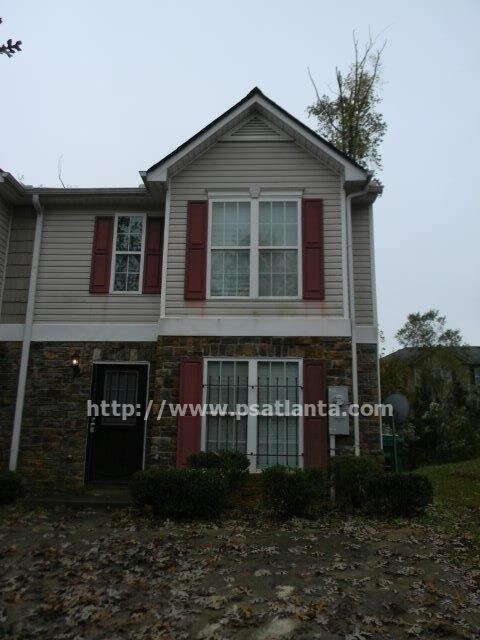
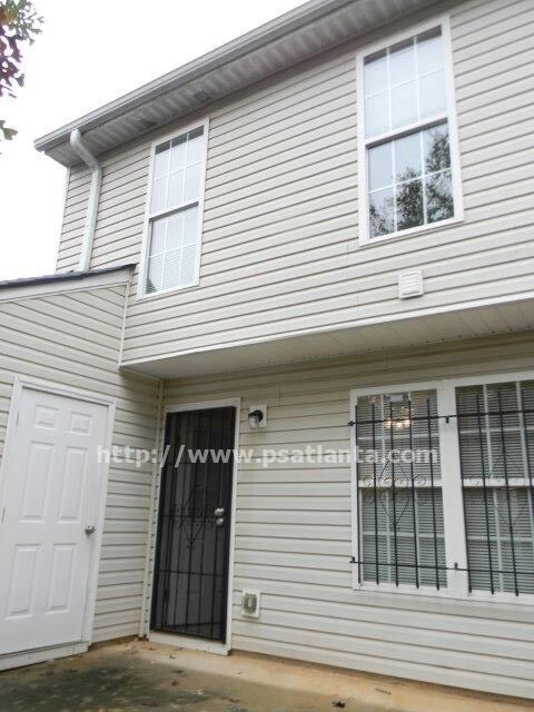
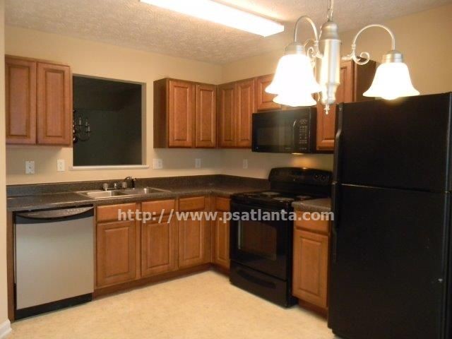
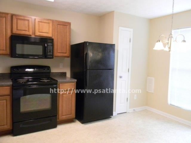
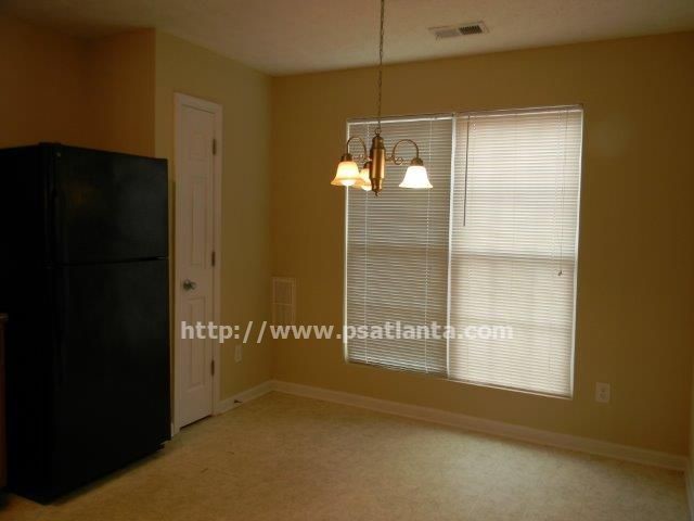
2453 Piering Drive Lithonia GA 30038NO PETSThis home does not accept housing Availability: Reservation HoldEnter this home with living room and dining area. Kitchen has all black appliances and a eat in breakfast area. You can access back yard to a patio area.Upstairs features 2 spare bedrooms with a full hall bath with garden tub There is a laundry closet. Master is spacious with a full bath an also a garden tub. Master also features a walk in closet.This home is close to everything Trash is included with rent.Directions: 20 to exit 71 right on Panola sharp left onto Farington Stay to the right and make a u turn at end of road and Piering is 2nd street on right. townhome is on right.Schools:Fairington ElementarySalem MiddleMartin Luther King Jr HighBuilt 2006 Approx sq ft 1520
2453 Piering Dr is a house located in DeKalb County and the 30038 ZIP Code. This area is served by the DeKalb County attendance zone.
Location
Get Directions
Southeast DeKalb refers to a sprawling region in the southeastern portion of DeKalb County. Among the many communities in this area are the communities of Clarkston, Stone Mountain, Lithonia, Panthersville, Gresham Park, and Sheffield Woods.
Each community in this region has its own distinct character. Southeast DeKalb offers ample opportunities for outdoor recreation at destinations such as Stone Mountain Park, Panola Mountain State Park, and Arabia Mountain National Heritage Area. Southeast DeKalb sits within easy driving distance of all that Greater Atlanta has to offer, with close proximity to major thoroughfares like I-285, I-20, and U.S. 278.
Learn more about living in Southeast DeKalbBelow are rent ranges for similar nearby apartments
Education
| Colleges & Universities | Distance | ||
|---|---|---|---|
| Colleges & Universities | Distance | ||
| Drive: | 18 min | 9.8 mi | |
| Drive: | 21 min | 11.9 mi | |
| Drive: | 21 min | 12.1 mi | |
| Drive: | 26 min | 15.2 mi |
2453 Piering Dr is within 18 minutes or 9.8 miles from Georgia Perim. Coll., Decatur. It is also near Georgia Perim., Clarkston and Agnes Scott College.
Schools


Public Elementary School
Grades PK-5
546 Students
Attendance Zone
Public Middle School
Grades 6-8
988 Students
Attendance Zone
Public High School
Grades 9-12
1,440 Students
Attendance Zone
Private Elementary, Middle & High School
Grades K-12
8 Students
Nearby
Private Elementary, Middle & High School
Grades PK-11
33 Students
Nearby
School data provided by
 The GreatSchools Rating helps parents compare schools within a state based on a variety of school quality indicators and provides a helpful picture of how effectively each school serves all of its students. Ratings are on a scale of 1 (below average) to 10 (above average) and can include test scores, college readiness, academic progress, advanced courses, equity, discipline and attendance data. We also advise parents to visit schools, consider other information on school performance and programs, and consider family needs as part of the school selection process.
View GreatSchools Rating Methodology
Data provided by GreatSchools.org © 2025. All rights reserved.
View GreatSchools Rating Methodology
Data provided by GreatSchools.org © 2025. All rights reserved.
Transportation options available in Lithonia include Indian Creek, located 9.7 miles from 2453 Piering Dr. 2453 Piering Dr is near Hartsfield - Jackson Atlanta International, located 19.8 miles or 32 minutes away.
| Transit / Subway | Distance | ||
|---|---|---|---|
| Transit / Subway | Distance | ||
|
|
Drive: | 16 min | 9.7 mi |
|
|
Drive: | 18 min | 10.7 mi |
|
|
Drive: | 21 min | 12.3 mi |
|
|
Drive: | 22 min | 13.1 mi |
| Commuter Rail | Distance | ||
|---|---|---|---|
| Commuter Rail | Distance | ||
|
|
Drive: | 30 min | 20.1 mi |
| Airports | Distance | ||
|---|---|---|---|
| Airports | Distance | ||
|
Hartsfield - Jackson Atlanta International
|
Drive: | 32 min | 19.8 mi |
Time and distance from 2453 Piering Dr.
| Shopping Centers | Distance | ||
|---|---|---|---|
| Shopping Centers | Distance | ||
| Walk: | 19 min | 1.0 mi | |
| Drive: | 5 min | 1.5 mi | |
| Drive: | 5 min | 1.5 mi |
2453 Piering Dr has 3 shopping centers within 1.5 miles, which is about a 5-minute walk. The miles and minutes will be for the farthest away property.
| Parks and Recreation | Distance | ||
|---|---|---|---|
| Parks and Recreation | Distance | ||
|
Panola Mountain State Park
|
Drive: | 16 min | 6.6 mi |
|
Arabia Mountain Heritage Area and Nature Center
|
Drive: | 15 min | 6.9 mi |
|
Ferns of the World Garden
|
Drive: | 17 min | 9.6 mi |
|
DeShong Park
|
Drive: | 26 min | 11.1 mi |
|
Stone Mountain State Memorial Park
|
Drive: | 27 min | 11.8 mi |
2453 Piering Dr has 5 parks within 11.8 miles, including Arabia Mountain Heritage Area and Nature Center, Panola Mountain State Park, and Ferns of the World Garden.
| Hospitals | Distance | ||
|---|---|---|---|
| Hospitals | Distance | ||
| Drive: | 7 min | 2.4 mi | |
| Drive: | 16 min | 9.2 mi | |
| Drive: | 20 min | 12.2 mi |
2453 Piering Dr has 3 hospitals within 12.2 miles, the nearest is Emory Hillandale Hospital which is 2.4 miles away and a 7 minute drive.
| Military Bases | Distance | ||
|---|---|---|---|
| Military Bases | Distance | ||
| Drive: | 29 min | 17.5 mi | |
| Drive: | 31 min | 20.5 mi |
2453 Piering Dr is 17.5 miles from Fort Gillem, and is convenient to other military bases, including Fort McPherson.
You May Also Like
Similar Rentals Nearby
-
-

-
-
-
1 / 28

-
-
-
-
-


What Are Walk Score®, Transit Score®, and Bike Score® Ratings?
Walk Score® measures the walkability of any address. Transit Score® measures access to public transit. Bike Score® measures the bikeability of any address.
What is a Sound Score Rating?
A Sound Score Rating aggregates noise caused by vehicle traffic, airplane traffic and local sources

2453 Piering Dr
Lithonia, GA 30038