
The Crest
207 Seaside Way,
Long Beach, CA 90802
Studio - 2 Beds $2,290 - $4,065
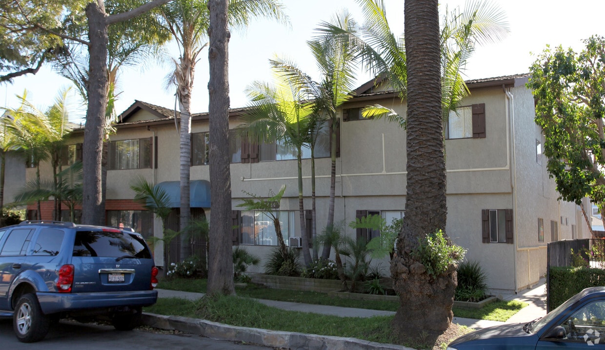
Application Fee: $62.00, effective immediately, non-refundable. 2450 E. 6th Street is a two story multi dwelling key access building. Building is centrally located near shopping and dining options, near Belmont Shores 2nd Street, The Pike, Retro Row and Ralphs shopping center. Minutes from the Beach and Bixby Park (Bixby Park has a great Farmer’s Market on Tuesdays and Saturdays) First floor Laundry Room (which can be operated with coins or app). Utilities included with rent – Water, sewage and trash, tenant pays other utilities-All electric building. Upper rear studio, one bath is bright and airy and features fresh two tone-paint, VPF flooring, vertical blinds, ceiling fan, large closet. Bathroom has a bathtub/shower combination and great storage space. Strictly street parking Non-smoking building Cats welcome with an increased deposit. Utilities: Water, Trash, Sewer MANAGED BY: Mashcole Property Management INC IT490818 - IT49MC491
2450 E. 6th Street is an apartment community located in Los Angeles County and the 90814 ZIP Code. This area is served by the Long Beach Unified attendance zone.
High Speed Internet Access
Smoke Free
Heating
Kitchen
The area defined as Eastside Long Beach puts you just two blocks from the white-sand beaches along the Pacific Ocean, two miles from Downtown Long Beach, and only 25 minutes from the heart of Los Angeles. You'll also be within easy reach of California State University-Long Beach, which is adjacent to the neighborhood. Eastside is just east of Alamitos Avenue with the Pacific Coast Highway forming the northern border. Recreation Park is on the neighborhood's southeast side. There’s a plethora of coastal rentals in a variety of styles here, ensuring you’ll find your perfect fit in one of SoCal’s most vibrant areas.
Learn more about living in Eastside Long Beach| Colleges & Universities | Distance | ||
|---|---|---|---|
| Colleges & Universities | Distance | ||
| Drive: | 7 min | 2.4 mi | |
| Drive: | 8 min | 3.4 mi | |
| Drive: | 12 min | 5.5 mi | |
| Drive: | 18 min | 7.9 mi |


Transportation options available in Long Beach include Pacific Station, located 1.9 miles from 2450 E. 6th Street. 2450 E. 6th Street is near Long Beach (Daugherty Field), located 4.2 miles or 10 minutes away, and John Wayne/Orange County, located 19.6 miles or 28 minutes away.
| Transit / Subway | Distance | ||
|---|---|---|---|
| Transit / Subway | Distance | ||
|
|
Drive: | 6 min | 1.9 mi |
|
|
Drive: | 5 min | 2.0 mi |
|
|
Drive: | 6 min | 2.0 mi |
|
|
Drive: | 6 min | 2.2 mi |
|
|
Drive: | 7 min | 2.6 mi |
| Commuter Rail | Distance | ||
|---|---|---|---|
| Commuter Rail | Distance | ||
|
|
Drive: | 26 min | 17.2 mi |
|
|
Drive: | 29 min | 17.3 mi |
|
|
Drive: | 33 min | 20.7 mi |
|
|
Drive: | 30 min | 20.9 mi |
|
|
Drive: | 32 min | 22.2 mi |
| Airports | Distance | ||
|---|---|---|---|
| Airports | Distance | ||
|
Long Beach (Daugherty Field)
|
Drive: | 10 min | 4.2 mi |
|
John Wayne/Orange County
|
Drive: | 28 min | 19.6 mi |
Time and distance from 2450 E. 6th Street.
| Shopping Centers | Distance | ||
|---|---|---|---|
| Shopping Centers | Distance | ||
| Walk: | 5 min | 0.3 mi | |
| Walk: | 7 min | 0.4 mi | |
| Walk: | 16 min | 0.8 mi |
| Parks and Recreation | Distance | ||
|---|---|---|---|
| Parks and Recreation | Distance | ||
|
Colorado Lagoon
|
Drive: | 5 min | 2.1 mi |
|
Aquarium of the Pacific
|
Drive: | 7 min | 2.5 mi |
|
Earl Burns Miller Japanese Garden
|
Drive: | 8 min | 3.9 mi |
|
Los Cerritos Wetlands Trust
|
Drive: | 9 min | 4.5 mi |
|
El Dorado East Regional Park
|
Drive: | 12 min | 5.7 mi |
| Hospitals | Distance | ||
|---|---|---|---|
| Hospitals | Distance | ||
| Drive: | 6 min | 2.1 mi | |
| Drive: | 6 min | 2.8 mi | |
| Drive: | 9 min | 3.8 mi |
| Military Bases | Distance | ||
|---|---|---|---|
| Military Bases | Distance | ||
| Drive: | 21 min | 8.3 mi | |
| Drive: | 18 min | 9.5 mi |
What Are Walk Score®, Transit Score®, and Bike Score® Ratings?
Walk Score® measures the walkability of any address. Transit Score® measures access to public transit. Bike Score® measures the bikeability of any address.
What is a Sound Score Rating?
A Sound Score Rating aggregates noise caused by vehicle traffic, airplane traffic and local sources


