
$2,300 / Month
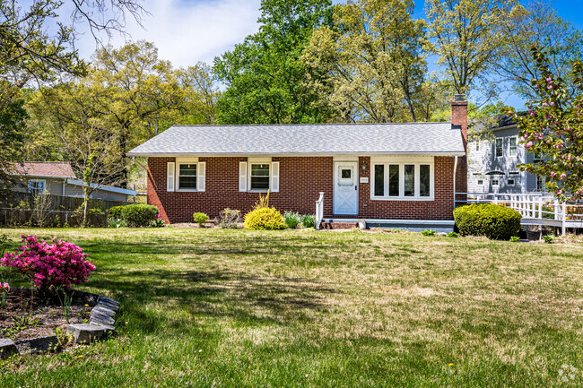
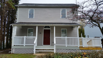
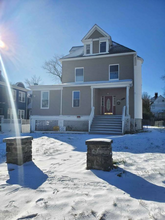
2427 Knapps Way
Odenton, MD 21113
2 Weeks Ago
Favorites
2427 Knapps Way

Favorites
Check Back Soon for Upcoming Availability
| Beds | Baths | Average SF |
|---|---|---|
| 3 Bedrooms 3 Bedrooms 3 Br | 3 Baths 3 Baths 3 Ba | 2,218 SF |
About This Property
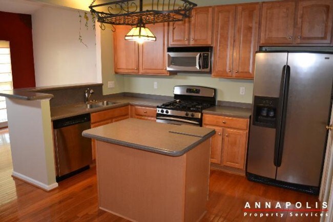
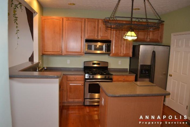
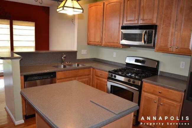
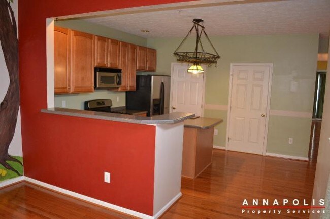
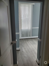
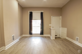
---- SCHEDULE A SHOWING ONLINE AT: http://showmojo.com/lac/0d645dc0f7 ---- Immaculate 3 bedroom, 3.5 bathroom duplex home with garage and fully finished basement with seperate office room in the Seven Oaks community of Odenton. Hardwood floors, stainless appliances, gas fireplace, and back deck. Community facilities include: 2 swimming pools, tennis courts and fitness center.
2427 Knapps Way is a house located in Anne Arundel County and the 21113 ZIP Code. This area is served by the Anne Arundel County Public Schools attendance zone.
Location
Get Directions
Situated in Anne Arundel County, Odenton is centrally located between Annapolis, Washington D.C., and Baltimore. The city is continuously growing in population, largely due to its proximity to Fort George G. Meade military base and the developing Piney Orchard neighborhood.
In Odenton, you’ll discover a lot of great shopping centers like Waugh Chapel Towne Centre. Hikers will enjoy the plethora of trails that reside within the community, including Little Patuxent River Trail, Wild Turkey Way, and Merganser Pond Trail, among others. Midland Park is a large green space just minutes from Bowie State University. This Baltimore suburb contains highly rated public schools, plus access to Interstate 97 and Odenton Station.
Learn more about living in Odenton
Education
| Colleges & Universities | Distance | ||
|---|---|---|---|
| Colleges & Universities | Distance | ||
| Drive: | 25 min | 13.7 mi | |
| Drive: | 26 min | 14.2 mi | |
| Drive: | 28 min | 15.2 mi | |
| Drive: | 29 min | 16.4 mi |
2427 Knapps Way is within 25 minutes or 13.7 miles from UMBC. It is also near CCBC Cantonsville and Anne Arundel Community College.
Schools


Public Elementary School
Grades PK-5
508 Students
Attendance Zone
Public Middle School
Grades 6-8
878 Students
Attendance Zone
Public High School
Grades 9-12
2,330 Students
Attendance Zone
Private Elementary, Middle & High School
Grades PK-12
181 Students
Nearby
Private Elementary, Middle & High School
Grades 2-12
7 Students
Nearby
School data provided by
 The GreatSchools Rating helps parents compare schools within a state based on a variety of school quality indicators and provides a helpful picture of how effectively each school serves all of its students. Ratings are on a scale of 1 (below average) to 10 (above average) and can include test scores, college readiness, academic progress, advanced courses, equity, discipline and attendance data. We also advise parents to visit schools, consider other information on school performance and programs, and consider family needs as part of the school selection process.
View GreatSchools Rating Methodology
View GreatSchools Rating Methodology
Transportation options available in Odenton include Dorsey, located 8.1 miles from 2427 Knapps Way. 2427 Knapps Way is near Baltimore/Washington International Thurgood Marshall, located 8.9 miles or 18 minutes away, and Ronald Reagan Washington Ntl, located 31.8 miles or 51 minutes away.
| Transit / Subway | Distance | ||
|---|---|---|---|
| Transit / Subway | Distance | ||
|
|
Drive: | 17 min | 8.1 mi |
|
|
Drive: | 18 min | 8.8 mi |
|
Bwi Airport
|
Drive: | 19 min | 9.2 mi |
|
Cromwell Station/Glen Burnie
|
Drive: | 17 min | 9.5 mi |
|
Ferndale
|
Drive: | 18 min | 9.8 mi |
| Commuter Rail | Distance | ||
|---|---|---|---|
| Commuter Rail | Distance | ||
|
|
Drive: | 6 min | 2.4 mi |
|
|
Drive: | 13 min | 5.9 mi |
|
Bwi Airport
|
Drive: | 17 min | 8.3 mi |
|
|
Drive: | 15 min | 8.3 mi |
|
Bowie State Marc Nb
|
Drive: | 29 min | 16.5 mi |
| Airports | Distance | ||
|---|---|---|---|
| Airports | Distance | ||
|
Baltimore/Washington International Thurgood Marshall
|
Drive: | 18 min | 8.9 mi |
|
Ronald Reagan Washington Ntl
|
Drive: | 51 min | 31.8 mi |
Time and distance from 2427 Knapps Way.
| Shopping Centers | Distance | ||
|---|---|---|---|
| Shopping Centers | Distance | ||
| Drive: | 4 min | 1.2 mi | |
| Drive: | 4 min | 1.5 mi | |
| Drive: | 6 min | 2.2 mi |
2427 Knapps Way has 3 shopping centers within 2.2 miles, which is about a 6-minute drive. The miles and minutes will be for the farthest away property.
| Parks and Recreation | Distance | ||
|---|---|---|---|
| Parks and Recreation | Distance | ||
|
Patuxent Research Refuge - North Tract
|
Drive: | 14 min | 6.1 mi |
|
Kinder Farm Park
|
Drive: | 24 min | 11.5 mi |
|
Patuxent Research Refuge - South Tract
|
Drive: | 27 min | 14.3 mi |
2427 Knapps Way has 3 parks within 14.3 miles, including Patuxent Research Refuge - North Tract, Kinder Farm Park, and Patuxent Research Refuge - South Tract.
| Hospitals | Distance | ||
|---|---|---|---|
| Hospitals | Distance | ||
| Drive: | 17 min | 8.7 mi | |
| Drive: | 24 min | 12.0 mi |
2427 Knapps Way is 8.7 miles from University of Maryland Baltimore Washington Medical Center, and is convenient to other hospitals, including Laurel Regional Medical Center.
| Military Bases | Distance | ||
|---|---|---|---|
| Military Bases | Distance | ||
| Drive: | 7 min | 2.7 mi |
2427 Knapps Way is 2.7 miles and a 7 minute drive from Fort George Meade.
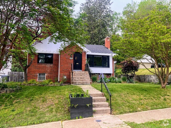
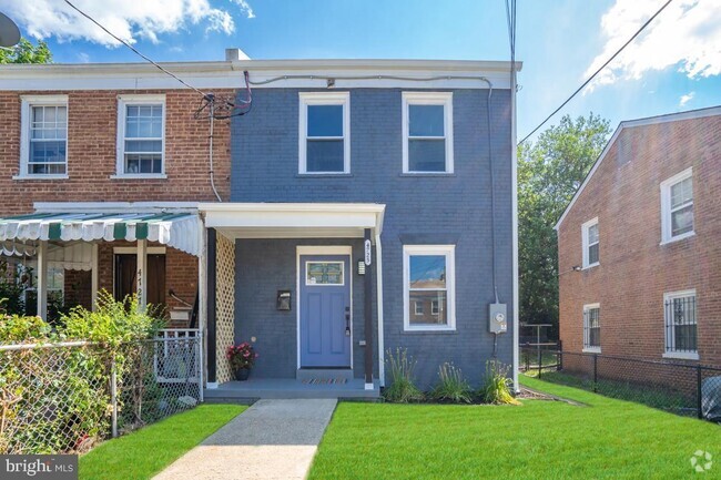
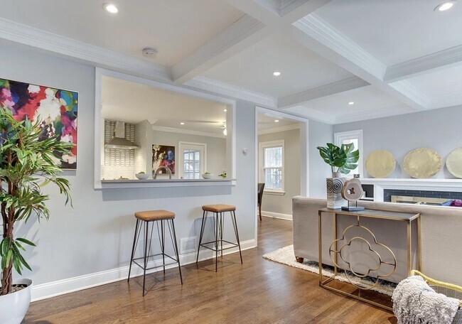
You May Also Like
Similar Rentals Nearby

What Are Walk Score®, Transit Score®, and Bike Score® Ratings?
Walk Score® measures the walkability of any address. Transit Score® measures access to public transit. Bike Score® measures the bikeability of any address.
What is a Sound Score Rating?
A Sound Score Rating aggregates noise caused by vehicle traffic, airplane traffic and local sources
2427 Knapps Way
Odenton, MD 21113