

237 54th St
San Diego, CA 92114
-
Bedrooms
2
-
Bathrooms
1
-
Square Feet
1,080 sq ft
-
Available
Available Now

Fees and Policies
The fees below are based on community-supplied data and may exclude additional fees and utilities.
- Parking
-
Other--
Contact
- Phone Number
- Contact
Valencia Park is almost entirely residential, with many of the local homes reflecting the Tuscan-style architecture so popular across Southern California. It’s an ideal location for folks who work at the Valencia Business Park on the north side or Paradise Valley Hospital on the south side.
Multiple schools in the immediate area give local students the option of walking to class quickly and safely no matter where in the neighborhood they live. Residents enjoy convenient access to San Diego’s favorite leisure activities, with the popular Gaslamp District only ten minutes away by car and Ocean Beach reachable in less than half an hour.
Learn more about living in Valencia Park| Colleges & Universities | Distance | ||
|---|---|---|---|
| Colleges & Universities | Distance | ||
| Drive: | 8 min | 5.3 mi | |
| Drive: | 9 min | 5.7 mi | |
| Drive: | 10 min | 6.4 mi | |
| Drive: | 20 min | 8.6 mi |


View GreatSchools Rating Methodology
Transportation options available in San Diego include Euclid Avenue, located 0.6 mile from 237 54th St. 237 54th St is near San Diego International, located 8.9 miles or 14 minutes away.
| Transit / Subway | Distance | ||
|---|---|---|---|
| Transit / Subway | Distance | ||
|
|
Walk: | 12 min | 0.6 mi |
|
|
Drive: | 3 min | 1.1 mi |
|
|
Drive: | 3 min | 1.4 mi |
|
|
Drive: | 5 min | 2.9 mi |
|
|
Drive: | 6 min | 3.0 mi |
| Commuter Rail | Distance | ||
|---|---|---|---|
| Commuter Rail | Distance | ||
|
|
Drive: | 11 min | 6.5 mi |
|
|
Drive: | 13 min | 9.5 mi |
|
|
Drive: | 24 min | 18.0 mi |
|
|
Drive: | 32 min | 25.0 mi |
|
|
Drive: | 36 min | 28.7 mi |
| Airports | Distance | ||
|---|---|---|---|
| Airports | Distance | ||
|
San Diego International
|
Drive: | 14 min | 8.9 mi |
Time and distance from 237 54th St.
| Shopping Centers | Distance | ||
|---|---|---|---|
| Shopping Centers | Distance | ||
| Walk: | 11 min | 0.6 mi | |
| Walk: | 14 min | 0.7 mi | |
| Walk: | 18 min | 1.0 mi |
| Parks and Recreation | Distance | ||
|---|---|---|---|
| Parks and Recreation | Distance | ||
|
Chollas Lake Park
|
Drive: | 12 min | 3.4 mi |
|
Sweetwater Lane County Park
|
Drive: | 10 min | 4.7 mi |
|
Sweetwater Regional Park
|
Drive: | 11 min | 6.2 mi |
|
Balboa Park
|
Drive: | 11 min | 6.6 mi |
|
Fleet Science Center
|
Drive: | 13 min | 7.2 mi |
| Hospitals | Distance | ||
|---|---|---|---|
| Hospitals | Distance | ||
| Drive: | 3 min | 1.8 mi | |
| Drive: | 9 min | 5.4 mi | |
| Drive: | 13 min | 6.9 mi |
| Military Bases | Distance | ||
|---|---|---|---|
| Military Bases | Distance | ||
| Drive: | 8 min | 4.1 mi | |
| Drive: | 17 min | 11.1 mi |
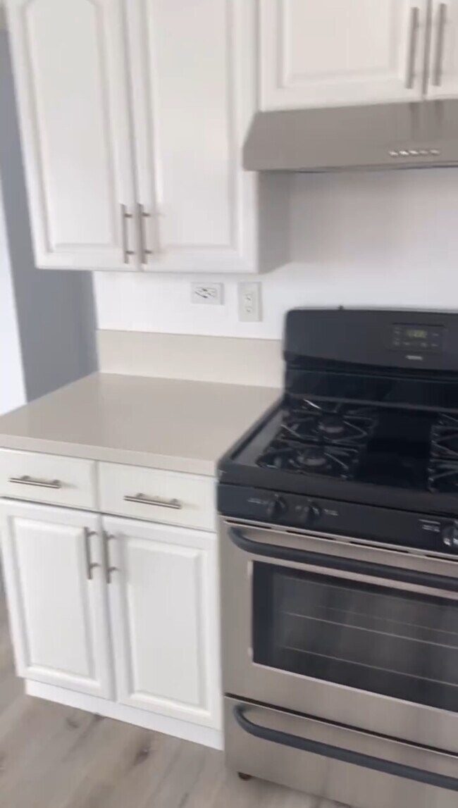
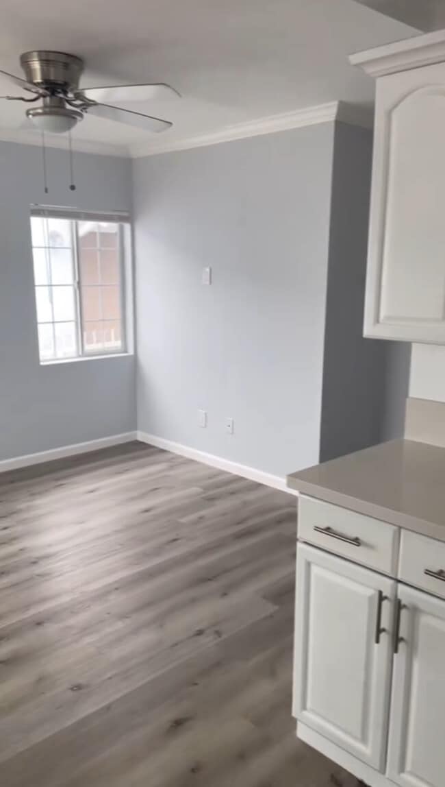
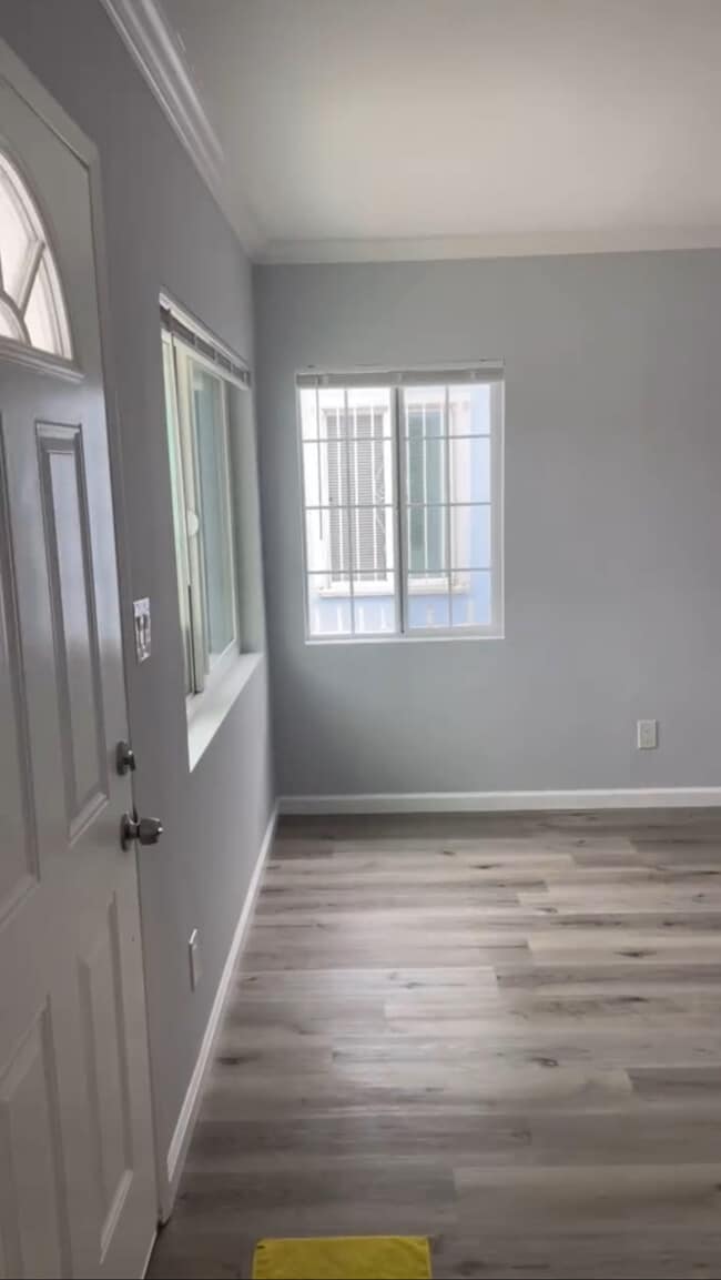
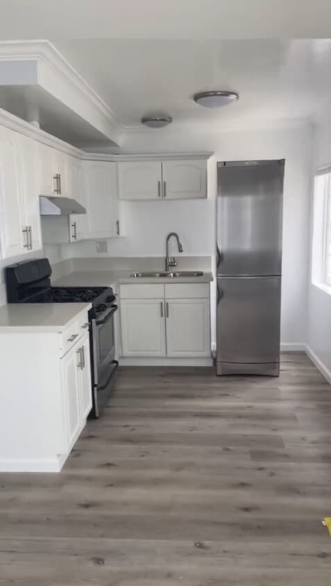
237 54th St Photos
What Are Walk Score®, Transit Score®, and Bike Score® Ratings?
Walk Score® measures the walkability of any address. Transit Score® measures access to public transit. Bike Score® measures the bikeability of any address.
What is a Sound Score Rating?
A Sound Score Rating aggregates noise caused by vehicle traffic, airplane traffic and local sources
237 54th St
San Diego, CA 92114