

$2,200 / Month
236 Neponset St
Canton, MA 02021
2 Weeks Ago
Favorites
236 Neponset St

Favorites
Check Back Soon for Upcoming Availability
| Beds | Baths | Average SF |
|---|---|---|
| 1 Bedroom 1 Bedroom 1 Br | 1 Bath 1 Bath 1 Ba | 650 SF |
Fees and Policies
The fees below are based on community-supplied data and may exclude additional fees and utilities.
- Dogs Allowed
-
Fees not specified
-
Weight limit--
-
Pet Limit--
About This Property
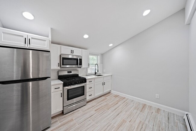
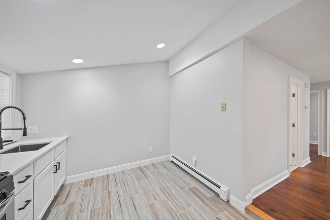
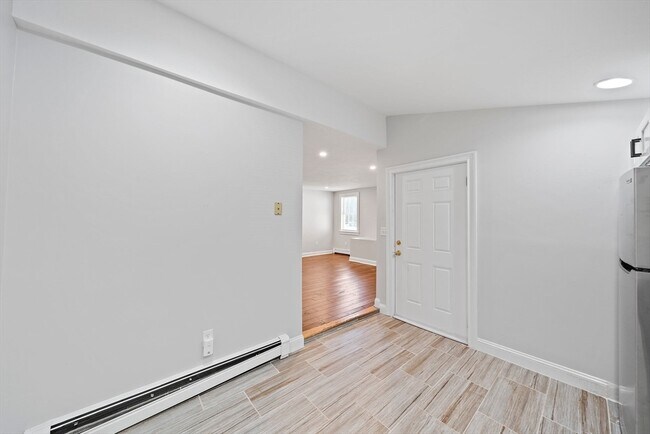
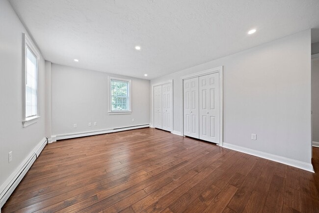
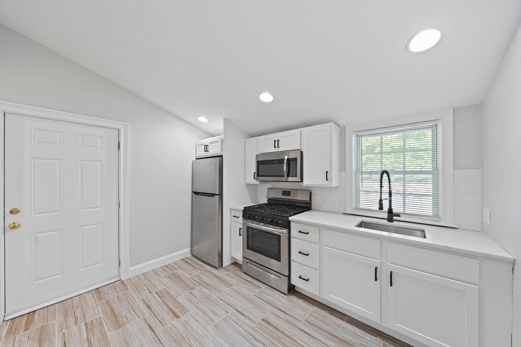
Discover modern living in this beautifully updated 1-bedroom, 1-bathroom apartment. The spacious layout offers a bedroom with ample room for relaxation, while the updated kitchen boasts gas cooking and sleek stainless steel appliances, perfect for culinary enthusiasts. Situated just minutes from the train station and highway, this apartment combines convenience with style, making it an ideal choice for those seeking comfort and accessibility. Laundry in the building and two parking spaces included. DON'T APPLY THROUGH AVAIL. CALL/TEXT US AT .
236 Neponset St is a townhome located in Norfolk County and the 02021 ZIP Code.
Location
Get Directions
The city of Canton is a densely wooded suburb approximately 15 miles southwest of Downtown Boston. Home to several golf courses and spacious parks, Canton has a park-like atmosphere and an active community. Canton is lined with picturesque single-family homes and towering trees, not to mention the welcoming neighbors. Apartments in Canton are mid-range to high-end, and residents appreciate the small-town feeling while still living in the Great Boston area. Although the city is mainly residential, there are a few small businesses in town like the popular Trillium Brewing Company on Shawmut Road.
Learn more about living in CantonBelow are rent ranges for similar nearby apartments
Education
| Colleges & Universities | Distance | ||
|---|---|---|---|
| Colleges & Universities | Distance | ||
| Drive: | 10 min | 4.5 mi | |
| Drive: | 15 min | 7.4 mi | |
| Drive: | 17 min | 9.4 mi | |
| Drive: | 22 min | 11.7 mi |
236 Neponset St is within 10 minutes or 4.5 miles from Massasoit C.C., Canton Campus. It is also near Curry College and Stonehill College.
Transportation options available in Canton include Mattapan Station, located 9.6 miles from 236 Neponset St. 236 Neponset St is near General Edward Lawrence Logan International, located 19.4 miles or 35 minutes away, and Rhode Island Tf Green International, located 39.8 miles or 56 minutes away.
| Transit / Subway | Distance | ||
|---|---|---|---|
| Transit / Subway | Distance | ||
|
|
Drive: | 17 min | 9.6 mi |
|
|
Drive: | 18 min | 10.0 mi |
|
|
Drive: | 18 min | 10.1 mi |
|
|
Drive: | 18 min | 10.3 mi |
|
|
Drive: | 22 min | 12.9 mi |
| Commuter Rail | Distance | ||
|---|---|---|---|
| Commuter Rail | Distance | ||
|
|
Walk: | 14 min | 0.7 mi |
|
|
Walk: | 15 min | 0.8 mi |
|
|
Drive: | 8 min | 3.8 mi |
|
|
Drive: | 7 min | 4.0 mi |
|
|
Drive: | 7 min | 4.1 mi |
| Airports | Distance | ||
|---|---|---|---|
| Airports | Distance | ||
|
General Edward Lawrence Logan International
|
Drive: | 35 min | 19.4 mi |
|
Rhode Island Tf Green International
|
Drive: | 56 min | 39.8 mi |
Time and distance from 236 Neponset St.
| Shopping Centers | Distance | ||
|---|---|---|---|
| Shopping Centers | Distance | ||
| Walk: | 12 min | 0.6 mi | |
| Drive: | 2 min | 1.4 mi | |
| Drive: | 4 min | 1.5 mi |
236 Neponset St has 3 shopping centers within 1.5 miles, which is about a 4-minute walk. The miles and minutes will be for the farthest away property.
| Parks and Recreation | Distance | ||
|---|---|---|---|
| Parks and Recreation | Distance | ||
|
Museum of American Bird Art at Mass Audubon
|
Drive: | 3 min | 1.5 mi |
|
Mass Audubon's Mildred Morse Allen Wildlife Sanctuary
|
Drive: | 3 min | 1.5 mi |
|
Mass Audubon's Moose Hill Wildlife Sanctuary
|
Drive: | 12 min | 4.6 mi |
|
Mass Audubon's Blue Hills Trailside Museum
|
Drive: | 9 min | 5.5 mi |
|
Houghton's Pond Recreation Area
|
Drive: | 11 min | 6.4 mi |
236 Neponset St has 5 parks within 6.4 miles, including Museum of American Bird Art at Mass Audubon, Mass Audubon's Mildred Morse Allen Wildlife Sanctuary, and Mass Audubon's Moose Hill Wildlife Sanctuary.
| Hospitals | Distance | ||
|---|---|---|---|
| Hospitals | Distance | ||
| Drive: | 7 min | 4.0 mi | |
| Drive: | 11 min | 5.8 mi | |
| Drive: | 13 min | 7.2 mi |
236 Neponset St has 3 hospitals within 7.2 miles, the nearest is Norwood Hospital which is 4.0 miles away and a 7 minute drive.
| Military Bases | Distance | ||
|---|---|---|---|
| Military Bases | Distance | ||
| Drive: | 32 min | 19.7 mi |
236 Neponset St is 19.7 miles and a 32 minute drive from US Military Reservation.
You May Also Like
Similar Rentals Nearby


What Are Walk Score®, Transit Score®, and Bike Score® Ratings?
Walk Score® measures the walkability of any address. Transit Score® measures access to public transit. Bike Score® measures the bikeability of any address.
What is a Sound Score Rating?
A Sound Score Rating aggregates noise caused by vehicle traffic, airplane traffic and local sources
236 Neponset St
Canton, MA 02021