
987 Kings Pkwy
987 Kings Pkwy,
Baldwin, NY 11510
$4,500
4 Beds
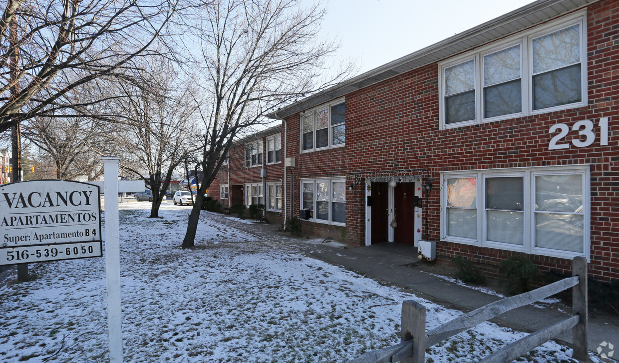
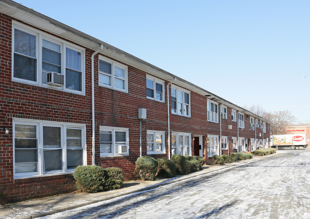
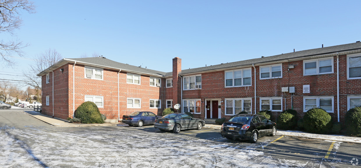

At 231 W Merrick Rd in Freeport, NY, find your new home. The convenient W. Merrick Rd. location in the 11520 Zip code of Freeport is a great place for you to move. Here at this community, the team of leasing professionals is ready and waiting to help you find the perfect floorplan. Come by to view the available floorplans. Stop by 231 W Merrick Rd today.
231 W Merrick Rd is an apartment community located in Nassau County and the 11520 ZIP Code. This area is served by the Freeport Union Free School District attendance zone.
Refrigerator
Heating
Range
Kitchen
Freeport is a South Shore Long Island village with deep roots in the water — it operated as a commercial oystering hub for generations before evolving into one of Nassau County's most recognizable waterfront communities. Sitting within the town of Hempstead, it is the second-largest village in New York state by population, which gives it an energy and density that most suburbs simply do not have. The Nautical Mile anchors the village's identity, drawing residents and visitors alike to its working waterfront, fish markets, and seasonal festivities including the annual Nautical Mile Festival. Cow Meadow Park and Preserve offers 150 acres of natural space and bird-watching trails for those who prefer a quieter pace. The Long Island Rail Road connects Freeport directly to Penn Station, making Manhattan genuinely accessible for daily commuters.
Learn more about living in FreeportCompare neighborhood and city base rent averages by bedroom.
| Southwestern Nassau | Freeport, NY | |
|---|---|---|
| Studio | $2,319 | $1,741 |
| 1 Bedroom | $2,628 | $1,778 |
| 2 Bedrooms | $3,336 | $1,981 |
| 3 Bedrooms | $4,445 | $3,083 |
| Colleges & Universities | Distance | ||
|---|---|---|---|
| Colleges & Universities | Distance | ||
| Drive: | 10 min | 5.0 mi | |
| Drive: | 11 min | 7.4 mi | |
| Drive: | 17 min | 8.1 mi | |
| Drive: | 13 min | 8.5 mi |


Transportation options available in Freeport include Far Rockaway-Mott Avenue, located 11.0 miles from 231 W Merrick Rd. 231 W Merrick Rd is near John F Kennedy International, located 13.3 miles or 21 minutes away, and LaGuardia, located 20.3 miles or 31 minutes away.
| Transit / Subway | Distance | ||
|---|---|---|---|
| Transit / Subway | Distance | ||
|
|
Drive: | 18 min | 11.0 mi |
|
|
Drive: | 19 min | 11.4 mi |
|
|
Drive: | 22 min | 13.4 mi |
| Commuter Rail | Distance | ||
|---|---|---|---|
| Commuter Rail | Distance | ||
|
|
Walk: | 14 min | 0.7 mi |
|
|
Drive: | 3 min | 1.4 mi |
|
|
Drive: | 4 min | 2.7 mi |
|
|
Drive: | 5 min | 3.4 mi |
|
|
Drive: | 6 min | 3.7 mi |
| Airports | Distance | ||
|---|---|---|---|
| Airports | Distance | ||
|
John F Kennedy International
|
Drive: | 21 min | 13.3 mi |
|
LaGuardia
|
Drive: | 31 min | 20.3 mi |
Scores provided by
Traffic
ActiveAirport
CalmBusinesses
BusyScores provided by
HowLoud What is a Sound Score Rating? A Sound Score Rating aggregates noise caused by vehicle traffic, airplane traffic and local sources. How It WorksTime and distance from 231 W Merrick Rd.
| Shopping Centers | Distance | ||
|---|---|---|---|
| Shopping Centers | Distance | ||
| Walk: | 7 min | 0.4 mi | |
| Walk: | 13 min | 0.7 mi | |
| Walk: | 17 min | 0.9 mi |
| Parks and Recreation | Distance | ||
|---|---|---|---|
| Parks and Recreation | Distance | ||
|
Marine Nature Study Area
|
Drive: | 10 min | 3.9 mi |
|
Center for Science Teaching and Learning
|
Drive: | 7 min | 4.4 mi |
|
Hempstead Lake State Park
|
Drive: | 10 min | 5.7 mi |
|
Hofstra University Arboretum
|
Drive: | 11 min | 7.3 mi |
|
Long Island Children's Museum
|
Drive: | 13 min | 8.2 mi |
| Hospitals | Distance | ||
|---|---|---|---|
| Hospitals | Distance | ||
| Drive: | 9 min | 4.9 mi | |
| Drive: | 12 min | 7.6 mi | |
| Drive: | 16 min | 8.1 mi |
| Military Bases | Distance | ||
|---|---|---|---|
| Military Bases | Distance | ||
| Drive: | 29 min | 18.5 mi | |
| Drive: | 34 min | 22.0 mi | |
| Drive: | 42 min | 23.5 mi |
What Are Walk Score®, Transit Score®, and Bike Score® Ratings?
Walk Score® measures the walkability of any address. Transit Score® measures access to public transit. Bike Score® measures the bikeability of any address.
What is a Sound Score Rating?
A Sound Score Rating aggregates noise caused by vehicle traffic, airplane traffic and local sources.


