
$1,195
Total Monthly Price
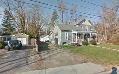
23 S Knox St
Westerville, OH 43081
Favorites
23 S Knox St

Favorites
Check Back Soon for Upcoming Availability
| Beds | Baths | Average SF |
|---|---|---|
| 2 Bedrooms 2 Bedrooms 2 Br | 1 Bath 1 Bath 1 Ba | 800 SF |
Fees and Policies
The fees listed below are community-provided and may exclude utilities or add-ons. All payments are made directly to the property and are non-refundable unless otherwise specified.
- Dogs Allowed
-
Fees not specified
- Cats Allowed
-
Fees not specified
- Parking
-
Surface Lot--
Details
Lease Options
-
12
About This Property
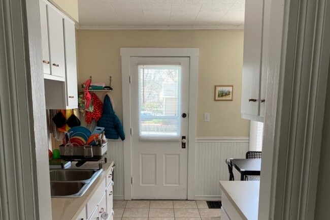
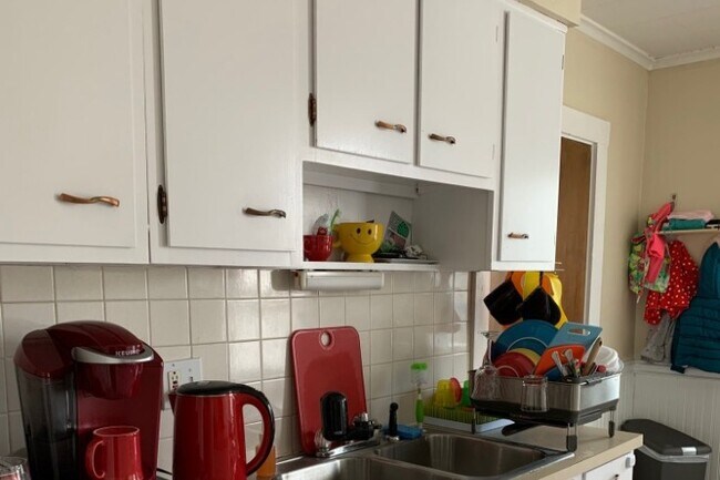
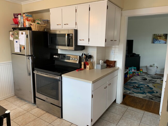
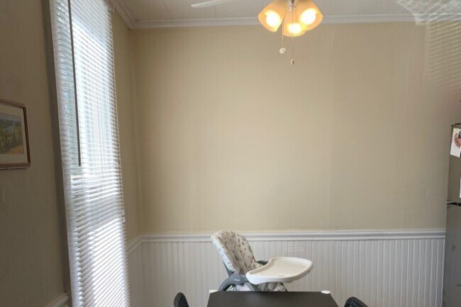
This is a nice half double in uptown Westerville, 800 Sq . Ft. +/- 23 Knox st. (Knox is between Park and College and one block W. of State St. 2 bedrooms and one bath Gas forced air heat and central air off street parking Hardwood floors in Lr and Bed rooms and ceramic in Bath and kitchen. FULL UNFINISHED BASEMENT (800 Sq. Ft.). With washer dryer in basement. All New double pain double hung windows. New siding and roof Pets possible 125 Sq. Ft. front porch Pet possible (small) Walking distance to all of uptown Westerville and Otterbein campus.
23 S Knox St is a townhome located in Franklin County and the 43081 ZIP Code.
Townhome Features
Washer/Dryer
Air Conditioning
Hardwood Floors
Smoke Free
- Washer/Dryer
- Air Conditioning
- Smoke Free
- Kitchen
- Hardwood Floors
- Basement
- Porch
23 S Knox St,
Westerville,
OH
43081
Around 15 miles outside of the center of Columbus, Ohio, Outer Northeast Columbus includes the neighborhoods of Westerville and Huber Ridge. The area has an abundant selection of parks, lakes and golf courses, attracting people who seek outdoor recreation. Both Interstate 71 and Highway 270 border Outer Northeast Columbus, making travel to downtown and other areas of the city simple and convenient.
Many families flock to outer northeast Columbus for its recreation and amenities. Westerville includes plenty of dining and shopping options, along with excellent residential neighborhoods and schools. Residents find refuge from busier areas of the city while enjoying the benefits of easy commutes, along with plenty of opportunities for fun and entertainment.
Learn more about living in Northeast Columbus
Amenities
- Washer/Dryer
- Air Conditioning
- Smoke Free
- Kitchen
- Hardwood Floors
- Basement
- Porch
Education
| Colleges & Universities | Distance | ||
|---|---|---|---|
| Colleges & Universities | Distance | ||
| Walk: | 5 min | 0.3 mi | |
| Drive: | 16 min | 10.3 mi | |
| Drive: | 21 min | 11.5 mi | |
| Drive: | 22 min | 13.1 mi |
23 S Knox St is within 5 minutes or 0.3 mile from Otterbein College. It is also near Ohio Dominican University and Columbus State C.C., Delaware.
Walkability Near 23 S Knox St Westerville, OH 43081
Getting Around
 What do Walkability, Transit, Drivability, and Bikeability mean?
Walkability measures the walking distance to day-to-day needs.
Transit measures access to public transportation.
Drivability measures congestion, parking availability, and access to major roads.
Bikeability measures the suitability for cycling.
How It Works
What do Walkability, Transit, Drivability, and Bikeability mean?
Walkability measures the walking distance to day-to-day needs.
Transit measures access to public transportation.
Drivability measures congestion, parking availability, and access to major roads.
Bikeability measures the suitability for cycling.
How It Works
Moderately Walkable
Walkability
60
/ 100
Limited Public Transit
Transit
30
/ 100
Moderately Drivable
Drivability
70
/ 100
Moderately Bikeable
Bikeability
60
/ 100
Scores provided by
-
Soundscore™
-
/ 100
Traffic
-Airport
-Businesses
-Scores provided by
HowLoud What is a Sound Score Rating? A Sound Score Rating aggregates noise caused by vehicle traffic, airplane traffic and local sources. How It WorksYou May Also Like
Similar Rentals Nearby


What Are Walk Score®, Transit Score®, and Bike Score® Ratings?
Walk Score® measures the walkability of any address. Transit Score® measures access to public transit. Bike Score® measures the bikeability of any address.
What is a Sound Score Rating?
A Sound Score Rating aggregates noise caused by vehicle traffic, airplane traffic and local sources.
23 S Knox St
Westerville, OH 43081